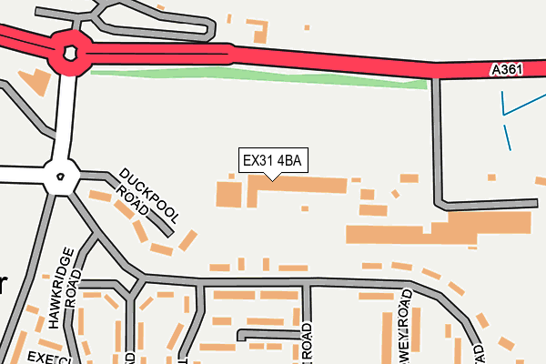
EX31 4BA is located in the Heanton Punchardon electoral ward, within the local authority district of North Devon and the English Parliamentary constituency of North Devon. The Sub Integrated Care Board (ICB) Location is NHS Devon ICB - 15N and the police force is Devon & Cornwall. This postcode has been in use since January 1980.


GetTheData
Source: OS OpenMap – Local (Ordnance Survey)
Source: OS VectorMap District (Ordnance Survey)
Licence: Open Government Licence (requires attribution)
| Easting | 250363 |
| Northing | 134615 |
| Latitude | 51.091269 |
| Longitude | -4.138143 |
GetTheData
Source: Open Postcode Geo
Licence: Open Government Licence
| Country | England |
| Postcode District | EX31 |
| ➜ EX31 open data dashboard ➜ See where EX31 is on a map ➜ Where is Chivenor? | |
GetTheData
Source: Land Registry Price Paid Data
Licence: Open Government Licence
Elevation or altitude of EX31 4BA as distance above sea level:
| Metres | Feet | |
|---|---|---|
| Elevation | 10m | 33ft |
Elevation is measured from the approximate centre of the postcode, to the nearest point on an OS contour line from OS Terrain 50, which has contour spacing of ten vertical metres.
➜ How high above sea level am I? Find the elevation of your current position using your device's GPS.
GetTheData
Source: Open Postcode Elevation
Licence: Open Government Licence
| Ward | Heanton Punchardon |
| Constituency | North Devon |
GetTheData
Source: ONS Postcode Database
Licence: Open Government Licence
| June 2022 | Anti-social behaviour | On or near Yeo Road | 183m |
| June 2022 | Other theft | On or near Petrol Station | 337m |
| June 2022 | Robbery | On or near Petrol Station | 337m |
| ➜ Get more crime data in our Crime section | |||
GetTheData
Source: data.police.uk
Licence: Open Government Licence
| Camp Gates | Chivenor | 247m |
| Caravan Park (A361) | Chivenor | 389m |
| Caravan Park (A361) | Chivenor | 414m |
| The Landings (A361) | Chivenor | 469m |
| The Landings (A361) | Chivenor | 485m |
GetTheData
Source: NaPTAN
Licence: Open Government Licence
GetTheData
Source: ONS Postcode Database
Licence: Open Government Licence


➜ Get more ratings from the Food Standards Agency
GetTheData
Source: Food Standards Agency
Licence: FSA terms & conditions
| Last Collection | |||
|---|---|---|---|
| Location | Mon-Fri | Sat | Distance |
| Taw View | 16:45 | 12:45 | 2,239m |
| South Street | 17:15 | 10:00 | 2,305m |
| Ashford Meadowside | 17:15 | 13:00 | 2,389m |
GetTheData
Source: Dracos
Licence: Creative Commons Attribution-ShareAlike
| Facility | Distance |
|---|---|
| Rm Chivenor A361, Chivenor, Barnstaple Grass Pitches, Health and Fitness Gym, Sports Hall, Squash Courts, Outdoor Tennis Courts, Artificial Grass Pitch | 300m |
| North Devon Athletics Track Wrafton Road, Braunton Athletics | 1.7km |
| Braunton Academy Barton Lane, Braunton Sports Hall, Grass Pitches, Studio, Artificial Grass Pitch, Outdoor Tennis Courts | 1.8km |
GetTheData
Source: Active Places
Licence: Open Government Licence
| School | Phase of Education | Distance |
|---|---|---|
| Braunton Academy Barton Lane, Braunton, EX33 2BP | Secondary | 1.8km |
| Southmead School Wrafton Road, Braunton, EX33 2BU | Primary | 1.8km |
| Fremington Primary School Beechfield Road, Fremington, Barnstaple, EX31 3DD | Primary | 2.4km |
GetTheData
Source: Edubase
Licence: Open Government Licence
The below table lists the International Territorial Level (ITL) codes (formerly Nomenclature of Territorial Units for Statistics (NUTS) codes) and Local Administrative Units (LAU) codes for EX31 4BA:
| ITL 1 Code | Name |
|---|---|
| TLK | South West (England) |
| ITL 2 Code | Name |
| TLK4 | Devon |
| ITL 3 Code | Name |
| TLK43 | Devon CC |
| LAU 1 Code | Name |
| E07000043 | North Devon |
GetTheData
Source: ONS Postcode Directory
Licence: Open Government Licence
The below table lists the Census Output Area (OA), Lower Layer Super Output Area (LSOA), and Middle Layer Super Output Area (MSOA) for EX31 4BA:
| Code | Name | |
|---|---|---|
| OA | E00165927 | |
| LSOA | E01020110 | North Devon 005E |
| MSOA | E02004179 | North Devon 005 |
GetTheData
Source: ONS Postcode Directory
Licence: Open Government Licence
| EX31 4BB | Hawkridge Road | 139m |
| EX31 4BG | Torridge Road | 233m |
| EX31 4BE | Torridge Road | 258m |
| EX31 4BN | 331m | |
| EX31 4BX | Heanton Lea | 432m |
| EX31 4AS | Old School Houses | 492m |
| EX31 4AY | 518m | |
| EX31 4DG | 983m | |
| EX31 4DQ | 1088m | |
| EX31 4DH | Woodland View | 1118m |
GetTheData
Source: Open Postcode Geo; Land Registry Price Paid Data
Licence: Open Government Licence