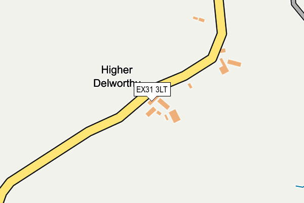
EX31 3LT is in Yarnscombe, Barnstaple. EX31 3LT is located in the Two Rivers & Three Moors electoral ward, within the local authority district of Torridge and the English Parliamentary constituency of Torridge and West Devon. The Sub Integrated Care Board (ICB) Location is NHS Devon ICB - 15N and the police force is Devon & Cornwall. This postcode has been in use since January 1980.


GetTheData
Source: OS OpenMap – Local (Ordnance Survey)
Source: OS VectorMap District (Ordnance Survey)
Licence: Open Government Licence (requires attribution)
| Easting | 254509 |
| Northing | 123724 |
| Latitude | 50.994465 |
| Longitude | -4.074604 |
GetTheData
Source: Open Postcode Geo
Licence: Open Government Licence
| Locality | Yarnscombe |
| Town/City | Barnstaple |
| Country | England |
| Postcode District | EX31 |
| ➜ EX31 open data dashboard ➜ See where EX31 is on a map | |
GetTheData
Source: Land Registry Price Paid Data
Licence: Open Government Licence
Elevation or altitude of EX31 3LT as distance above sea level:
| Metres | Feet | |
|---|---|---|
| Elevation | 120m | 394ft |
Elevation is measured from the approximate centre of the postcode, to the nearest point on an OS contour line from OS Terrain 50, which has contour spacing of ten vertical metres.
➜ How high above sea level am I? Find the elevation of your current position using your device's GPS.
GetTheData
Source: Open Postcode Elevation
Licence: Open Government Licence
| Ward | Two Rivers & Three Moors |
| Constituency | Torridge And West Devon |
GetTheData
Source: ONS Postcode Database
Licence: Open Government Licence
| Chapelton (Devon) Station | 4.3km |
GetTheData
Source: NaPTAN
Licence: Open Government Licence
| Percentage of properties with Next Generation Access | 100.0% |
| Percentage of properties with Superfast Broadband | 0.0% |
| Percentage of properties with Ultrafast Broadband | 0.0% |
| Percentage of properties with Full Fibre Broadband | 0.0% |
Superfast Broadband is between 30Mbps and 300Mbps
Ultrafast Broadband is > 300Mbps
| Percentage of properties unable to receive 2Mbps | 100.0% |
| Percentage of properties unable to receive 5Mbps | 100.0% |
| Percentage of properties unable to receive 10Mbps | 100.0% |
| Percentage of properties unable to receive 30Mbps | 100.0% |
GetTheData
Source: Ofcom
Licence: Ofcom Terms of Use (requires attribution)
GetTheData
Source: ONS Postcode Database
Licence: Open Government Licence

➜ Get more ratings from the Food Standards Agency
GetTheData
Source: Food Standards Agency
Licence: FSA terms & conditions
| Last Collection | |||
|---|---|---|---|
| Location | Mon-Fri | Sat | Distance |
| Fishleigh Rock | 16:35 | 07:30 | 4,125m |
| Atherington Post Office | 16:15 | 12:00 | 4,649m |
| Wellcombe | 09:00 | 11:45 | 5,707m |
GetTheData
Source: Dracos
Licence: Creative Commons Attribution-ShareAlike
| Facility | Distance |
|---|---|
| Newton Tracey Cricket Club The Lawn, Newton Tracey Grass Pitches | 4km |
| Atherington Playing Field Atherington, Umberleigh Grass Pitches | 4.8km |
| Donnacroft Fields (Torridgeside Fc) Hatchmoor Road, Torrington Grass Pitches | 5.8km |
GetTheData
Source: Active Places
Licence: Open Government Licence
| School | Phase of Education | Distance |
|---|---|---|
| Horwood and Newton Tracey Community Primary School Lovacott, Barnstaple, EX31 3PU | Primary | 4.4km |
| Great Torrington School Calvesford Road, Torrington, EX38 7DJ | Secondary | 6km |
| Great Torrington Bluecoat Church of England Primary School Borough Road, Torrington, EX38 7NU | Primary | 6.4km |
GetTheData
Source: Edubase
Licence: Open Government Licence
The below table lists the International Territorial Level (ITL) codes (formerly Nomenclature of Territorial Units for Statistics (NUTS) codes) and Local Administrative Units (LAU) codes for EX31 3LT:
| ITL 1 Code | Name |
|---|---|
| TLK | South West (England) |
| ITL 2 Code | Name |
| TLK4 | Devon |
| ITL 3 Code | Name |
| TLK43 | Devon CC |
| LAU 1 Code | Name |
| E07000046 | Torridge |
GetTheData
Source: ONS Postcode Directory
Licence: Open Government Licence
The below table lists the Census Output Area (OA), Lower Layer Super Output Area (LSOA), and Middle Layer Super Output Area (MSOA) for EX31 3LT:
| Code | Name | |
|---|---|---|
| OA | E00102880 | |
| LSOA | E01020308 | Torridge 007C |
| MSOA | E02004226 | Torridge 007 |
GetTheData
Source: ONS Postcode Directory
Licence: Open Government Licence
| EX31 3LX | 873m | |
| EX31 3LU | 906m | |
| EX31 3NA | 1230m | |
| EX31 3LS | 1346m | |
| EX31 3LZ | 1401m | |
| EX31 3PP | 1474m | |
| EX31 3LN | 1535m | |
| EX31 3LP | 1572m | |
| EX31 3LW | 1648m | |
| EX31 3LB | St Andrews Close | 1670m |
GetTheData
Source: Open Postcode Geo; Land Registry Price Paid Data
Licence: Open Government Licence