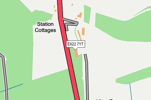
EX22 7YT is located in the Broadheath electoral ward, within the local authority district of Torridge and the English Parliamentary constituency of Torridge and West Devon. The Sub Integrated Care Board (ICB) Location is NHS Devon ICB - 15N and the police force is Devon & Cornwall. This postcode has been in use since May 2007.


GetTheData
Source: OS OpenMap – Local (Ordnance Survey)
Source: OS VectorMap District (Ordnance Survey)
Licence: Open Government Licence (requires attribution)
| Easting | 240510 |
| Northing | 102714 |
| Latitude | 50.801976 |
| Longitude | -4.264720 |
GetTheData
Source: Open Postcode Geo
Licence: Open Government Licence
| Country | England |
| Postcode District | EX22 |
| ➜ EX22 open data dashboard ➜ See where EX22 is on a map | |
GetTheData
Source: Land Registry Price Paid Data
Licence: Open Government Licence
Elevation or altitude of EX22 7YT as distance above sea level:
| Metres | Feet | |
|---|---|---|
| Elevation | 150m | 492ft |
Elevation is measured from the approximate centre of the postcode, to the nearest point on an OS contour line from OS Terrain 50, which has contour spacing of ten vertical metres.
➜ How high above sea level am I? Find the elevation of your current position using your device's GPS.
GetTheData
Source: Open Postcode Elevation
Licence: Open Government Licence
| Ward | Broadheath |
| Constituency | Torridge And West Devon |
GetTheData
Source: ONS Postcode Database
Licence: Open Government Licence
| Station Cottages (A3079) | Brandis Corner | 120m |
| Station Cottages (A3079) | Brandis Corner | 128m |
| Morecombe Cross (A3079) | Brandis Corner | 995m |
| Morecombe Cross (A3079) | Brandis Corner | 1,002m |
| Dunsland Cross (A3079) | Cookbury | 1,154m |
GetTheData
Source: NaPTAN
Licence: Open Government Licence
GetTheData
Source: ONS Postcode Database
Licence: Open Government Licence

➜ Get more ratings from the Food Standards Agency
GetTheData
Source: Food Standards Agency
Licence: FSA terms & conditions
| Last Collection | |||
|---|---|---|---|
| Location | Mon-Fri | Sat | Distance |
| Brandis Corner Post Office | 14:45 | 10:00 | 1,354m |
| Dunsland Gate | 14:45 | 09:45 | 2,732m |
| Beaworthy Post Office | 17:15 | 11:45 | 4,806m |
GetTheData
Source: Dracos
Licence: Creative Commons Attribution-ShareAlike
| Facility | Distance |
|---|---|
| Halwill Junction Playing Field Halwill Junction, Beaworthy Grass Pitches | 4.9km |
| Halwill Primary School Halwill Junction, Beaworthy Grass Pitches | 5km |
GetTheData
Source: Active Places
Licence: Open Government Licence
| School | Phase of Education | Distance |
|---|---|---|
| Bradford Primary School Bradford, Holemoor, Holsworthy, EX22 7AB | Primary | 3.3km |
| Halwill Community Primary School Dreybury Lane, Halwill, Beaworthy, EX21 5XU | Primary | 5km |
GetTheData
Source: Edubase
Licence: Open Government Licence
The below table lists the International Territorial Level (ITL) codes (formerly Nomenclature of Territorial Units for Statistics (NUTS) codes) and Local Administrative Units (LAU) codes for EX22 7YT:
| ITL 1 Code | Name |
|---|---|
| TLK | South West (England) |
| ITL 2 Code | Name |
| TLK4 | Devon |
| ITL 3 Code | Name |
| TLK43 | Devon CC |
| LAU 1 Code | Name |
| E07000046 | Torridge |
GetTheData
Source: ONS Postcode Directory
Licence: Open Government Licence
The below table lists the Census Output Area (OA), Lower Layer Super Output Area (LSOA), and Middle Layer Super Output Area (MSOA) for EX22 7YT:
| Code | Name | |
|---|---|---|
| OA | E00102781 | |
| LSOA | E01020290 | Torridge 009C |
| MSOA | E02004228 | Torridge 009 |
GetTheData
Source: ONS Postcode Directory
Licence: Open Government Licence
| EX22 7YH | Dunsland Cross | 120m |
| EX21 5UT | 881m | |
| EX22 7YQ | 1382m | |
| EX21 5UX | 1411m | |
| EX21 5XJ | Firconia Terrace | 1430m |
| EX22 7YP | The Gardens | 1457m |
| EX21 5UU | Forest Houses | 1572m |
| EX22 7XZ | 1860m | |
| EX22 7YD | 1918m | |
| EX21 5UR | 2130m |
GetTheData
Source: Open Postcode Geo; Land Registry Price Paid Data
Licence: Open Government Licence