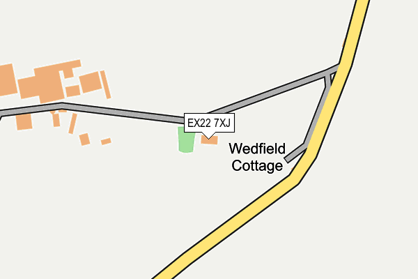
EX22 7XJ is located in the Monkleigh & Putford electoral ward, within the local authority district of Torridge and the English Parliamentary constituency of Torridge and West Devon. The Sub Integrated Care Board (ICB) Location is NHS Devon ICB - 15N and the police force is Devon & Cornwall. This postcode has been in use since January 1980.


GetTheData
Source: OS OpenMap – Local (Ordnance Survey)
Source: OS VectorMap District (Ordnance Survey)
Licence: Open Government Licence (requires attribution)
| Easting | 236162 |
| Northing | 117431 |
| Latitude | 50.932995 |
| Longitude | -4.332965 |
GetTheData
Source: Open Postcode Geo
Licence: Open Government Licence
| Country | England |
| Postcode District | EX22 |
| ➜ EX22 open data dashboard ➜ See where EX22 is on a map | |
GetTheData
Source: Land Registry Price Paid Data
Licence: Open Government Licence
Elevation or altitude of EX22 7XJ as distance above sea level:
| Metres | Feet | |
|---|---|---|
| Elevation | 170m | 558ft |
Elevation is measured from the approximate centre of the postcode, to the nearest point on an OS contour line from OS Terrain 50, which has contour spacing of ten vertical metres.
➜ How high above sea level am I? Find the elevation of your current position using your device's GPS.
GetTheData
Source: Open Postcode Elevation
Licence: Open Government Licence
| Ward | Monkleigh & Putford |
| Constituency | Torridge And West Devon |
GetTheData
Source: ONS Postcode Database
Licence: Open Government Licence
| East Putford | East Putford | 1,215m |
| East Putford | East Putford | 1,224m |
| Stores | Powler's Piece | 1,313m |
| Stores | Powler's Piece | 1,318m |
GetTheData
Source: NaPTAN
Licence: Open Government Licence
| Percentage of properties with Next Generation Access | 100.0% |
| Percentage of properties with Superfast Broadband | 0.0% |
| Percentage of properties with Ultrafast Broadband | 0.0% |
| Percentage of properties with Full Fibre Broadband | 0.0% |
Superfast Broadband is between 30Mbps and 300Mbps
Ultrafast Broadband is > 300Mbps
| Percentage of properties unable to receive 2Mbps | 80.0% |
| Percentage of properties unable to receive 5Mbps | 100.0% |
| Percentage of properties unable to receive 10Mbps | 100.0% |
| Percentage of properties unable to receive 30Mbps | 100.0% |
GetTheData
Source: Ofcom
Licence: Ofcom Terms of Use (requires attribution)
GetTheData
Source: ONS Postcode Database
Licence: Open Government Licence
| Facility | Distance |
|---|---|
| Woolsery Sports And Community Hall Meadow Court, Woolsery, Bideford Sports Hall, Grass Pitches, Health and Fitness Gym, Outdoor Tennis Courts | 4.2km |
| Putford Fc (Glebe Field) Babeleigh Road, Parkham, Bideford Grass Pitches | 4.5km |
| Bradworthy Football Ground North Road, Bradworthy Grass Pitches | 5km |
GetTheData
Source: Active Places
Licence: Open Government Licence
| School | Phase of Education | Distance |
|---|---|---|
| Parkham Primary School Parkham, Bideford, EX39 5PL | Primary | 4.5km |
| Woolsery Primary School Woolsery, Bideford, EX39 5QS | Primary | 4.7km |
| Bradworthy Primary Academy Bradworthy, Holsworthy, EX22 7RT | Primary | 5.1km |
GetTheData
Source: Edubase
Licence: Open Government Licence
The below table lists the International Territorial Level (ITL) codes (formerly Nomenclature of Territorial Units for Statistics (NUTS) codes) and Local Administrative Units (LAU) codes for EX22 7XJ:
| ITL 1 Code | Name |
|---|---|
| TLK | South West (England) |
| ITL 2 Code | Name |
| TLK4 | Devon |
| ITL 3 Code | Name |
| TLK43 | Devon CC |
| LAU 1 Code | Name |
| E07000046 | Torridge |
GetTheData
Source: ONS Postcode Directory
Licence: Open Government Licence
The below table lists the Census Output Area (OA), Lower Layer Super Output Area (LSOA), and Middle Layer Super Output Area (MSOA) for EX22 7XJ:
| Code | Name | |
|---|---|---|
| OA | E00102885 | |
| LSOA | E01020309 | Torridge 008E |
| MSOA | E02004227 | Torridge 008 |
GetTheData
Source: ONS Postcode Directory
Licence: Open Government Licence
| EX22 7XP | 1084m | |
| EX22 7XQ | 1124m | |
| EX22 7UG | 1213m | |
| EX22 7XW | Powlers Piece | 1323m |
| EX22 7XG | Sessacott | 1398m |
| EX22 7UF | 1527m | |
| EX22 7XD | 1675m | |
| EX22 7UQ | 1751m | |
| EX22 7XH | 1790m | |
| EX22 7UU | 1839m |
GetTheData
Source: Open Postcode Geo; Land Registry Price Paid Data
Licence: Open Government Licence