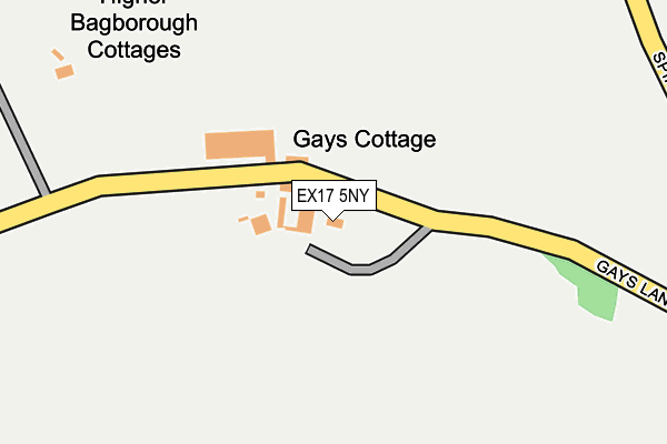
EX17 5NY is located in the Sandford & Creedy electoral ward, within the local authority district of Mid Devon and the English Parliamentary constituency of Central Devon. The Sub Integrated Care Board (ICB) Location is NHS Devon ICB - 15N and the police force is Devon & Cornwall. This postcode has been in use since January 1980.


GetTheData
Source: OS OpenMap – Local (Ordnance Survey)
Source: OS VectorMap District (Ordnance Survey)
Licence: Open Government Licence (requires attribution)
| Easting | 278371 |
| Northing | 104524 |
| Latitude | 50.827438 |
| Longitude | -3.728330 |
GetTheData
Source: Open Postcode Geo
Licence: Open Government Licence
| Country | England |
| Postcode District | EX17 |
| ➜ EX17 open data dashboard ➜ See where EX17 is on a map | |
GetTheData
Source: Land Registry Price Paid Data
Licence: Open Government Licence
Elevation or altitude of EX17 5NY as distance above sea level:
| Metres | Feet | |
|---|---|---|
| Elevation | 150m | 492ft |
Elevation is measured from the approximate centre of the postcode, to the nearest point on an OS contour line from OS Terrain 50, which has contour spacing of ten vertical metres.
➜ How high above sea level am I? Find the elevation of your current position using your device's GPS.
GetTheData
Source: Open Postcode Elevation
Licence: Open Government Licence
| Ward | Sandford & Creedy |
| Constituency | Central Devon |
GetTheData
Source: ONS Postcode Database
Licence: Open Government Licence
| Shelter | Newbuildings | 1,517m |
| Shelter | Newbuildings | 1,528m |
| Copplestone Station | 2.2km |
| Morchard Road Station | 3.4km |
GetTheData
Source: NaPTAN
Licence: Open Government Licence
| Percentage of properties with Next Generation Access | 0.0% |
| Percentage of properties with Superfast Broadband | 0.0% |
| Percentage of properties with Ultrafast Broadband | 0.0% |
| Percentage of properties with Full Fibre Broadband | 0.0% |
Superfast Broadband is between 30Mbps and 300Mbps
Ultrafast Broadband is > 300Mbps
| Percentage of properties unable to receive 2Mbps | 0.0% |
| Percentage of properties unable to receive 5Mbps | 0.0% |
| Percentage of properties unable to receive 10Mbps | 100.0% |
| Percentage of properties unable to receive 30Mbps | 100.0% |
GetTheData
Source: Ofcom
Licence: Ofcom Terms of Use (requires attribution)
GetTheData
Source: ONS Postcode Database
Licence: Open Government Licence


➜ Get more ratings from the Food Standards Agency
GetTheData
Source: Food Standards Agency
Licence: FSA terms & conditions
| Last Collection | |||
|---|---|---|---|
| Location | Mon-Fri | Sat | Distance |
| Copplestone Post Office | 17:00 | 11:15 | 2,311m |
| Morchard Bishop Post Office | 16:15 | 11:45 | 3,548m |
| Coleford | 15:15 | 09:45 | 3,668m |
GetTheData
Source: Dracos
Licence: Creative Commons Attribution-ShareAlike
| Facility | Distance |
|---|---|
| David Pullen Recreational Field Bewsley Hill, Copplestone Grass Pitches | 1.9km |
| Copplestone Primary School Copplestone, Crediton Grass Pitches | 2km |
| Waterbridge Golf Course Down St Mary, Crediton Golf | 2.7km |
GetTheData
Source: Active Places
Licence: Open Government Licence
| School | Phase of Education | Distance |
|---|---|---|
| Copplestone Primary School Bewsley Hill, Copplestone, Crediton, EX17 5NX | Primary | 2km |
| Morchard Bishop Church of England Primary School Church Street, Morchard Bishop, Crediton, EX17 6PJ | Primary | 3.2km |
| Sandford School Sandford, Crediton, EX17 4NE | Primary | 4.9km |
GetTheData
Source: Edubase
Licence: Open Government Licence
The below table lists the International Territorial Level (ITL) codes (formerly Nomenclature of Territorial Units for Statistics (NUTS) codes) and Local Administrative Units (LAU) codes for EX17 5NY:
| ITL 1 Code | Name |
|---|---|
| TLK | South West (England) |
| ITL 2 Code | Name |
| TLK4 | Devon |
| ITL 3 Code | Name |
| TLK43 | Devon CC |
| LAU 1 Code | Name |
| E07000042 | Mid Devon |
GetTheData
Source: ONS Postcode Directory
Licence: Open Government Licence
The below table lists the Census Output Area (OA), Lower Layer Super Output Area (LSOA), and Middle Layer Super Output Area (MSOA) for EX17 5NY:
| Code | Name | |
|---|---|---|
| OA | E00101621 | |
| LSOA | E01020069 | Mid Devon 010B |
| MSOA | E02004173 | Mid Devon 010 |
GetTheData
Source: ONS Postcode Directory
Licence: Open Government Licence
| EX17 5NZ | Lower Bagborough Cottages | 578m |
| EX17 4PS | 806m | |
| EX17 4PU | New Buildings | 1449m |
| EX17 5NX | 1469m | |
| EX17 4PL | Leave Acre | 1547m |
| EX17 4PP | 1556m | |
| EX17 5PA | Mount Pleasant | 1577m |
| EX17 4PW | New Buildings | 1616m |
| EX17 6RY | 1759m | |
| EX17 6SQ | 1848m |
GetTheData
Source: Open Postcode Geo; Land Registry Price Paid Data
Licence: Open Government Licence