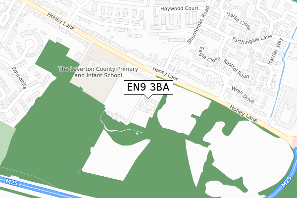
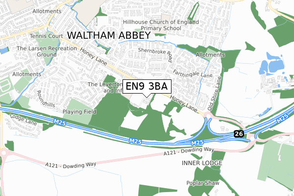
EN9 3BA lies on Honey Lane in Waltham Abbey. EN9 3BA is located in the Waltham Abbey Honey Lane electoral ward, within the local authority district of Epping Forest and the English Parliamentary constituency of Epping Forest. The Sub Integrated Care Board (ICB) Location is NHS Hertfordshire and West Essex ICB - 07H and the police force is Essex. This postcode has been in use since January 1980.


GetTheData
Source: OS Open Zoomstack (Ordnance Survey)
Licence: Open Government Licence (requires attribution)
Attribution: Contains OS data © Crown copyright and database right 2024
Source: Open Postcode Geo
Licence: Open Government Licence (requires attribution)
Attribution: Contains OS data © Crown copyright and database right 2024; Contains Royal Mail data © Royal Mail copyright and database right 2024; Source: Office for National Statistics licensed under the Open Government Licence v.3.0
| Easting | 539865 |
| Northing | 200032 |
| Latitude | 51.681644 |
| Longitude | 0.021693 |
GetTheData
Source: Open Postcode Geo
Licence: Open Government Licence
| Street | Honey Lane |
| Town/City | Waltham Abbey |
| Country | England |
| Postcode District | EN9 |
| ➜ EN9 open data dashboard ➜ See where EN9 is on a map ➜ Where is Waltham Abbey? | |
GetTheData
Source: Land Registry Price Paid Data
Licence: Open Government Licence
Elevation or altitude of EN9 3BA as distance above sea level:
| Metres | Feet | |
|---|---|---|
| Elevation | 40m | 131ft |
Elevation is measured from the approximate centre of the postcode, to the nearest point on an OS contour line from OS Terrain 50, which has contour spacing of ten vertical metres.
➜ How high above sea level am I? Find the elevation of your current position using your device's GPS.
GetTheData
Source: Open Postcode Elevation
Licence: Open Government Licence
| Ward | Waltham Abbey Honey Lane |
| Constituency | Epping Forest |
GetTheData
Source: ONS Postcode Database
Licence: Open Government Licence
176A, HONEY LANE, WALTHAM ABBEY, EN9 3BA 2022 14 JUL £675,000 |
176D, HONEY LANE, WALTHAM ABBEY, EN9 3BA 2022 12 JUL £699,995 |
176, HONEY LANE, WALTHAM ABBEY, EN9 3BA 2020 3 JUL £850,000 |
174, HONEY LANE, WALTHAM ABBEY, EN9 3BA 2001 31 AUG £335,000 |
HONEYLANDS COTTAGE, HONEY LANE, WALTHAM ABBEY, EN9 3BA 2001 30 APR £135,000 |
HONEY LANE CARE HOME, HONEY LANE, WALTHAM ABBEY, EN9 3BA 1998 9 APR £695,000 |
GetTheData
Source: HM Land Registry Price Paid Data
Licence: Contains HM Land Registry data © Crown copyright and database right 2024. This data is licensed under the Open Government Licence v3.0.
| January 2024 | Drugs | On or near Farthingale Lane | 417m |
| December 2023 | Violence and sexual offences | On or near Harrier Way | 392m |
| December 2023 | Violence and sexual offences | On or near Mason Close | 483m |
| ➜ Get more crime data in our Crime section | |||
GetTheData
Source: data.police.uk
Licence: Open Government Licence
| Farthingale Lane (Shernbroke Road) | Waltham Abbey | 248m |
| Margherita Road (Honey Lane) | Waltham Abbey | 252m |
| Margherita Road (Honey Lane) | Waltham Abbey | 259m |
| Farthingale Lane (Shernbroke Road) | Waltham Abbey | 295m |
| Masons Court (Shernbroke Road) | Waltham Abbey | 380m |
| Waltham Cross Station | 3.4km |
| Enfield Lock Station | 3.7km |
| Cheshunt Station | 3.9km |
GetTheData
Source: NaPTAN
Licence: Open Government Licence
| Percentage of properties with Next Generation Access | 100.0% |
| Percentage of properties with Superfast Broadband | 100.0% |
| Percentage of properties with Ultrafast Broadband | 0.0% |
| Percentage of properties with Full Fibre Broadband | 0.0% |
Superfast Broadband is between 30Mbps and 300Mbps
Ultrafast Broadband is > 300Mbps
| Percentage of properties unable to receive 2Mbps | 0.0% |
| Percentage of properties unable to receive 5Mbps | 0.0% |
| Percentage of properties unable to receive 10Mbps | 0.0% |
| Percentage of properties unable to receive 30Mbps | 0.0% |
GetTheData
Source: Ofcom
Licence: Ofcom Terms of Use (requires attribution)
GetTheData
Source: ONS Postcode Database
Licence: Open Government Licence


➜ Get more ratings from the Food Standards Agency
GetTheData
Source: Food Standards Agency
Licence: FSA terms & conditions
| Last Collection | |||
|---|---|---|---|
| Location | Mon-Fri | Sat | Distance |
| Skilletts Hill | 16:45 | 11:30 | 284m |
| Windmill Close (Patmore Rd) | 16:30 | 11:30 | 649m |
| Upshire | 16:30 | 11:30 | 1,237m |
GetTheData
Source: Dracos
Licence: Creative Commons Attribution-ShareAlike
| Facility | Distance |
|---|---|
| Marriott Leisure Club (Waltham Abbey) Old Shire Lane, Waltham Abbey Swimming Pool, Health and Fitness Gym | 457m |
| Ninefields Playing Fields Hillhouse, Waltham Abbey Grass Pitches | 482m |
| Waltham Abbey Leisure Centre Waltham Abbey Health and Fitness Gym, Swimming Pool, Studio | 520m |
GetTheData
Source: Active Places
Licence: Open Government Licence
| School | Phase of Education | Distance |
|---|---|---|
| Leverton Primary School Honey Lane, Waltham Abbey, EN9 3BE | Primary | 258m |
| Hillhouse CofE Primary School Ninefields Estate, Waltham Abbey, EN9 3EL | Primary | 604m |
| King Harold Business & Enterprise Academy Broomstick Hall Road, Waltham Abbey, EN9 1LF | Secondary | 990m |
GetTheData
Source: Edubase
Licence: Open Government Licence
The below table lists the International Territorial Level (ITL) codes (formerly Nomenclature of Territorial Units for Statistics (NUTS) codes) and Local Administrative Units (LAU) codes for EN9 3BA:
| ITL 1 Code | Name |
|---|---|
| TLH | East |
| ITL 2 Code | Name |
| TLH3 | Essex |
| ITL 3 Code | Name |
| TLH35 | West Essex |
| LAU 1 Code | Name |
| E07000072 | Epping Forest |
GetTheData
Source: ONS Postcode Directory
Licence: Open Government Licence
The below table lists the Census Output Area (OA), Lower Layer Super Output Area (LSOA), and Middle Layer Super Output Area (MSOA) for EN9 3BA:
| Code | Name | |
|---|---|---|
| OA | E00110797 | |
| LSOA | E01021810 | Epping Forest 008D |
| MSOA | E02004534 | Epping Forest 008 |
GetTheData
Source: ONS Postcode Directory
Licence: Open Government Licence
| EN9 3AY | Honey Lane | 112m |
| EN9 3BE | Honey Lane | 118m |
| EN9 3JH | The Birches | 144m |
| EN9 3TT | Margherita Place | 159m |
| EN9 3DN | Caterham Court | 187m |
| EN9 3NA | Eagle Close | 221m |
| EN9 3AX | Honey Lane | 223m |
| EN9 3DZ | Harlton Court | 227m |
| EN9 3TU | Margherita Road | 245m |
| EN9 3DW | Millhoo Court | 252m |
GetTheData
Source: Open Postcode Geo; Land Registry Price Paid Data
Licence: Open Government Licence