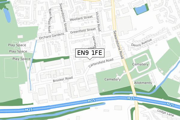
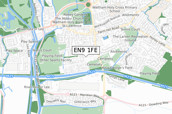
EN9 1FE is located in the Waltham Abbey South West electoral ward, within the local authority district of Epping Forest and the English Parliamentary constituency of Epping Forest. The Sub Integrated Care Board (ICB) Location is NHS Hertfordshire and West Essex ICB - 07H and the police force is Essex. This postcode has been in use since January 2011.


GetTheData
Source: OS Open Zoomstack (Ordnance Survey)
Licence: Open Government Licence (requires attribution)
Attribution: Contains OS data © Crown copyright and database right 2024
Source: Open Postcode Geo
Licence: Open Government Licence (requires attribution)
Attribution: Contains OS data © Crown copyright and database right 2024; Contains Royal Mail data © Royal Mail copyright and database right 2024; Source: Office for National Statistics licensed under the Open Government Licence v.3.0
| Easting | 538337 |
| Northing | 200139 |
| Latitude | 51.682980 |
| Longitude | -0.000378 |
GetTheData
Source: Open Postcode Geo
Licence: Open Government Licence
| Country | England |
| Postcode District | EN9 |
| ➜ EN9 open data dashboard ➜ See where EN9 is on a map ➜ Where is Waltham Abbey? | |
GetTheData
Source: Land Registry Price Paid Data
Licence: Open Government Licence
Elevation or altitude of EN9 1FE as distance above sea level:
| Metres | Feet | |
|---|---|---|
| Elevation | 20m | 66ft |
Elevation is measured from the approximate centre of the postcode, to the nearest point on an OS contour line from OS Terrain 50, which has contour spacing of ten vertical metres.
➜ How high above sea level am I? Find the elevation of your current position using your device's GPS.
GetTheData
Source: Open Postcode Elevation
Licence: Open Government Licence
| Ward | Waltham Abbey South West |
| Constituency | Epping Forest |
GetTheData
Source: ONS Postcode Database
Licence: Open Government Licence
| June 2022 | Violence and sexual offences | On or near Cartersfield Road | 38m |
| June 2022 | Vehicle crime | On or near Cartersfield Road | 38m |
| June 2022 | Burglary | On or near Harveyfields | 59m |
| ➜ Get more crime data in our Crime section | |||
GetTheData
Source: data.police.uk
Licence: Open Government Licence
| The Sultan (Sewardstone Road) | Waltham Abbey | 184m |
| Cartersfield (Sewardstone Road) | Waltham Abbey | 220m |
| The Sultan (Sewardstone Road) | Waltham Abbey | 233m |
| Quaker Lane | Waltham Abbey | 333m |
| Quaker Lane | Waltham Abbey | 355m |
| Waltham Cross Station | 1.8km |
| Enfield Lock Station | 2.4km |
| Theobalds Grove Station | 2.6km |
GetTheData
Source: NaPTAN
Licence: Open Government Licence
GetTheData
Source: ONS Postcode Database
Licence: Open Government Licence


➜ Get more ratings from the Food Standards Agency
GetTheData
Source: Food Standards Agency
Licence: FSA terms & conditions
| Last Collection | |||
|---|---|---|---|
| Location | Mon-Fri | Sat | Distance |
| Waltham Abbey P.o | 18:30 | 12:00 | 436m |
| Greenyard | 17:30 | 11:30 | 506m |
| Highbridge Street | 17:30 | 11:30 | 697m |
GetTheData
Source: Dracos
Licence: Creative Commons Attribution-ShareAlike
| Facility | Distance |
|---|---|
| Krunch Gym (Closed) Cartersfield Road, Waltham Abbey Health and Fitness Gym, Studio | 105m |
| Town Mead Leisure Park Brooker Road, Waltham Abbey Grass Pitches, Artificial Grass Pitch | 346m |
| Waltham Abbey Fc (Capershotts) Sewardstone Road, Waltham Abbey Grass Pitches | 426m |
GetTheData
Source: Active Places
Licence: Open Government Licence
| School | Phase of Education | Distance |
|---|---|---|
| Waltham Holy Cross Primary Academy Quendon Drive, Waltham Abbey, EN9 1LG | Primary | 839m |
| King Harold Business & Enterprise Academy Broomstick Hall Road, Waltham Abbey, EN9 1LF | Secondary | 1.3km |
| Leverton Primary School Honey Lane, Waltham Abbey, EN9 3BE | Primary | 1.3km |
GetTheData
Source: Edubase
Licence: Open Government Licence
The below table lists the International Territorial Level (ITL) codes (formerly Nomenclature of Territorial Units for Statistics (NUTS) codes) and Local Administrative Units (LAU) codes for EN9 1FE:
| ITL 1 Code | Name |
|---|---|
| TLH | East |
| ITL 2 Code | Name |
| TLH3 | Essex |
| ITL 3 Code | Name |
| TLH35 | West Essex |
| LAU 1 Code | Name |
| E07000072 | Epping Forest |
GetTheData
Source: ONS Postcode Directory
Licence: Open Government Licence
The below table lists the Census Output Area (OA), Lower Layer Super Output Area (LSOA), and Middle Layer Super Output Area (MSOA) for EN9 1FE:
| Code | Name | |
|---|---|---|
| OA | E00110834 | |
| LSOA | E01021817 | Epping Forest 008E |
| MSOA | E02004534 | Epping Forest 008 |
GetTheData
Source: ONS Postcode Directory
Licence: Open Government Licence
| EN9 1HP | Harveyfields | 42m |
| EN9 1HN | Harveyfields | 81m |
| EN9 1HW | Harveyfields | 116m |
| EN9 1HL | Greenfield Street | 150m |
| EN9 1HG | King George Road | 158m |
| EN9 1HH | Victoria Road | 159m |
| EN9 1HY | Brooker Road | 164m |
| EN9 1PB | Lexden Terrace | 169m |
| EN9 1HJ | Greenfield Street | 181m |
| EN9 1NU | Nobel Villas | 198m |
GetTheData
Source: Open Postcode Geo; Land Registry Price Paid Data
Licence: Open Government Licence