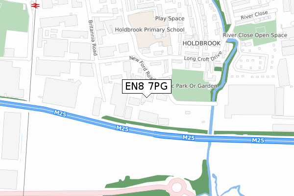
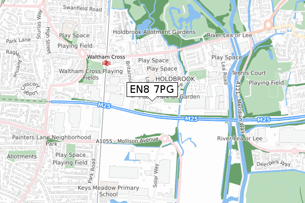
EN8 7PG maps, stats, and open data
EN8 7PG is located in the Waltham Cross electoral ward, within the local authority district of Broxbourne and the English Parliamentary constituency of Broxbourne. The Sub Integrated Care Board (ICB) Location is NHS Hertfordshire and West Essex ICB - 06K and the police force is Hertfordshire. This postcode has been in use since January 1980.
EN8 7PG maps


Licence: Open Government Licence (requires attribution)
Attribution: Contains OS data © Crown copyright and database right 2025
Source: Open Postcode Geo
Licence: Open Government Licence (requires attribution)
Attribution: Contains OS data © Crown copyright and database right 2025; Contains Royal Mail data © Royal Mail copyright and database right 2025; Source: Office for National Statistics licensed under the Open Government Licence v.3.0
EN8 7PG geodata
| Easting | 536907 |
| Northing | 200003 |
| Latitude | 51.682108 |
| Longitude | -0.021103 |
Where is EN8 7PG?
| Country | England |
| Postcode District | EN8 |
EN8 7PG Elevation
Elevation or altitude of EN8 7PG as distance above sea level:
| Metres | Feet | |
|---|---|---|
| Elevation | 20m | 66ft |
Elevation is measured from the approximate centre of the postcode, to the nearest point on an OS contour line from OS Terrain 50, which has contour spacing of ten vertical metres.
➜ How high above sea level am I? Find the elevation of your current position using your device's GPS.
Politics
| Ward | Waltham Cross |
|---|---|
| Constituency | Broxbourne |
Transport
Nearest bus stops to EN8 7PG
| Long Croft Drive | Waltham Cross | 360m |
| Long Croft Drive | Waltham Cross | 364m |
| Queensway (Eleanor Cross Road) | Waltham Cross | 397m |
| Queensway (Eleanor Cross Road) | Waltham Cross | 425m |
| Waltham Cross Railway Station (Eleanor Cross Road) | Waltham Cross | 526m |
Nearest railway stations to EN8 7PG
| Waltham Cross Station | 0.5km |
| Enfield Lock Station | 1.3km |
| Theobalds Grove Station | 1.5km |
Deprivation
87.1% of English postcodes are less deprived than EN8 7PG:Food Standards Agency
Three nearest food hygiene ratings to EN8 7PG (metres)

➜ Get more ratings from the Food Standards Agency
Nearest post box to EN8 7PG
| Last Collection | |||
|---|---|---|---|
| Location | Mon-Fri | Sat | Distance |
| Holdbrook | 17:30 | 11:30 | 790m |
| Highbridge Street | 17:30 | 11:30 | 1,049m |
| Enfield Lock Station | 17:30 | 12:00 | 1,235m |
Environment
| Risk of EN8 7PG flooding from rivers and sea | Low |
EN8 7PG ITL and EN8 7PG LAU
The below table lists the International Territorial Level (ITL) codes (formerly Nomenclature of Territorial Units for Statistics (NUTS) codes) and Local Administrative Units (LAU) codes for EN8 7PG:
| ITL 1 Code | Name |
|---|---|
| TLH | East |
| ITL 2 Code | Name |
| TLH2 | Bedfordshire and Hertfordshire |
| ITL 3 Code | Name |
| TLH23 | Hertfordshire CC |
| LAU 1 Code | Name |
| E07000095 | Broxbourne |
EN8 7PG census areas
The below table lists the Census Output Area (OA), Lower Layer Super Output Area (LSOA), and Middle Layer Super Output Area (MSOA) for EN8 7PG:
| Code | Name | |
|---|---|---|
| OA | E00118563 | |
| LSOA | E01023338 | Broxbourne 013C |
| MSOA | E02004855 | Broxbourne 013 |
Nearest postcodes to EN8 7PG
| EN8 7QJ | Fowley Close | 109m |
| EN8 7QL | Longcroft Drive | 125m |
| EN8 7NZ | Britannia Road | 151m |
| EN8 7QQ | Longcroft Drive | 160m |
| EN8 7QH | Longcroft Drive | 161m |
| EN8 7QE | Longcroft Drive | 176m |
| EN8 7QG | Longcroft Drive | 193m |
| EN8 7QD | Longcroft Drive | 202m |
| EN8 7PU | Berwick Close | 213m |
| EN8 7QB | Longcroft Drive | 234m |