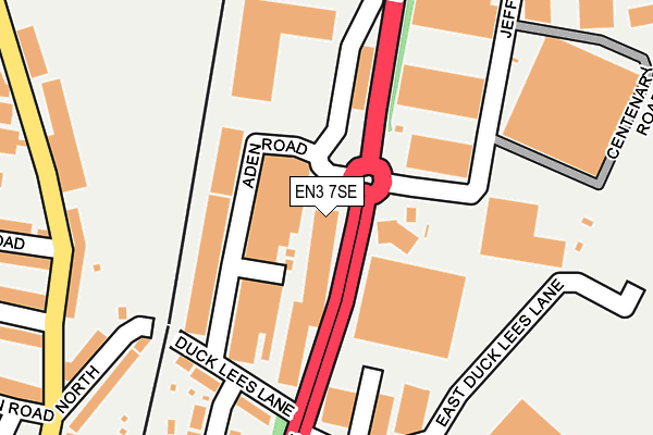
EN3 7SE is located in the Ponders End electoral ward, within the London borough of Enfield and the English Parliamentary constituency of Edmonton. The Sub Integrated Care Board (ICB) Location is NHS North Central London ICB - 93C and the police force is Metropolitan Police. This postcode has been in use since June 1996.


GetTheData
Source: OS OpenMap – Local (Ordnance Survey)
Source: OS VectorMap District (Ordnance Survey)
Licence: Open Government Licence (requires attribution)
| Easting | 536350 |
| Northing | 196222 |
| Latitude | 51.648268 |
| Longitude | -0.030628 |
GetTheData
Source: Open Postcode Geo
Licence: Open Government Licence
| Country | England |
| Postcode District | EN3 |
| ➜ EN3 open data dashboard ➜ See where EN3 is on a map ➜ Where is London? | |
GetTheData
Source: Land Registry Price Paid Data
Licence: Open Government Licence
Elevation or altitude of EN3 7SE as distance above sea level:
| Metres | Feet | |
|---|---|---|
| Elevation | 20m | 66ft |
Elevation is measured from the approximate centre of the postcode, to the nearest point on an OS contour line from OS Terrain 50, which has contour spacing of ten vertical metres.
➜ How high above sea level am I? Find the elevation of your current position using your device's GPS.
GetTheData
Source: Open Postcode Elevation
Licence: Open Government Licence
| Ward | Ponders End |
| Constituency | Edmonton |
GetTheData
Source: ONS Postcode Database
Licence: Open Government Licence
| June 2022 | Anti-social behaviour | On or near Aden Road | 78m |
| June 2022 | Robbery | On or near Aden Road | 78m |
| June 2022 | Burglary | On or near Aden Road | 78m |
| ➜ Get more crime data in our Crime section | |||
GetTheData
Source: data.police.uk
Licence: Open Government Licence
| Duck Lees Lane (Mollison Avenue) | Ponders End | 38m |
| Duck Lees Lane (Mollison Avenue) | Ponders End | 125m |
| Scotland Green Road (Alma Road) | Ponders End | 289m |
| Lea Valley Road (En3) (Mollison Avenue) | Ponders End | 311m |
| Scotland Green Road (Alma Road) | Ponders End | 337m |
| Ponders End Station | 0.7km |
| Brimsdown Station | 0.8km |
| Southbury Station | 1.5km |
GetTheData
Source: NaPTAN
Licence: Open Government Licence
GetTheData
Source: ONS Postcode Database
Licence: Open Government Licence


➜ Get more ratings from the Food Standards Agency
GetTheData
Source: Food Standards Agency
Licence: FSA terms & conditions
| Last Collection | |||
|---|---|---|---|
| Location | Mon-Fri | Sat | Distance |
| Avondale Crescent | 18:30 | 12:00 | 533m |
| Scotland Green Road | 17:30 | 12:00 | 578m |
| Green Street Postoffice | 18:30 | 12:00 | 806m |
GetTheData
Source: Dracos
Licence: Creative Commons Attribution-ShareAlike
| Facility | Distance |
|---|---|
| Alma Road Open Space Alma Road, Enfield Grass Pitches | 432m |
| Muscle Base Gym Alma Road, Enfield Health and Fitness Gym | 450m |
| Brimsdown Primary School Green Street, Enfield Grass Pitches | 772m |
GetTheData
Source: Active Places
Licence: Open Government Licence
| School | Phase of Education | Distance |
|---|---|---|
| Alma Primary School Alma Road, Ponders End, Enfield, EN3 4UQ | Primary | 559m |
| St Mary's Catholic Primary School Durants Road, Ponders End, Enfield, EN3 7DE | Primary | 596m |
| Brimsdown Primary School Green Street, Enfield, EN3 7NA | Primary | 805m |
GetTheData
Source: Edubase
Licence: Open Government Licence
The below table lists the International Territorial Level (ITL) codes (formerly Nomenclature of Territorial Units for Statistics (NUTS) codes) and Local Administrative Units (LAU) codes for EN3 7SE:
| ITL 1 Code | Name |
|---|---|
| TLI | London |
| ITL 2 Code | Name |
| TLI5 | Outer London - East and North East |
| ITL 3 Code | Name |
| TLI54 | Enfield |
| LAU 1 Code | Name |
| E09000010 | Enfield |
GetTheData
Source: ONS Postcode Directory
Licence: Open Government Licence
The below table lists the Census Output Area (OA), Lower Layer Super Output Area (LSOA), and Middle Layer Super Output Area (MSOA) for EN3 7SE:
| Code | Name | |
|---|---|---|
| OA | E00007481 | |
| LSOA | E01001506 | Enfield 014B |
| MSOA | E02000290 | Enfield 014 |
GetTheData
Source: ONS Postcode Directory
Licence: Open Government Licence
| EN3 7PS | Suez Road | 164m |
| EN3 7UH | Duck Lees Lane | 184m |
| EN3 7BA | Alma Road | 236m |
| EN3 4SE | Scotland Green Road | 239m |
| EN3 7UG | Scotland Green Road North | 258m |
| EN3 7UD | Centenary Road | 266m |
| EN3 7UJ | Gilda Avenue | 290m |
| EN3 7UE | Alma Road | 339m |
| EN3 4UP | Alma Road | 357m |
| EN3 7DA | King Edwards Road | 359m |
GetTheData
Source: Open Postcode Geo; Land Registry Price Paid Data
Licence: Open Government Licence