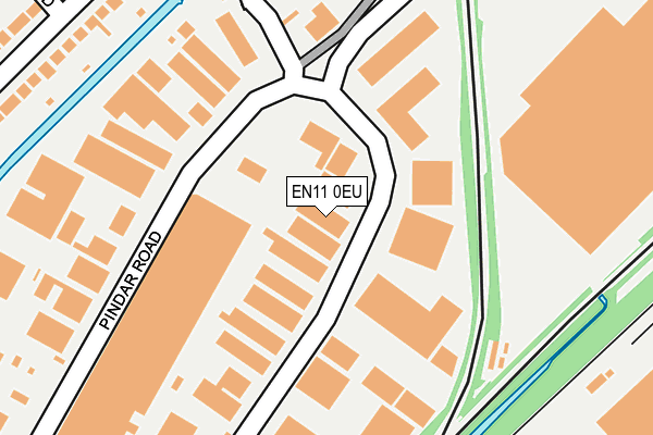
EN11 0EU is located in the Hoddesdon Town and Rye Park electoral ward, within the local authority district of Broxbourne and the English Parliamentary constituency of Broxbourne. The Sub Integrated Care Board (ICB) Location is NHS Hertfordshire and West Essex ICB - 06K and the police force is Hertfordshire. This postcode has been in use since January 1980.


GetTheData
Source: OS OpenMap – Local (Ordnance Survey)
Source: OS VectorMap District (Ordnance Survey)
Licence: Open Government Licence (requires attribution)
| Easting | 538391 |
| Northing | 209216 |
| Latitude | 51.764529 |
| Longitude | 0.004006 |
GetTheData
Source: Open Postcode Geo
Licence: Open Government Licence
| Country | England |
| Postcode District | EN11 |
| ➜ EN11 open data dashboard ➜ See where EN11 is on a map ➜ Where is Hoddesdon? | |
GetTheData
Source: Land Registry Price Paid Data
Licence: Open Government Licence
Elevation or altitude of EN11 0EU as distance above sea level:
| Metres | Feet | |
|---|---|---|
| Elevation | 30m | 98ft |
Elevation is measured from the approximate centre of the postcode, to the nearest point on an OS contour line from OS Terrain 50, which has contour spacing of ten vertical metres.
➜ How high above sea level am I? Find the elevation of your current position using your device's GPS.
GetTheData
Source: Open Postcode Elevation
Licence: Open Government Licence
| Ward | Hoddesdon Town And Rye Park |
| Constituency | Broxbourne |
GetTheData
Source: ONS Postcode Database
Licence: Open Government Licence
| June 2022 | Burglary | On or near Pindar Road | 169m |
| June 2022 | Violence and sexual offences | On or near Salisbury Road | 364m |
| June 2022 | Violence and sexual offences | On or near Ivy Terrace | 391m |
| ➜ Get more crime data in our Crime section | |||
GetTheData
Source: data.police.uk
Licence: Open Government Licence
| Rye Road (Old Highway) | Rye Park | 455m |
| Rye Road (Old Highway) | Rye Park | 482m |
| Crossfield Road (Rye Road) | Rye Park | 529m |
| Crossfield Road (Rye Road) | Rye Park | 543m |
| Whitley Road (Old Highway) | Rye Park | 677m |
| Rye House Station | 0.6km |
| Broxbourne Station | 2.2km |
| Roydon Station | 2.5km |
GetTheData
Source: NaPTAN
Licence: Open Government Licence
GetTheData
Source: ONS Postcode Database
Licence: Open Government Licence
➜ Get more ratings from the Food Standards Agency
GetTheData
Source: Food Standards Agency
Licence: FSA terms & conditions
| Last Collection | |||
|---|---|---|---|
| Location | Mon-Fri | Sat | Distance |
| Essex Road/Pindar Road | 18:30 | 11:00 | 414m |
| Stortford Road | 18:15 | 11:00 | 475m |
| Rye House | 18:30 | 11:00 | 534m |
GetTheData
Source: Dracos
Licence: Creative Commons Attribution-ShareAlike
| Facility | Distance |
|---|---|
| Old Highway Park Plumpton Road, Hoddesdon Grass Pitches, Outdoor Tennis Courts | 606m |
| Rivers Education Support Centre Old Essex Road, Hoddesdon Grass Pitches | 632m |
| Pound Close Playing Field Burford Gardens, Hoddesdon Grass Pitches | 785m |
GetTheData
Source: Active Places
Licence: Open Government Licence
| School | Phase of Education | Distance |
|---|---|---|
| Rye Park Nursery School Walton Road, Walton Road, Hoddesden, EN11 0LN | Nursery | 632m |
| Rivers Education Support Centre Old Essex Road, Hoddesdon, EN11 0AA | Not applicable | 779m |
| St Catherine's Hoddesdon CofE Primary School Haslewood Avenue, Hoddesdon, EN11 8HT | Primary | 944m |
GetTheData
Source: Edubase
Licence: Open Government Licence
The below table lists the International Territorial Level (ITL) codes (formerly Nomenclature of Territorial Units for Statistics (NUTS) codes) and Local Administrative Units (LAU) codes for EN11 0EU:
| ITL 1 Code | Name |
|---|---|
| TLH | East |
| ITL 2 Code | Name |
| TLH2 | Bedfordshire and Hertfordshire |
| ITL 3 Code | Name |
| TLH23 | Hertfordshire CC |
| LAU 1 Code | Name |
| E07000095 | Broxbourne |
GetTheData
Source: ONS Postcode Directory
Licence: Open Government Licence
The below table lists the Census Output Area (OA), Lower Layer Super Output Area (LSOA), and Middle Layer Super Output Area (MSOA) for EN11 0EU:
| Code | Name | |
|---|---|---|
| OA | E00118511 | |
| LSOA | E01023330 | Broxbourne 002D |
| MSOA | E02004844 | Broxbourne 002 |
GetTheData
Source: ONS Postcode Directory
Licence: Open Government Licence
| EN11 0AP | Stortford Road | 281m |
| EN11 0HD | Farm Lane | 321m |
| EN11 0HX | Salisbury Road | 329m |
| EN11 0AW | Stortford Road | 340m |
| EN11 0JF | Ivy Terrace | 368m |
| EN11 0HY | Salisbury Road | 370m |
| EN11 0JA | Cecil Road | 377m |
| EN11 0AN | Stortford Road | 385m |
| EN11 0JG | Aylsham Road | 388m |
| EN11 0HA | Bantel Villas | 398m |
GetTheData
Source: Open Postcode Geo; Land Registry Price Paid Data
Licence: Open Government Licence