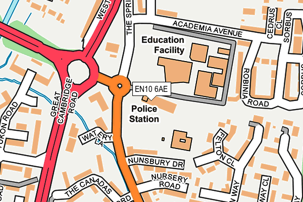
EN10 6AE is located in the Wormley and Turnford electoral ward, within the local authority district of Broxbourne and the English Parliamentary constituency of Broxbourne. The Sub Integrated Care Board (ICB) Location is NHS Hertfordshire and West Essex ICB - 06K and the police force is Hertfordshire. This postcode has been in use since January 1980.


GetTheData
Source: OS OpenMap – Local (Ordnance Survey)
Source: OS VectorMap District (Ordnance Survey)
Licence: Open Government Licence (requires attribution)
| Easting | 536514 |
| Northing | 204763 |
| Latitude | 51.724980 |
| Longitude | -0.024896 |
GetTheData
Source: Open Postcode Geo
Licence: Open Government Licence
| Country | England |
| Postcode District | EN10 |
| ➜ EN10 open data dashboard ➜ See where EN10 is on a map ➜ Where is Hoddesdon? | |
GetTheData
Source: Land Registry Price Paid Data
Licence: Open Government Licence
Elevation or altitude of EN10 6AE as distance above sea level:
| Metres | Feet | |
|---|---|---|
| Elevation | 30m | 98ft |
Elevation is measured from the approximate centre of the postcode, to the nearest point on an OS contour line from OS Terrain 50, which has contour spacing of ten vertical metres.
➜ How high above sea level am I? Find the elevation of your current position using your device's GPS.
GetTheData
Source: Open Postcode Elevation
Licence: Open Government Licence
| Ward | Wormley And Turnford |
| Constituency | Broxbourne |
GetTheData
Source: ONS Postcode Database
Licence: Open Government Licence
| January 2024 | Violence and sexual offences | On or near Rowan Drive | 335m |
| December 2023 | Violence and sexual offences | On or near Rowan Drive | 335m |
| October 2023 | Anti-social behaviour | On or near The Oval | 307m |
| ➜ Get more crime data in our Crime section | |||
GetTheData
Source: data.police.uk
Licence: Open Government Licence
| Hertford Regional College (High Road) | Turnford | 134m |
| Bulls Head Ph (High Road) | Turnford | 250m |
| Bulls Head Ph (High Road) | Turnford | 301m |
| Hertford Regional College (High Road) | Turnford | 327m |
| Canada Fields (Vancouver Road) | Turnford | 365m |
| Cheshunt Station | 2.5km |
| Broxbourne Station | 2.6km |
| Theobalds Grove Station | 3.7km |
GetTheData
Source: NaPTAN
Licence: Open Government Licence
GetTheData
Source: ONS Postcode Database
Licence: Open Government Licence


➜ Get more ratings from the Food Standards Agency
GetTheData
Source: Food Standards Agency
Licence: FSA terms & conditions
| Last Collection | |||
|---|---|---|---|
| Location | Mon-Fri | Sat | Distance |
| East Herts College | 18:00 | 11:30 | 99m |
| Groom Road | 18:00 | 11:30 | 320m |
| Wormley P.o | 18:15 | 12:00 | 818m |
GetTheData
Source: Dracos
Licence: Creative Commons Attribution-ShareAlike
| Facility | Distance |
|---|---|
| Hertford Regional College High Road, Turnford, Broxbourne Health and Fitness Gym, Sports Hall | 2m |
| Wormley Community Centre Fairfield Drive, Broxbourne Sports Hall | 596m |
| Cheshunt Marriott Health Club Halfhide Lane, Turnford, Broxbourne Health and Fitness Gym, Swimming Pool | 695m |
GetTheData
Source: Active Places
Licence: Open Government Licence
| School | Phase of Education | Distance |
|---|---|---|
| Longlands Primary School and Nursery Nunsbury Drive, Turnford, Broxbourne, EN10 6AG | Primary | 150m |
| Churchfield Church of England Academy Cheshunt Wash, Waltham Cross, EN8 0LU | Primary | 1.1km |
| Wormley CofE Primary School Cozens Lane East, Wormley, Wormley Primary School, Cozens Lane East, Broxbourne, EN10 6QA | Primary | 1.4km |
GetTheData
Source: Edubase
Licence: Open Government Licence
The below table lists the International Territorial Level (ITL) codes (formerly Nomenclature of Territorial Units for Statistics (NUTS) codes) and Local Administrative Units (LAU) codes for EN10 6AE:
| ITL 1 Code | Name |
|---|---|
| TLH | East |
| ITL 2 Code | Name |
| TLH2 | Bedfordshire and Hertfordshire |
| ITL 3 Code | Name |
| TLH23 | Hertfordshire CC |
| LAU 1 Code | Name |
| E07000095 | Broxbourne |
GetTheData
Source: ONS Postcode Directory
Licence: Open Government Licence
The below table lists the Census Output Area (OA), Lower Layer Super Output Area (LSOA), and Middle Layer Super Output Area (MSOA) for EN10 6AE:
| Code | Name | |
|---|---|---|
| OA | E00118595 | |
| LSOA | E01023343 | Broxbourne 005D |
| MSOA | E02004847 | Broxbourne 005 |
GetTheData
Source: ONS Postcode Directory
Licence: Open Government Licence
| EN10 6FX | The Cedars | 137m |
| EN10 6FW | Academia Avenue | 173m |
| EN10 6GF | Watery Lane | 174m |
| EN10 6AG | Nunsbury Drive | 178m |
| EN10 6GE | Robinia Road | 178m |
| EN10 6DF | West Side | 189m |
| EN10 6HH | Rowan Drive | 196m |
| EN10 6BT | Felton Close | 197m |
| EN10 6AJ | High Road | 216m |
| EN10 6AQ | Nunsbury Drive | 220m |
GetTheData
Source: Open Postcode Geo; Land Registry Price Paid Data
Licence: Open Government Licence