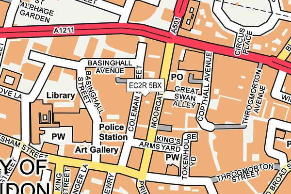
EC2R 5BX is located in the Coleman Street electoral ward, within the London borough of City of London and the English Parliamentary constituency of Cities of London and Westminster. The Sub Integrated Care Board (ICB) Location is NHS North East London ICB - A3A8R and the police force is City of London. This postcode has been in use since December 1998.


GetTheData
Source: OS OpenMap – Local (Ordnance Survey)
Source: OS VectorMap District (Ordnance Survey)
Licence: Open Government Licence (requires attribution)
| Easting | 532657 |
| Northing | 181431 |
| Latitude | 51.516234 |
| Longitude | -0.089557 |
GetTheData
Source: Open Postcode Geo
Licence: Open Government Licence
| Country | England |
| Postcode District | EC2R |
| ➜ EC2R open data dashboard ➜ See where EC2R is on a map ➜ Where is City of London? | |
GetTheData
Source: Land Registry Price Paid Data
Licence: Open Government Licence
Elevation or altitude of EC2R 5BX as distance above sea level:
| Metres | Feet | |
|---|---|---|
| Elevation | 10m | 33ft |
Elevation is measured from the approximate centre of the postcode, to the nearest point on an OS contour line from OS Terrain 50, which has contour spacing of ten vertical metres.
➜ How high above sea level am I? Find the elevation of your current position using your device's GPS.
GetTheData
Source: Open Postcode Elevation
Licence: Open Government Licence
| Ward | Coleman Street |
| Constituency | Cities Of London And Westminster |
GetTheData
Source: ONS Postcode Database
Licence: Open Government Licence
| January 2024 | Bicycle theft | On or near Park/Open Space | 334m |
| January 2024 | Bicycle theft | On or near Park/Open Space | 456m |
| December 2023 | Other theft | On or near Park/Open Space | 458m |
| ➜ Get more crime data in our Crime section | |||
GetTheData
Source: data.police.uk
Licence: Open Government Licence
| London Wall (Moorgate) | City Of London | 40m |
| Great Swan Alley (Moorgate) | City Of London | 42m |
| Moorgate Station (London Wall) | City Of London | 143m |
| Moorgate Station | City Of London | 152m |
| Bank Station Princes Street (Princes Street) | City Of London | 214m |
| Moorgate Underground Station | Moorgate | 232m |
| Bank Underground Station | Bank | 316m |
| Bank Dlr Station (Cornhill) | Bank | 342m |
| Liverpool Street Underground Station | Liverpool Street | 460m |
| Cannon Street Underground Station | Cannon Street | 529m |
| Moorgate Station | 0.3km |
| London Cannon Street Station | 0.5km |
| London Liverpool Street Station | 0.6km |
GetTheData
Source: NaPTAN
Licence: Open Government Licence
GetTheData
Source: ONS Postcode Database
Licence: Open Government Licence


➜ Get more ratings from the Food Standards Agency
GetTheData
Source: Food Standards Agency
Licence: FSA terms & conditions
| Last Collection | |||
|---|---|---|---|
| Location | Mon-Fri | Sat | Distance |
| Moorgate (Gt Swan Alley) | 18:30 | 12:00 | 28m |
| Moorgate (Great Swan Alley) | 18:30 | 35m | |
| Finsbury Circus (Circus Pl) | 18:30 | 12:00 | 228m |
GetTheData
Source: Dracos
Licence: Creative Commons Attribution-ShareAlike
| Facility | Distance |
|---|---|
| City Golf And Health Club (Closed) Coleman Street, London Health and Fitness Gym | 124m |
| Puregym (London Wall) London Wall, London Swimming Pool, Health and Fitness Gym, Studio | 126m |
| Another_space (Bank) (Closed) Coleman Street, London Studio | 138m |
GetTheData
Source: Active Places
Licence: Open Government Licence
| School | Phase of Education | Distance |
|---|---|---|
| Guildhall School of Music and Drama Silk Street, Barbican, London, EC2Y 8DT | Not applicable | 415m |
| City of London School for Girls St Giles' Terrace, Barbican, London, EC2Y 8BB | Not applicable | 475m |
| St Paul's Cathedral School 2 New Change, London, EC4M 9AD | Not applicable | 570m |
GetTheData
Source: Edubase
Licence: Open Government Licence
The below table lists the International Territorial Level (ITL) codes (formerly Nomenclature of Territorial Units for Statistics (NUTS) codes) and Local Administrative Units (LAU) codes for EC2R 5BX:
| ITL 1 Code | Name |
|---|---|
| TLI | London |
| ITL 2 Code | Name |
| TLI3 | Inner London - West |
| ITL 3 Code | Name |
| TLI31 | Camden and City of London |
| LAU 1 Code | Name |
| E09000001 | City of London |
GetTheData
Source: ONS Postcode Directory
Licence: Open Government Licence
The below table lists the Census Output Area (OA), Lower Layer Super Output Area (LSOA), and Middle Layer Super Output Area (MSOA) for EC2R 5BX:
| Code | Name | |
|---|---|---|
| OA | E00166755 | |
| LSOA | E01032739 | City of London 001F |
| MSOA | E02000001 | City of London 001 |
GetTheData
Source: ONS Postcode Directory
Licence: Open Government Licence
| EC2R 5TA | Coleman Street | 53m |
| EC2R 6EL | Moorgate | 79m |
| EC2V 5BT | Masons Avenue | 86m |
| EC2R 6BH | Moorgate | 95m |
| EC2R 7NH | Great Swan Alley | 107m |
| EC2R 7BH | Copthall Avenue | 114m |
| EC2M 5TB | London Wall | 118m |
| EC2R 7DA | Copthall Avenue | 125m |
| EC2M 5TE | London Wall | 137m |
| EC2M 5QD | London Wall | 171m |
GetTheData
Source: Open Postcode Geo; Land Registry Price Paid Data
Licence: Open Government Licence