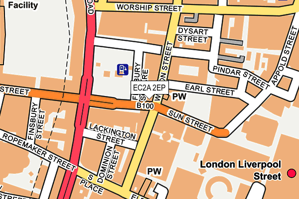
EC2A 2EP is located in the Bunhill electoral ward, within the London borough of Islington and the English Parliamentary constituency of Islington South and Finsbury. The Sub Integrated Care Board (ICB) Location is NHS North Central London ICB - 93C and the police force is Metropolitan Police. This postcode has been in use since January 1980.


GetTheData
Source: OS OpenMap – Local (Ordnance Survey)
Source: OS VectorMap District (Ordnance Survey)
Licence: Open Government Licence (requires attribution)
| Easting | 532932 |
| Northing | 181908 |
| Latitude | 51.520456 |
| Longitude | -0.085416 |
GetTheData
Source: Open Postcode Geo
Licence: Open Government Licence
| Country | England |
| Postcode District | EC2A |
| ➜ EC2A open data dashboard ➜ See where EC2A is on a map ➜ Where is London? | |
GetTheData
Source: Land Registry Price Paid Data
Licence: Open Government Licence
Elevation or altitude of EC2A 2EP as distance above sea level:
| Metres | Feet | |
|---|---|---|
| Elevation | 10m | 33ft |
Elevation is measured from the approximate centre of the postcode, to the nearest point on an OS contour line from OS Terrain 50, which has contour spacing of ten vertical metres.
➜ How high above sea level am I? Find the elevation of your current position using your device's GPS.
GetTheData
Source: Open Postcode Elevation
Licence: Open Government Licence
| Ward | Bunhill |
| Constituency | Islington South And Finsbury |
GetTheData
Source: ONS Postcode Database
Licence: Open Government Licence
| January 2024 | Anti-social behaviour | On or near Parking Area | 125m |
| January 2024 | Anti-social behaviour | On or near Parking Area | 125m |
| January 2024 | Drugs | On or near Parking Area | 125m |
| ➜ Get more crime data in our Crime section | |||
GetTheData
Source: data.police.uk
Licence: Open Government Licence
| Finsbury Square | Old Street | 24m |
| Finsbury Square | Old Street | 27m |
| Finsbury Square | Old Street | 54m |
| Finsbury Square | Old Street | 134m |
| Finsbury Square (Finsbury Pavement) | Old Street | 139m |
| Moorgate Underground Station | Moorgate | 324m |
| Liverpool Street Underground Station | Liverpool Street | 377m |
| Old Street Underground Station | Old Street | 623m |
| Bank Underground Station | Bank | 820m |
| Bank Dlr Station (Cornhill) | Bank | 832m |
| Moorgate Station | 0.3km |
| London Liverpool Street Station | 0.4km |
| Old Street Station | 0.6km |
GetTheData
Source: NaPTAN
Licence: Open Government Licence
GetTheData
Source: ONS Postcode Database
Licence: Open Government Licence

➜ Get more ratings from the Food Standards Agency
GetTheData
Source: Food Standards Agency
Licence: FSA terms & conditions
| Last Collection | |||
|---|---|---|---|
| Location | Mon-Fri | Sat | Distance |
| Finsbury Pavement (Lack'n St) | 18:30 | 12:00 | 145m |
| South Place (Dominion St) | 18:30 | 12:00 | 182m |
| Appold Street (Sun St) | 18:30 | 12:00 | 203m |
GetTheData
Source: Dracos
Licence: Creative Commons Attribution-ShareAlike
| Facility | Distance |
|---|---|
| Slim Jim's Health Club (Closed) Finsbury Avenue, London Health and Fitness Gym, Studio, Squash Courts | 116m |
| City And Islington College (Closed) 22-25, Finsbury Square, London Health and Fitness Gym | 163m |
| Barrys Bootcamp (London East) Worship Street, Islington, London Health and Fitness Gym | 191m |
GetTheData
Source: Active Places
Licence: Open Government Licence
| School | Phase of Education | Distance |
|---|---|---|
| The Lyceum 59-65 Worship Street, Shoreditch, London, EC2A 2DU | Not applicable | 214m |
| Guildhall School of Music and Drama Silk Street, Barbican, London, EC2Y 8DT | Not applicable | 498m |
| Workers' Educational Association 4 Luke Street, London, EC2A 4XW | 16 plus | 518m |
GetTheData
Source: Edubase
Licence: Open Government Licence
The below table lists the International Territorial Level (ITL) codes (formerly Nomenclature of Territorial Units for Statistics (NUTS) codes) and Local Administrative Units (LAU) codes for EC2A 2EP:
| ITL 1 Code | Name |
|---|---|
| TLI | London |
| ITL 2 Code | Name |
| TLI4 | Inner London - East |
| ITL 3 Code | Name |
| TLI43 | Haringey and Islington |
| LAU 1 Code | Name |
| E09000019 | Islington |
GetTheData
Source: ONS Postcode Directory
Licence: Open Government Licence
The below table lists the Census Output Area (OA), Lower Layer Super Output Area (LSOA), and Middle Layer Super Output Area (MSOA) for EC2A 2EP:
| Code | Name | |
|---|---|---|
| OA | E00013428 | |
| LSOA | E01002704 | Islington 023D |
| MSOA | E02000576 | Islington 023 |
GetTheData
Source: ONS Postcode Directory
Licence: Open Government Licence
| EC2A 2BS | Christopher Street | 138m |
| EC2M 2PL | Sun Street | 145m |
| EC2A 2AH | Worship Street | 173m |
| EC2M 7LS | Eldon Street | 195m |
| EC2A 1AN | Finsbury Square | 200m |
| EC2Y 9AQ | Finsbury Street | 210m |
| EC1Y 2AA | City Road | 230m |
| EC2A 4JJ | Paul Street | 236m |
| EC2A 4JE | Clifton Street | 247m |
| EC1Y 2AF | City Road | 248m |
GetTheData
Source: Open Postcode Geo; Land Registry Price Paid Data
Licence: Open Government Licence