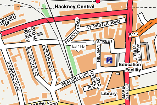
E8 1FB is located in the Hackney Central electoral ward, within the London borough of Hackney and the English Parliamentary constituency of Hackney South and Shoreditch. The Sub Integrated Care Board (ICB) Location is NHS North East London ICB - A3A8R and the police force is Metropolitan Police. This postcode has been in use since August 2007.


GetTheData
Source: OS OpenMap – Local (Ordnance Survey)
Source: OS VectorMap District (Ordnance Survey)
Licence: Open Government Licence (requires attribution)
| Easting | 534762 |
| Northing | 184723 |
| Latitude | 51.545319 |
| Longitude | -0.057980 |
GetTheData
Source: Open Postcode Geo
Licence: Open Government Licence
| Country | England |
| Postcode District | E8 |
| ➜ E8 open data dashboard ➜ See where E8 is on a map ➜ Where is Hackney? | |
GetTheData
Source: Land Registry Price Paid Data
Licence: Open Government Licence
Elevation or altitude of E8 1FB as distance above sea level:
| Metres | Feet | |
|---|---|---|
| Elevation | 20m | 66ft |
Elevation is measured from the approximate centre of the postcode, to the nearest point on an OS contour line from OS Terrain 50, which has contour spacing of ten vertical metres.
➜ How high above sea level am I? Find the elevation of your current position using your device's GPS.
GetTheData
Source: Open Postcode Elevation
Licence: Open Government Licence
| Ward | Hackney Central |
| Constituency | Hackney South And Shoreditch |
GetTheData
Source: ONS Postcode Database
Licence: Open Government Licence
| June 2022 | Anti-social behaviour | On or near Penpoll Road | 78m |
| June 2022 | Anti-social behaviour | On or near Penpoll Road | 78m |
| June 2022 | Drugs | On or near Penpoll Road | 78m |
| ➜ Get more crime data in our Crime section | |||
GetTheData
Source: data.police.uk
Licence: Open Government Licence
| Graham Road Hackney Central (Graham Road) | Hackney | 157m |
| Hackney Town Hall (Mare Street) | Hackney | 178m |
| Hackney Town Hall (Mare Street) | Hackney | 193m |
| Royal Oak Road | Dalston | 205m |
| Hackney Central Mare Street | Hackney | 215m |
| Hackney Central Station | 0.2km |
| Hackney Downs Station | 0.4km |
| London Fields Station | 0.5km |
GetTheData
Source: NaPTAN
Licence: Open Government Licence
GetTheData
Source: ONS Postcode Database
Licence: Open Government Licence


➜ Get more ratings from the Food Standards Agency
GetTheData
Source: Food Standards Agency
Licence: FSA terms & conditions
| Last Collection | |||
|---|---|---|---|
| Location | Mon-Fri | Sat | Distance |
| Reading Lane E8 | 18:30 | 11:30 | 185m |
| 67 Wilton Way E8 | 18:30 | 11:30 | 240m |
| Amhurst Road | 18:30 | 11:30 | 292m |
GetTheData
Source: Dracos
Licence: Creative Commons Attribution-ShareAlike
| Facility | Distance |
|---|---|
| Fit - This Gym Reading Lane, London Health and Fitness Gym, Studio | 154m |
| The Urswick School (Closed) Paragon Road, London Health and Fitness Gym, Sports Hall, Studio | 291m |
| Titan Gym Mare Street, Hackney, London Health and Fitness Gym | 318m |
GetTheData
Source: Active Places
Licence: Open Government Licence
| School | Phase of Education | Distance |
|---|---|---|
| The Urswick School - A Church of England Secondary School Paragon Road, Hackney, London, E9 6NR | Secondary | 298m |
| Gayhurst Community School Gayhurst Road, Hackney, London, E8 3EN | Primary | 459m |
| Mossbourne Parkside Academy Sigdon Road, Hackney, London, E8 1AS | Primary | 494m |
GetTheData
Source: Edubase
Licence: Open Government Licence
The below table lists the International Territorial Level (ITL) codes (formerly Nomenclature of Territorial Units for Statistics (NUTS) codes) and Local Administrative Units (LAU) codes for E8 1FB:
| ITL 1 Code | Name |
|---|---|
| TLI | London |
| ITL 2 Code | Name |
| TLI4 | Inner London - East |
| ITL 3 Code | Name |
| TLI41 | Hackney and Newham |
| LAU 1 Code | Name |
| E09000012 | Hackney |
GetTheData
Source: ONS Postcode Directory
Licence: Open Government Licence
The below table lists the Census Output Area (OA), Lower Layer Super Output Area (LSOA), and Middle Layer Super Output Area (MSOA) for E8 1FB:
| Code | Name | |
|---|---|---|
| OA | E00008770 | |
| LSOA | E01001762 | Hackney 017D |
| MSOA | E02000361 | Hackney 017 |
GetTheData
Source: ONS Postcode Directory
Licence: Open Government Licence
| E8 1BN | Casterton Street | 24m |
| E8 1BH | Wilton Way | 51m |
| E8 1ET | Sylvester Road | 80m |
| E8 1EX | Penpoll Road | 87m |
| E8 1BL | Wilton Way | 97m |
| E8 1DT | Florfield Road | 98m |
| E8 1ES | Sylvester Road | 100m |
| E8 1DP | Horton Road | 104m |
| E8 1DD | Florfield Road | 108m |
| E8 1EA | Reading Lane | 112m |
GetTheData
Source: Open Postcode Geo; Land Registry Price Paid Data
Licence: Open Government Licence