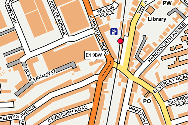
E4 9BW is located in the Hale End & Highams Park South electoral ward, within the London borough of Waltham Forest and the English Parliamentary constituency of Chingford and Woodford Green. The Sub Integrated Care Board (ICB) Location is NHS North East London ICB - A3A8R and the police force is Metropolitan Police. This postcode has been in use since July 2013.


GetTheData
Source: OS OpenMap – Local (Ordnance Survey)
Source: OS VectorMap District (Ordnance Survey)
Licence: Open Government Licence (requires attribution)
| Easting | 538487 |
| Northing | 191773 |
| Latitude | 51.607769 |
| Longitude | -0.001493 |
GetTheData
Source: Open Postcode Geo
Licence: Open Government Licence
| Country | England |
| Postcode District | E4 |
| ➜ E4 open data dashboard ➜ See where E4 is on a map ➜ Where is London? | |
GetTheData
Source: Land Registry Price Paid Data
Licence: Open Government Licence
Elevation or altitude of E4 9BW as distance above sea level:
| Metres | Feet | |
|---|---|---|
| Elevation | 30m | 98ft |
Elevation is measured from the approximate centre of the postcode, to the nearest point on an OS contour line from OS Terrain 50, which has contour spacing of ten vertical metres.
➜ How high above sea level am I? Find the elevation of your current position using your device's GPS.
GetTheData
Source: Open Postcode Elevation
Licence: Open Government Licence
| Ward | Hale End & Highams Park South |
| Constituency | Chingford And Woodford Green |
GetTheData
Source: ONS Postcode Database
Licence: Open Government Licence
| January 2024 | Anti-social behaviour | On or near Parking Area | 108m |
| January 2024 | Anti-social behaviour | On or near Parking Area | 108m |
| January 2024 | Anti-social behaviour | On or near Parking Area | 108m |
| ➜ Get more crime data in our Crime section | |||
GetTheData
Source: data.police.uk
Licence: Open Government Licence
| Highams Park Station | Highams Park | 38m |
| Highams Park Station | Highams Park | 53m |
| Highams Park Station (The Avenue) | Highams Park | 117m |
| Highams Park Station (The Avenue) | Highams Park | 153m |
| Beverley Road (E4) (Hale End Road) | Hale End | 190m |
| Highams Park Station | 0.1km |
| Wood Street Station | 2.4km |
| Chingford Station | 2.9km |
GetTheData
Source: NaPTAN
Licence: Open Government Licence
GetTheData
Source: ONS Postcode Database
Licence: Open Government Licence


➜ Get more ratings from the Food Standards Agency
GetTheData
Source: Food Standards Agency
Licence: FSA terms & conditions
| Last Collection | |||
|---|---|---|---|
| Location | Mon-Fri | Sat | Distance |
| Broadway Parade | 17:30 | 11:30 | 33m |
| Highams Park Station | 17:30 | 11:30 | 119m |
| 481 Hale End Road E4 | 18:30 | 12:00 | 194m |
GetTheData
Source: Dracos
Licence: Creative Commons Attribution-ShareAlike
| Facility | Distance |
|---|---|
| Highams Park School Handsworth Avenue, London Health and Fitness Gym, Sports Hall, Grass Pitches, Artificial Grass Pitch, Cycling | 356m |
| E4 Fitness And Leisure Ltd Hickman Avenue, London Health and Fitness Gym, Studio | 377m |
| Chingford School Of Tennis Club Hickman Avenue, Highams Park, London Indoor Tennis Centre, Outdoor Tennis Courts | 407m |
GetTheData
Source: Active Places
Licence: Open Government Licence
| School | Phase of Education | Distance |
|---|---|---|
| Handsworth Primary School Handsworth Avenue, Highams Park, London, E4 9PJ | Primary | 264m |
| Highams Park School 34 Handsworth Avenue, Highams Park, London, E4 9PJ | Secondary | 318m |
| Joseph Clarke School Vincent Road, London, E4 9PP | Not applicable | 368m |
GetTheData
Source: Edubase
Licence: Open Government Licence
The below table lists the International Territorial Level (ITL) codes (formerly Nomenclature of Territorial Units for Statistics (NUTS) codes) and Local Administrative Units (LAU) codes for E4 9BW:
| ITL 1 Code | Name |
|---|---|
| TLI | London |
| ITL 2 Code | Name |
| TLI5 | Outer London - East and North East |
| ITL 3 Code | Name |
| TLI53 | Redbridge and Waltham Forest |
| LAU 1 Code | Name |
| E09000031 | Waltham Forest |
GetTheData
Source: ONS Postcode Directory
Licence: Open Government Licence
The below table lists the Census Output Area (OA), Lower Layer Super Output Area (LSOA), and Middle Layer Super Output Area (MSOA) for E4 9BW:
| Code | Name | |
|---|---|---|
| OA | E00022038 | |
| LSOA | E01004379 | Waltham Forest 007A |
| MSOA | E02000901 | Waltham Forest 007 |
GetTheData
Source: ONS Postcode Directory
Licence: Open Government Licence
| E4 9LG | Broadway Parade | 21m |
| E4 9EF | Larkshall Road | 29m |
| E4 9LQ | The Broadway | 60m |
| E4 9LN | Winchester Road | 109m |
| E4 9LE | Bank Buildings | 114m |
| E4 9AQ | Jacks Farm Way | 125m |
| E4 9LH | Winchester Road | 127m |
| E4 9FQ | Jacks Farm Way | 145m |
| E4 9LR | Selwyn Avenue | 149m |
| E4 9LD | The Avenue | 149m |
GetTheData
Source: Open Postcode Geo; Land Registry Price Paid Data
Licence: Open Government Licence