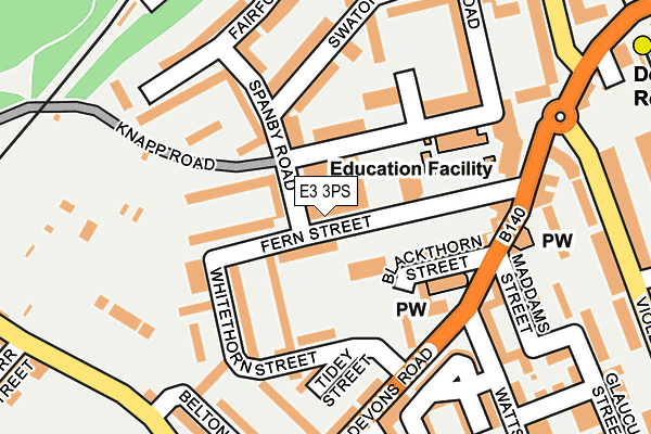
E3 3PS is located in the Bromley South electoral ward, within the London borough of Tower Hamlets and the English Parliamentary constituency of Poplar and Limehouse. The Sub Integrated Care Board (ICB) Location is NHS North East London ICB - A3A8R and the police force is Metropolitan Police. This postcode has been in use since January 1980.


GetTheData
Source: OS OpenMap – Local (Ordnance Survey)
Source: OS VectorMap District (Ordnance Survey)
Licence: Open Government Licence (requires attribution)
| Easting | 537351 |
| Northing | 182096 |
| Latitude | 51.521089 |
| Longitude | -0.021691 |
GetTheData
Source: Open Postcode Geo
Licence: Open Government Licence
| Country | England |
| Postcode District | E3 |
| ➜ E3 open data dashboard ➜ See where E3 is on a map ➜ Where is London? | |
GetTheData
Source: Land Registry Price Paid Data
Licence: Open Government Licence
Elevation or altitude of E3 3PS as distance above sea level:
| Metres | Feet | |
|---|---|---|
| Elevation | 10m | 33ft |
Elevation is measured from the approximate centre of the postcode, to the nearest point on an OS contour line from OS Terrain 50, which has contour spacing of ten vertical metres.
➜ How high above sea level am I? Find the elevation of your current position using your device's GPS.
GetTheData
Source: Open Postcode Elevation
Licence: Open Government Licence
| Ward | Bromley South |
| Constituency | Poplar And Limehouse |
GetTheData
Source: ONS Postcode Database
Licence: Open Government Licence
| January 2024 | Anti-social behaviour | On or near Hawgood Street | 377m |
| January 2024 | Anti-social behaviour | On or near Hawgood Street | 377m |
| January 2024 | Anti-social behaviour | On or near Hawgood Street | 377m |
| ➜ Get more crime data in our Crime section | |||
GetTheData
Source: data.police.uk
Licence: Open Government Licence
| Watts Grove (Devons Road) | Bow Common | 148m |
| Watts Grove (Devons Road) | Bow Common | 170m |
| St Pauls Way Trust School (Bow Common Lane) | Bow Common | 255m |
| Cranwell Close (Violet Road) | Bromley | 265m |
| Cranwell Close (Violet Road) | Bromley | 267m |
| Devons Road Dlr Station (Devons Road) | Devons Road | 333m |
| Bow Road Underground Station | Bow | 693m |
| Bow Church Dlr Station (Bow Road) | Bow | 755m |
| Bromley-by-bow Underground Station | Bromley | 819m |
| Langdon Park Dlr Station (Hay Currie Street) | Poplar | 841m |
| Limehouse Station | 1.6km |
| West Ham Station | 2.1km |
| Hackney Wick Station | 2.5km |
GetTheData
Source: NaPTAN
Licence: Open Government Licence
GetTheData
Source: ONS Postcode Database
Licence: Open Government Licence


➜ Get more ratings from the Food Standards Agency
GetTheData
Source: Food Standards Agency
Licence: FSA terms & conditions
| Last Collection | |||
|---|---|---|---|
| Location | Mon-Fri | Sat | Distance |
| 159 Devons Road E3 | 18:30 | 12:00 | 161m |
| Belton Way | 17:30 | 11:30 | 258m |
| Violet Road | 17:30 | 11:30 | 258m |
GetTheData
Source: Dracos
Licence: Creative Commons Attribution-ShareAlike
| Facility | Distance |
|---|---|
| Linc Centre Fern Street, London Sports Hall | 84m |
| St Pauls Way Community School (Closed) Shelmerdine Close, London Health and Fitness Gym, Sports Hall, Artificial Grass Pitch, Swimming Pool, Studio | 320m |
| St Pauls Way Trust School St Pauls Way, London Health and Fitness Gym, Artificial Grass Pitch, Sports Hall, Studio, Outdoor Tennis Courts | 339m |
GetTheData
Source: Active Places
Licence: Open Government Licence
| School | Phase of Education | Distance |
|---|---|---|
| The Clara Grant Primary School Knapp Road, Bow, London, E3 4BU | Primary | 157m |
| St Paul's Way Trust School 125 St Paul's Way, London, E3 4FT | All-through | 346m |
| Wellington Primary School Wellington Way, Bow, London, E3 4NE | Primary | 543m |
GetTheData
Source: Edubase
Licence: Open Government Licence
The below table lists the International Territorial Level (ITL) codes (formerly Nomenclature of Territorial Units for Statistics (NUTS) codes) and Local Administrative Units (LAU) codes for E3 3PS:
| ITL 1 Code | Name |
|---|---|
| TLI | London |
| ITL 2 Code | Name |
| TLI4 | Inner London - East |
| ITL 3 Code | Name |
| TLI42 | Tower Hamlets |
| LAU 1 Code | Name |
| E09000030 | Tower Hamlets |
GetTheData
Source: ONS Postcode Directory
Licence: Open Government Licence
The below table lists the Census Output Area (OA), Lower Layer Super Output Area (LSOA), and Middle Layer Super Output Area (MSOA) for E3 3PS:
| Code | Name | |
|---|---|---|
| OA | E00021329 | |
| LSOA | E01004241 | Tower Hamlets 012B |
| MSOA | E02000875 | Tower Hamlets 012 |
GetTheData
Source: ONS Postcode Directory
Licence: Open Government Licence
| E3 4EU | Spanby Road | 45m |
| E3 3PT | Fern Street | 54m |
| E3 3PY | Fern Street | 64m |
| E3 3PZ | Fern Street | 64m |
| E3 3PR | Fern Street | 80m |
| E3 4BP | Knapp Road | 92m |
| E3 4BT | Knapp Road | 93m |
| E3 4EN | Spanby Road | 93m |
| E3 4EW | Spanby Road | 97m |
| E3 4DB | Whitethorn Street | 107m |
GetTheData
Source: Open Postcode Geo; Land Registry Price Paid Data
Licence: Open Government Licence