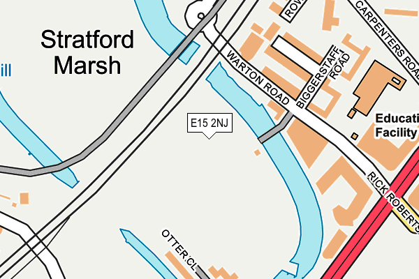
E15 2NJ is located in the Stratford electoral ward, within the London borough of Newham and the English Parliamentary constituency of West Ham. The Sub Integrated Care Board (ICB) Location is NHS North East London ICB - A3A8R and the police force is Metropolitan Police. This postcode has been in use since November 2021.


GetTheData
Source: OS OpenMap – Local (Ordnance Survey)
Source: OS VectorMap District (Ordnance Survey)
Licence: Open Government Licence (requires attribution)
| Easting | 538059 |
| Northing | 183400 |
| Latitude | 51.532636 |
| Longitude | -0.010955 |
GetTheData
Source: Open Postcode Geo
Licence: Open Government Licence
| Country | England |
| Postcode District | E15 |
| ➜ E15 open data dashboard ➜ See where E15 is on a map | |
GetTheData
Source: Land Registry Price Paid Data
Licence: Open Government Licence
Elevation or altitude of E15 2NJ as distance above sea level:
| Metres | Feet | |
|---|---|---|
| Elevation | 10m | 33ft |
Elevation is measured from the approximate centre of the postcode, to the nearest point on an OS contour line from OS Terrain 50, which has contour spacing of ten vertical metres.
➜ How high above sea level am I? Find the elevation of your current position using your device's GPS.
GetTheData
Source: Open Postcode Elevation
Licence: Open Government Licence
| Ward | Stratford |
| Constituency | West Ham |
GetTheData
Source: ONS Postcode Database
Licence: Open Government Licence
| November 2023 | Anti-social behaviour | On or near Abbey Lane | 498m |
| November 2023 | Anti-social behaviour | On or near Abbey Lane | 498m |
| November 2023 | Drugs | On or near Abbey Lane | 498m |
| ➜ Get more crime data in our Crime section | |||
GetTheData
Source: data.police.uk
Licence: Open Government Licence
| Marshgate Lane (Stratford High Street) | Stratford | 151m |
| Bow Flyover (Stratford High Street) | Bow | 269m |
| Abbey Lane (Stratford High Street) | Stratford | 288m |
| Warton Road | Stratford | 381m |
| Bow Interchange (Bromley High Street) | Bromley | 457m |
| Pudding Mill Lane Dlr Station (Pudding Mill Lane) | Pudding Mill Lane | 223m |
| Bromley-by-bow Underground Station | Bromley | 868m |
| Bow Church Dlr Station (Bow Road) | Bow | 871m |
| Stratford High Street Dlr Station | Stratford | 924m |
| Abbey Road Dlr Station | Stratford | 1,024m |
| Stratford (London) Station | 1.2km |
| West Ham Station | 1.2km |
| Stratford International Station | 1.4km |
GetTheData
Source: NaPTAN
Licence: Open Government Licence
GetTheData
Source: ONS Postcode Database
Licence: Open Government Licence


➜ Get more ratings from the Food Standards Agency
GetTheData
Source: Food Standards Agency
Licence: FSA terms & conditions
| Last Collection | |||
|---|---|---|---|
| Location | Mon-Fri | Sat | Distance |
| Abbey Lane | 18:30 | 11:30 | 259m |
| 64 Abbey Lane E15 | 18:30 | 11:30 | 466m |
| Franklin Street | 17:30 | 11:30 | 602m |
GetTheData
Source: Dracos
Licence: Creative Commons Attribution-ShareAlike
| Facility | Distance |
|---|---|
| Anytime Fitness (London Stratford) High Street, High Street, London Health and Fitness Gym | 444m |
| London Marathon Community Track Pudding Mill Lane, Pudding Mill Lane, Stratford, London Athletics, Grass Pitches | 615m |
| London Stadium Queen Elizabeth Olympic Park, London Grass Pitches, Athletics | 767m |
GetTheData
Source: Active Places
Licence: Open Government Licence
| School | Phase of Education | Distance |
|---|---|---|
| School 360 5 Sugar House Lane, London, E15 2QS | Primary | 165m |
| Bobby Moore Academy 1 Siding Street, Queen Elizabeth Olympic Park, London, E20 2AE | All-through | 451m |
| Carpenters Primary School Friendship Way, Stratford, London, E15 2JQ | Primary | 576m |
GetTheData
Source: Edubase
Licence: Open Government Licence
The below table lists the International Territorial Level (ITL) codes (formerly Nomenclature of Territorial Units for Statistics (NUTS) codes) and Local Administrative Units (LAU) codes for E15 2NJ:
| ITL 1 Code | Name |
|---|---|
| TLI | London |
| ITL 2 Code | Name |
| TLI4 | Inner London - East |
| ITL 3 Code | Name |
| TLI41 | Hackney and Newham |
| LAU 1 Code | Name |
| E09000025 | Newham |
GetTheData
Source: ONS Postcode Directory
Licence: Open Government Licence
The below table lists the Census Output Area (OA), Lower Layer Super Output Area (LSOA), and Middle Layer Super Output Area (MSOA) for E15 2NJ:
| Code | Name | |
|---|---|---|
| OA | E00175074 | |
| LSOA | E01033578 | Newham 013E |
| MSOA | E02000726 | Newham 013 |
GetTheData
Source: ONS Postcode Directory
Licence: Open Government Licence
| E15 2NS | High Street | 105m |
| E15 2NY | High Street | 105m |
| E15 2NZ | High Street | 105m |
| E15 2QB | High Street | 114m |
| E15 2QF | High Street | 114m |
| E15 2QG | High Street | 114m |
| E15 2PY | Blaker Road | 140m |
| E15 2PL | High Street | 173m |
| E15 2PR | High Street | 173m |
| E15 2PZ | Otter Close | 196m |
GetTheData
Source: Open Postcode Geo; Land Registry Price Paid Data
Licence: Open Government Licence