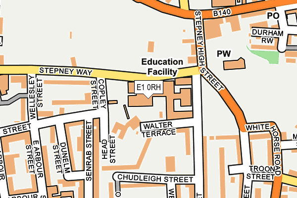
E1 0RH is located in the Stepney Green electoral ward, within the London borough of Tower Hamlets and the English Parliamentary constituency of Bethnal Green and Bow. The Sub Integrated Care Board (ICB) Location is NHS North East London ICB - A3A8R and the police force is Metropolitan Police. This postcode has been in use since January 1980.


GetTheData
Source: OS OpenMap – Local (Ordnance Survey)
Source: OS VectorMap District (Ordnance Survey)
Licence: Open Government Licence (requires attribution)
| Easting | 535803 |
| Northing | 181516 |
| Latitude | 51.516251 |
| Longitude | -0.044212 |
GetTheData
Source: Open Postcode Geo
Licence: Open Government Licence
| Country | England |
| Postcode District | E1 |
| ➜ E1 open data dashboard ➜ See where E1 is on a map ➜ Where is Stepney? | |
GetTheData
Source: Land Registry Price Paid Data
Licence: Open Government Licence
Elevation or altitude of E1 0RH as distance above sea level:
| Metres | Feet | |
|---|---|---|
| Elevation | 10m | 33ft |
Elevation is measured from the approximate centre of the postcode, to the nearest point on an OS contour line from OS Terrain 50, which has contour spacing of ten vertical metres.
➜ How high above sea level am I? Find the elevation of your current position using your device's GPS.
GetTheData
Source: Open Postcode Elevation
Licence: Open Government Licence
| Ward | Stepney Green |
| Constituency | Bethnal Green And Bow |
GetTheData
Source: ONS Postcode Database
Licence: Open Government Licence
| January 2024 | Criminal damage and arson | On or near Belgrave Street | 173m |
| January 2024 | Criminal damage and arson | On or near Belgrave Street | 173m |
| January 2024 | Public order | On or near Belgrave Street | 173m |
| ➜ Get more crime data in our Crime section | |||
GetTheData
Source: data.police.uk
Licence: Open Government Licence
| St Dunstan's Church (Stepney Way) | Stepney | 25m |
| St Dunstan's Church (Stepney Way) | Stepney | 72m |
| Stepney Green School (White Horse Lane) | Stepney | 217m |
| Stepney Green School (White Horse Lane) | Stepney | 280m |
| Jamaica Street (Stepney Way) | Stepney | 304m |
| Limehouse Dlr Station (Commercial Road) | Limehouse | 527m |
| Stepney Green Underground Station | Stepney Green | 645m |
| Shadwell Dlr Station (Martha Street) | Shadwell | 1,001m |
| Whitechapel Underground Station | Whitechapel | 1,152m |
| Mile End Underground Station | Mile End | 1,230m |
| Limehouse Station | 0.5km |
| Shadwell Station | 1km |
| Whitechapel Station | 1.1km |
GetTheData
Source: NaPTAN
Licence: Open Government Licence
GetTheData
Source: ONS Postcode Database
Licence: Open Government Licence


➜ Get more ratings from the Food Standards Agency
GetTheData
Source: Food Standards Agency
Licence: FSA terms & conditions
| Last Collection | |||
|---|---|---|---|
| Location | Mon-Fri | Sat | Distance |
| Aylward Street | 18:30 | 11:30 | 138m |
| Aylward Street | 18:30 | 11:30 | 140m |
| Commercial Road | 18:30 | 11:30 | 349m |
GetTheData
Source: Dracos
Licence: Creative Commons Attribution-ShareAlike
| Facility | Distance |
|---|---|
| Stepney All Saints School Stepney Way, London Health and Fitness Gym, Swimming Pool, Sports Hall | 0m |
| Haileybury Youth Centre Ben Jonson Road, London Sports Hall, Studio, Artificial Grass Pitch | 216m |
| Mulberry Stepney Green Maths Computing And Science College Ben Jonson Road, London Sports Hall | 289m |
GetTheData
Source: Active Places
Licence: Open Government Licence
| School | Phase of Education | Distance |
|---|---|---|
| Stepney All Saints Church of England Secondary School Stepney Way, Stepney, London, E1 0RH | Secondary | 22m |
| Mulberry Stepney Green Mathematics and Computing College Ben Jonson Road, Stepney, London, E1 4SD | Secondary | 254m |
| Marion Richardson Primary School Senrab Street, London, E1 0QF | Primary | 298m |
GetTheData
Source: Edubase
Licence: Open Government Licence
The below table lists the International Territorial Level (ITL) codes (formerly Nomenclature of Territorial Units for Statistics (NUTS) codes) and Local Administrative Units (LAU) codes for E1 0RH:
| ITL 1 Code | Name |
|---|---|
| TLI | London |
| ITL 2 Code | Name |
| TLI4 | Inner London - East |
| ITL 3 Code | Name |
| TLI42 | Tower Hamlets |
| LAU 1 Code | Name |
| E09000030 | Tower Hamlets |
GetTheData
Source: ONS Postcode Directory
Licence: Open Government Licence
The below table lists the Census Output Area (OA), Lower Layer Super Output Area (LSOA), and Middle Layer Super Output Area (MSOA) for E1 0RH:
| Code | Name | |
|---|---|---|
| OA | E00021587 | |
| LSOA | E01004288 | Tower Hamlets 019D |
| MSOA | E02000882 | Tower Hamlets 019 |
GetTheData
Source: ONS Postcode Directory
Licence: Open Government Licence
| E1 0RG | Walter Terrace | 90m |
| E1 0RQ | Chudleigh Street | 118m |
| E1 0QE | Senrab Street | 146m |
| E1 0RF | Chudleigh Street | 150m |
| E1 0QW | Aylward Street | 154m |
| E1 0QJ | Seagrave Close | 167m |
| E1 3DP | Stepney Way | 177m |
| E1 0RE | Chudleigh Street | 177m |
| E1 0NX | Tottan Terrace | 180m |
| E1 0QQ | Dunelm Street | 189m |
GetTheData
Source: Open Postcode Geo; Land Registry Price Paid Data
Licence: Open Government Licence