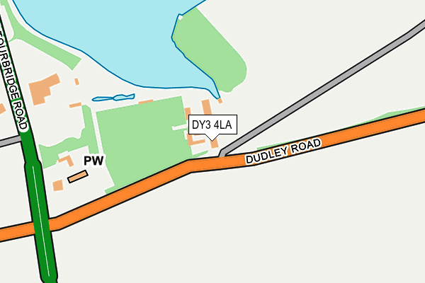
DY3 4LA is located in the Himley & Swindon electoral ward, within the local authority district of South Staffordshire and the English Parliamentary constituency of South Staffordshire. The Sub Integrated Care Board (ICB) Location is NHS Staffordshire and Stoke-on-Trent ICB - 05Q and the police force is Staffordshire. This postcode has been in use since January 1980.


GetTheData
Source: OS OpenMap – Local (Ordnance Survey)
Source: OS VectorMap District (Ordnance Survey)
Licence: Open Government Licence (requires attribution)
| Easting | 388486 |
| Northing | 291156 |
| Latitude | 52.518162 |
| Longitude | -2.171110 |
GetTheData
Source: Open Postcode Geo
Licence: Open Government Licence
| Country | England |
| Postcode District | DY3 |
| ➜ DY3 open data dashboard ➜ See where DY3 is on a map ➜ Where is Himley? | |
GetTheData
Source: Land Registry Price Paid Data
Licence: Open Government Licence
Elevation or altitude of DY3 4LA as distance above sea level:
| Metres | Feet | |
|---|---|---|
| Elevation | 80m | 262ft |
Elevation is measured from the approximate centre of the postcode, to the nearest point on an OS contour line from OS Terrain 50, which has contour spacing of ten vertical metres.
➜ How high above sea level am I? Find the elevation of your current position using your device's GPS.
GetTheData
Source: Open Postcode Elevation
Licence: Open Government Licence
| Ward | Himley & Swindon |
| Constituency | South Staffordshire |
GetTheData
Source: ONS Postcode Database
Licence: Open Government Licence
| January 2024 | Vehicle crime | On or near Cherry Lane | 434m |
| December 2023 | Violence and sexual offences | On or near Cherry Lane | 434m |
| December 2023 | Public order | On or near Cherry Lane | 434m |
| ➜ Get more crime data in our Crime section | |||
GetTheData
Source: data.police.uk
Licence: Open Government Licence
| Himley House Hotel (Wolverhampton Road) | Himley | 269m |
| Dudley Road (Stourbridge Road) | Himley | 297m |
| Himley House Hotel (Stourbridge Road) | Himley | 333m |
| Regal Hotel (School Road) | Himley | 457m |
| Regal Hotel (School Road) | Himley | 495m |
GetTheData
Source: NaPTAN
Licence: Open Government Licence
| Percentage of properties with Next Generation Access | 100.0% |
| Percentage of properties with Superfast Broadband | 0.0% |
| Percentage of properties with Ultrafast Broadband | 0.0% |
| Percentage of properties with Full Fibre Broadband | 0.0% |
Superfast Broadband is between 30Mbps and 300Mbps
Ultrafast Broadband is > 300Mbps
| Percentage of properties unable to receive 2Mbps | 0.0% |
| Percentage of properties unable to receive 5Mbps | 0.0% |
| Percentage of properties unable to receive 10Mbps | 100.0% |
| Percentage of properties unable to receive 30Mbps | 100.0% |
GetTheData
Source: Ofcom
Licence: Ofcom Terms of Use (requires attribution)
GetTheData
Source: ONS Postcode Database
Licence: Open Government Licence


➜ Get more ratings from the Food Standards Agency
GetTheData
Source: Food Standards Agency
Licence: FSA terms & conditions
| Last Collection | |||
|---|---|---|---|
| Location | Mon-Fri | Sat | Distance |
| Beachcroft Road | 18:30 | 11:00 | 909m |
| Rangeways Road | 17:30 | 11:30 | 1,024m |
| Victoria Street | 18:30 | 11:00 | 1,205m |
GetTheData
Source: Dracos
Licence: Creative Commons Attribution-ShareAlike
| Facility | Distance |
|---|---|
| Himley Cricket Club Wolverhampton Road, Himley, Dudley Grass Pitches | 631m |
| Maidensbridge Primary School Beachcroft Road, Kingswinford Grass Pitches | 1km |
| Sixes Football Centre (Closed) Ham Lane, Kingswinford Artificial Grass Pitch | 1.1km |
GetTheData
Source: Active Places
Licence: Open Government Licence
| School | Phase of Education | Distance |
|---|---|---|
| Maidensbridge Primary School Beachcroft Road, Wall Heath, Kingswinford, DY6 0HX | Primary | 971m |
| Church of the Ascension CofE Primary School New Street, Wall Heath, Kingswinford, DY6 9AH | Primary | 1.5km |
| Blakeley Heath Primary School Sytch Lane, Wombourne, Wolverhampton, WV5 0JR | Primary | 1.7km |
GetTheData
Source: Edubase
Licence: Open Government Licence
The below table lists the International Territorial Level (ITL) codes (formerly Nomenclature of Territorial Units for Statistics (NUTS) codes) and Local Administrative Units (LAU) codes for DY3 4LA:
| ITL 1 Code | Name |
|---|---|
| TLG | West Midlands (England) |
| ITL 2 Code | Name |
| TLG2 | Shropshire and Staffordshire |
| ITL 3 Code | Name |
| TLG24 | Staffordshire CC |
| LAU 1 Code | Name |
| E07000196 | South Staffordshire |
GetTheData
Source: ONS Postcode Directory
Licence: Open Government Licence
The below table lists the Census Output Area (OA), Lower Layer Super Output Area (LSOA), and Middle Layer Super Output Area (MSOA) for DY3 4LA:
| Code | Name | |
|---|---|---|
| OA | E00151045 | |
| LSOA | E01029645 | South Staffordshire 013A |
| MSOA | E02006186 | South Staffordshire 013 |
GetTheData
Source: ONS Postcode Directory
Licence: Open Government Licence
| DY3 4LB | Wolverhampton Road | 318m |
| DY3 4LG | School Road | 601m |
| DY3 4LY | Churns Hill Lane | 662m |
| DY3 4LX | Churns Hill Lane | 677m |
| DY6 0HT | Beachcroft Road | 828m |
| DY3 4LJ | Bridgnorth Road | 832m |
| DY3 4LL | Plantation Lane | 845m |
| DY3 4LN | Himley Lane | 855m |
| DY6 7SF | Collindale Court | 881m |
| DY6 7SG | Kilburn Drive | 888m |
GetTheData
Source: Open Postcode Geo; Land Registry Price Paid Data
Licence: Open Government Licence