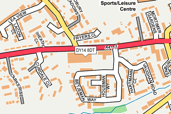
DY14 8DT is located in the Cleobury Mortimer electoral ward, within the unitary authority of Shropshire and the English Parliamentary constituency of Ludlow. The Sub Integrated Care Board (ICB) Location is NHS Shropshire, Telford and Wrekin ICB - M2L0M and the police force is West Mercia. This postcode has been in use since January 1980.


GetTheData
Source: OS OpenMap – Local (Ordnance Survey)
Source: OS VectorMap District (Ordnance Survey)
Licence: Open Government Licence (requires attribution)
| Easting | 366860 |
| Northing | 275662 |
| Latitude | 52.377986 |
| Longitude | -2.488258 |
GetTheData
Source: Open Postcode Geo
Licence: Open Government Licence
| Country | England |
| Postcode District | DY14 |
| ➜ DY14 open data dashboard ➜ See where DY14 is on a map ➜ Where is Cleobury Mortimer? | |
GetTheData
Source: Land Registry Price Paid Data
Licence: Open Government Licence
Elevation or altitude of DY14 8DT as distance above sea level:
| Metres | Feet | |
|---|---|---|
| Elevation | 140m | 459ft |
Elevation is measured from the approximate centre of the postcode, to the nearest point on an OS contour line from OS Terrain 50, which has contour spacing of ten vertical metres.
➜ How high above sea level am I? Find the elevation of your current position using your device's GPS.
GetTheData
Source: Open Postcode Elevation
Licence: Open Government Licence
| Ward | Cleobury Mortimer |
| Constituency | Ludlow |
GetTheData
Source: ONS Postcode Database
Licence: Open Government Licence
| January 2024 | Other theft | On or near Larks Rise | 260m |
| December 2023 | Other theft | On or near Larks Rise | 260m |
| November 2023 | Other theft | On or near Larks Rise | 260m |
| ➜ Get more crime data in our Crime section | |||
GetTheData
Source: data.police.uk
Licence: Open Government Licence
| Curdale Close Jct (Ludlow Road) | Cleobury Mortimer | 180m |
| Curdale Close Jct (Ludlow Road) | Cleobury Mortimer | 181m |
| Lacon Childe School (Love Lane) | Cleobury Mortimer | 379m |
| Talbot Inn (High Street) | Cleobury Mortimer | 399m |
| Talbot Inn (High Street) | Cleobury Mortimer | 427m |
GetTheData
Source: NaPTAN
Licence: Open Government Licence
Estimated total energy consumption in DY14 8DT by fuel type, 2015.
| Consumption (kWh) | 169,925 |
|---|---|
| Meter count | 23 |
| Mean (kWh/meter) | 7,388 |
| Median (kWh/meter) | 6,987 |
GetTheData
Source: Postcode level gas estimates: 2015 (experimental)
Source: Postcode level electricity estimates: 2015 (experimental)
Licence: Open Government Licence
GetTheData
Source: ONS Postcode Database
Licence: Open Government Licence


➜ Get more ratings from the Food Standards Agency
GetTheData
Source: Food Standards Agency
Licence: FSA terms & conditions
| Last Collection | |||
|---|---|---|---|
| Location | Mon-Fri | Sat | Distance |
| Cleobury Mortimer Post Office | 17:30 | 11:00 | 473m |
| Oreton Post Office | 15:50 | 10:30 | 4,596m |
| Hopton Wafers | 16:00 | 09:30 | 5,908m |
GetTheData
Source: Dracos
Licence: Creative Commons Attribution-ShareAlike
| Facility | Distance |
|---|---|
| Lacon Childe School Love Lane, Cleobury Mortimer, Kidderminster Grass Pitches, Sports Hall | 331m |
| Teme Cleobury Love Lane, Cleobury Mortimer, Kidderminster Sports Hall, Health and Fitness Gym, Artificial Grass Pitch, Grass Pitches, Outdoor Tennis Courts | 383m |
| Cleobury Mortimer Playing Field St. Marys Place, Cleobury Mortimer, Kidderminster Grass Pitches | 459m |
GetTheData
Source: Active Places
Licence: Open Government Licence
| School | Phase of Education | Distance |
|---|---|---|
| Cleobury Mortimer Primary School Love Lane, Cleobury Mortimer, Kidderminster, DY14 8PE | Primary | 383m |
| The Lacon Childe School Love Lane, Cleobury Mortimer, Kidderminster, DY14 8PE | Secondary | 383m |
| Bayton CofE Primary School Bayton, Near Kidderminster, DY14 9LG | Primary | 3.5km |
GetTheData
Source: Edubase
Licence: Open Government Licence
The below table lists the International Territorial Level (ITL) codes (formerly Nomenclature of Territorial Units for Statistics (NUTS) codes) and Local Administrative Units (LAU) codes for DY14 8DT:
| ITL 1 Code | Name |
|---|---|
| TLG | West Midlands (England) |
| ITL 2 Code | Name |
| TLG2 | Shropshire and Staffordshire |
| ITL 3 Code | Name |
| TLG22 | Shropshire |
| LAU 1 Code | Name |
| E06000051 | Shropshire |
GetTheData
Source: ONS Postcode Directory
Licence: Open Government Licence
The below table lists the Census Output Area (OA), Lower Layer Super Output Area (LSOA), and Middle Layer Super Output Area (MSOA) for DY14 8DT:
| Code | Name | |
|---|---|---|
| OA | E00147702 | |
| LSOA | E01029001 | Shropshire 039E |
| MSOA | E02006046 | Shropshire 039 |
GetTheData
Source: ONS Postcode Directory
Licence: Open Government Licence
| DY14 8DU | Ludlow Road | 71m |
| DY14 8BH | Housman Way | 110m |
| DY14 8EA | Catherton Close | 139m |
| DY14 8BB | Betjeman Way | 142m |
| DY14 8DZ | Curdale Close | 158m |
| DY14 8DN | High Street | 177m |
| DY14 8DP | High Street | 184m |
| DY14 8EB | Catherton Road | 188m |
| DY14 8DB | Vaughan Road | 188m |
| DY14 8DE | Hartmann Close | 193m |
GetTheData
Source: Open Postcode Geo; Land Registry Price Paid Data
Licence: Open Government Licence