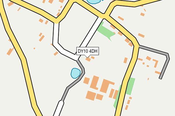
DY10 4DH is in Shenstone, Kidderminster. DY10 4DH is located in the Wyre Forest Rural electoral ward, within the local authority district of Wyre Forest and the English Parliamentary constituency of Wyre Forest. The Sub Integrated Care Board (ICB) Location is NHS Herefordshire and Worcestershire ICB - 18C and the police force is West Mercia. This postcode has been in use since January 1980.


GetTheData
Source: OS OpenMap – Local (Ordnance Survey)
Source: OS VectorMap District (Ordnance Survey)
Licence: Open Government Licence (requires attribution)
| Easting | 386429 |
| Northing | 273400 |
| Latitude | 52.358489 |
| Longitude | -2.200696 |
GetTheData
Source: Open Postcode Geo
Licence: Open Government Licence
| Locality | Shenstone |
| Town/City | Kidderminster |
| Country | England |
| Postcode District | DY10 |
| ➜ DY10 open data dashboard ➜ See where DY10 is on a map ➜ Where is Shenstone? | |
GetTheData
Source: Land Registry Price Paid Data
Licence: Open Government Licence
Elevation or altitude of DY10 4DH as distance above sea level:
| Metres | Feet | |
|---|---|---|
| Elevation | 80m | 262ft |
Elevation is measured from the approximate centre of the postcode, to the nearest point on an OS contour line from OS Terrain 50, which has contour spacing of ten vertical metres.
➜ How high above sea level am I? Find the elevation of your current position using your device's GPS.
GetTheData
Source: Open Postcode Elevation
Licence: Open Government Licence
| Ward | Wyre Forest Rural |
| Constituency | Wyre Forest |
GetTheData
Source: ONS Postcode Database
Licence: Open Government Licence
| June 2022 | Violence and sexual offences | On or near Sports/Recreation Area | 392m |
| June 2022 | Violence and sexual offences | On or near Sports/Recreation Area | 392m |
| May 2022 | Anti-social behaviour | On or near Sports/Recreation Area | 392m |
| ➜ Get more crime data in our Crime section | |||
GetTheData
Source: data.police.uk
Licence: Open Government Licence
| Mustow Green Island (Bromsgrove Road) | Mustow Green | 947m |
| Mustow Green Island (Bromsgrove Road) | Mustow Green | 968m |
| Winterfold Cottages (Kidderminster Road) | Winterfold | 1,273m |
| Winterfold Cottages (Kidderminster Road) | Winterfold | 1,281m |
| Whitlenge Lane (Droitwich Road) | Podmoor | 1,383m |
| Hartlebury Station | 3km |
| Kidderminster Station | 3.9km |
GetTheData
Source: NaPTAN
Licence: Open Government Licence
| Percentage of properties with Next Generation Access | 100.0% |
| Percentage of properties with Superfast Broadband | 0.0% |
| Percentage of properties with Ultrafast Broadband | 0.0% |
| Percentage of properties with Full Fibre Broadband | 0.0% |
Superfast Broadband is between 30Mbps and 300Mbps
Ultrafast Broadband is > 300Mbps
| Percentage of properties unable to receive 2Mbps | 0.0% |
| Percentage of properties unable to receive 5Mbps | 0.0% |
| Percentage of properties unable to receive 10Mbps | 0.0% |
| Percentage of properties unable to receive 30Mbps | 100.0% |
GetTheData
Source: Ofcom
Licence: Ofcom Terms of Use (requires attribution)
GetTheData
Source: ONS Postcode Database
Licence: Open Government Licence


➜ Get more ratings from the Food Standards Agency
GetTheData
Source: Food Standards Agency
Licence: FSA terms & conditions
| Last Collection | |||
|---|---|---|---|
| Location | Mon-Fri | Sat | Distance |
| Spennells Post Office | 17:30 | 11:45 | 2,532m |
| Linnett Rise | 17:30 | 11:30 | 2,657m |
| Mallard Avenue | 16:45 | 11:45 | 2,702m |
GetTheData
Source: Dracos
Licence: Creative Commons Attribution-ShareAlike
| Facility | Distance |
|---|---|
| Winterfold House School Winterfold, Chaddesley Corbett, Kidderminster Sports Hall, Swimming Pool, Grass Pitches, Outdoor Tennis Courts, Artificial Grass Pitch | 1.2km |
| Chaddesley Corbett Sports Ground Long More, Chaddesley Corbett, Kidderminster Grass Pitches | 2.2km |
| Heronswood Primary School Heronswood Road, Kidderminster Grass Pitches | 2.5km |
GetTheData
Source: Active Places
Licence: Open Government Licence
| School | Phase of Education | Distance |
|---|---|---|
| Madinatul Uloom Al Islamiya School Heath Lane, Summerfield, Kidderminster, Worcestershire, DY10 4BS | Not applicable | 937m |
| Heronswood Primary School Heronswood Road, Kidderminster, DY10 4EX | Primary | 2.5km |
| Chaddesley Corbett Endowed Primary School Nethercroft Meadow, Lower Chaddesley, Kidderminster, DY10 4QN | Primary | 2.8km |
GetTheData
Source: Edubase
Licence: Open Government Licence
The below table lists the International Territorial Level (ITL) codes (formerly Nomenclature of Territorial Units for Statistics (NUTS) codes) and Local Administrative Units (LAU) codes for DY10 4DH:
| ITL 1 Code | Name |
|---|---|
| TLG | West Midlands (England) |
| ITL 2 Code | Name |
| TLG1 | Herefordshire, Worcestershire and Warwickshire |
| ITL 3 Code | Name |
| TLG12 | Worcestershire CC |
| LAU 1 Code | Name |
| E07000239 | Wyre Forest |
GetTheData
Source: ONS Postcode Directory
Licence: Open Government Licence
The below table lists the Census Output Area (OA), Lower Layer Super Output Area (LSOA), and Middle Layer Super Output Area (MSOA) for DY10 4DH:
| Code | Name | |
|---|---|---|
| OA | E00165416 | |
| LSOA | E01032431 | Wyre Forest 001A |
| MSOA | E02006767 | Wyre Forest 001 |
GetTheData
Source: ONS Postcode Directory
Licence: Open Government Licence
| DY10 4DR | 132m | |
| DY10 4DL | 146m | |
| DY10 4DN | 181m | |
| DY10 4DD | 187m | |
| DY10 4DS | 205m | |
| DY10 4BY | 220m | |
| DY10 4DP | Back Lane | 242m |
| DY10 4BZ | 251m | |
| DY10 4DW | 264m | |
| DY10 4BU | Worcester Road | 405m |
GetTheData
Source: Open Postcode Geo; Land Registry Price Paid Data
Licence: Open Government Licence