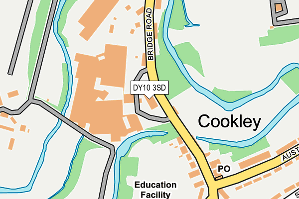
DY10 3SD is located in the Wyre Forest Rural electoral ward, within the local authority district of Wyre Forest and the English Parliamentary constituency of Wyre Forest. The Sub Integrated Care Board (ICB) Location is NHS Herefordshire and Worcestershire ICB - 18C and the police force is West Mercia. This postcode has been in use since January 1980.


GetTheData
Source: OS OpenMap – Local (Ordnance Survey)
Source: OS VectorMap District (Ordnance Survey)
Licence: Open Government Licence (requires attribution)
| Easting | 384166 |
| Northing | 280495 |
| Latitude | 52.422212 |
| Longitude | -2.234263 |
GetTheData
Source: Open Postcode Geo
Licence: Open Government Licence
| Country | England |
| Postcode District | DY10 |
| ➜ DY10 open data dashboard ➜ See where DY10 is on a map ➜ Where is Cookley? | |
GetTheData
Source: Land Registry Price Paid Data
Licence: Open Government Licence
Elevation or altitude of DY10 3SD as distance above sea level:
| Metres | Feet | |
|---|---|---|
| Elevation | 50m | 164ft |
Elevation is measured from the approximate centre of the postcode, to the nearest point on an OS contour line from OS Terrain 50, which has contour spacing of ten vertical metres.
➜ How high above sea level am I? Find the elevation of your current position using your device's GPS.
GetTheData
Source: Open Postcode Elevation
Licence: Open Government Licence
| Ward | Wyre Forest Rural |
| Constituency | Wyre Forest |
GetTheData
Source: ONS Postcode Database
Licence: Open Government Licence
| September 2023 | Other theft | On or near Staite Drive | 392m |
| June 2023 | Anti-social behaviour | On or near Staite Drive | 392m |
| June 2023 | Anti-social behaviour | On or near Staite Drive | 392m |
| ➜ Get more crime data in our Crime section | |||
GetTheData
Source: data.police.uk
Licence: Open Government Licence
| Bulls Head (Castle Road) | Cookley | 144m |
| Bulls Head (Castle Road) | Cookley | 163m |
| Brodge Road Shops (Brodge Road) | Cookley | 190m |
| Kinver Lane (Bridge Road) | Caunsall | 312m |
| Kinver Lane (Bridge Road) | Caunsall | 333m |
| Kidderminster Station | 4.2km |
| Blakedown Station | 4.3km |
GetTheData
Source: NaPTAN
Licence: Open Government Licence
GetTheData
Source: ONS Postcode Database
Licence: Open Government Licence


➜ Get more ratings from the Food Standards Agency
GetTheData
Source: Food Standards Agency
Licence: FSA terms & conditions
| Last Collection | |||
|---|---|---|---|
| Location | Mon-Fri | Sat | Distance |
| Cookley Post Office | 17:00 | 10:00 | 205m |
| Wolverley Post Office | 17:15 | 10:30 | 1,675m |
| Fairfield Lane | 10:45 | 09:00 | 2,262m |
GetTheData
Source: Dracos
Licence: Creative Commons Attribution-ShareAlike
| Facility | Distance |
|---|---|
| Cookley Sebright Primary School Lea Lane, Cookley, Kidderminster Grass Pitches | 261m |
| Cookley Playing Fields Lea Lane, Cookley, Kidderminster Grass Pitches, Sports Hall, Artificial Grass Pitch | 456m |
| Wolverley Ce Secondary School Blakeshall Lane, Wolverley, Kidderminster Health and Fitness Gym, Grass Pitches, Sports Hall, Ski Slopes, Artificial Grass Pitch | 1.5km |
GetTheData
Source: Active Places
Licence: Open Government Licence
| School | Phase of Education | Distance |
|---|---|---|
| Cookley Sebright Primary School 16 Lea Lane, Cookley, Kidderminster, DY10 3TA | Primary | 261m |
| Wolverley CofE Secondary School Blakeshall Lane, Wolverley, Kidderminster, DY11 5XQ | Secondary | 1.5km |
| Heathfield Knoll School Wolverley, Kidderminster, DY10 3QE | Not applicable | 1.8km |
GetTheData
Source: Edubase
Licence: Open Government Licence
The below table lists the International Territorial Level (ITL) codes (formerly Nomenclature of Territorial Units for Statistics (NUTS) codes) and Local Administrative Units (LAU) codes for DY10 3SD:
| ITL 1 Code | Name |
|---|---|
| TLG | West Midlands (England) |
| ITL 2 Code | Name |
| TLG1 | Herefordshire, Worcestershire and Warwickshire |
| ITL 3 Code | Name |
| TLG12 | Worcestershire CC |
| LAU 1 Code | Name |
| E07000239 | Wyre Forest |
GetTheData
Source: ONS Postcode Directory
Licence: Open Government Licence
The below table lists the Census Output Area (OA), Lower Layer Super Output Area (LSOA), and Middle Layer Super Output Area (MSOA) for DY10 3SD:
| Code | Name | |
|---|---|---|
| OA | E00165450 | |
| LSOA | E01032439 | Wyre Forest 001D |
| MSOA | E02006767 | Wyre Forest 001 |
GetTheData
Source: ONS Postcode Directory
Licence: Open Government Licence
| DY10 3SB | Bridge Road | 141m |
| DY10 3SA | Bridge Road | 147m |
| DY11 5YA | Bridge Road | 294m |
| DY10 3UP | Austcliffe Road | 299m |
| DY10 3TA | Lea Lane | 308m |
| DY10 3SJ | 322m | |
| DY11 5YD | Caunsall Road | 344m |
| DY10 3US | Austcliffe Gardens | 357m |
| DY10 3UW | Shrubbery Hill | 365m |
| DY10 3UB | Highfield Road | 374m |
GetTheData
Source: Open Postcode Geo; Land Registry Price Paid Data
Licence: Open Government Licence