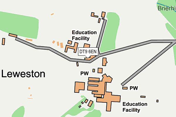
DT9 6EN is located in the Yetminster electoral ward, within the unitary authority of Dorset and the English Parliamentary constituency of West Dorset. The Sub Integrated Care Board (ICB) Location is NHS Dorset ICB - 11J and the police force is Dorset. This postcode has been in use since January 1980.


GetTheData
Source: OS OpenMap – Local (Ordnance Survey)
Source: OS VectorMap District (Ordnance Survey)
Licence: Open Government Licence (requires attribution)
| Easting | 363597 |
| Northing | 112352 |
| Latitude | 50.909473 |
| Longitude | -2.519137 |
GetTheData
Source: Open Postcode Geo
Licence: Open Government Licence
| Country | England |
| Postcode District | DT9 |
| ➜ DT9 open data dashboard ➜ See where DT9 is on a map ➜ Where is Leweston? | |
GetTheData
Source: Land Registry Price Paid Data
Licence: Open Government Licence
Elevation or altitude of DT9 6EN as distance above sea level:
| Metres | Feet | |
|---|---|---|
| Elevation | 110m | 361ft |
Elevation is measured from the approximate centre of the postcode, to the nearest point on an OS contour line from OS Terrain 50, which has contour spacing of ten vertical metres.
➜ How high above sea level am I? Find the elevation of your current position using your device's GPS.
GetTheData
Source: Open Postcode Elevation
Licence: Open Government Licence
| Ward | Yetminster |
| Constituency | West Dorset |
GetTheData
Source: ONS Postcode Database
Licence: Open Government Licence
| March 2022 | Anti-social behaviour | On or near Sports/Recreation Area | 384m |
| March 2022 | Public order | On or near Sports/Recreation Area | 384m |
| March 2022 | Public order | On or near Sports/Recreation Area | 384m |
| ➜ Get more crime data in our Crime section | |||
GetTheData
Source: data.police.uk
Licence: Open Government Licence
| Bradford Lane | Longburton | 1,298m |
| Bradford Lane | Longburton | 1,305m |
| Rose And Crown (A352) | Longburton | 1,311m |
| Rose And Crown (A352) | Longburton | 1,328m |
| Kings Close (A352) | Longburton | 1,415m |
| Sherborne Station | 3.9km |
| Yetminster Station | 4.1km |
| Thornford Station | 4.2km |
GetTheData
Source: NaPTAN
Licence: Open Government Licence
GetTheData
Source: ONS Postcode Database
Licence: Open Government Licence


➜ Get more ratings from the Food Standards Agency
GetTheData
Source: Food Standards Agency
Licence: FSA terms & conditions
| Last Collection | |||
|---|---|---|---|
| Location | Mon-Fri | Sat | Distance |
| Holmbushes | 09:30 | 09:00 | 2,107m |
| Folke | 09:30 | 09:00 | 2,554m |
| Railway Station | 17:00 | 12:00 | 3,582m |
GetTheData
Source: Dracos
Licence: Creative Commons Attribution-ShareAlike
| Facility | Distance |
|---|---|
| Leweston School Sherborne Swimming Pool, Sports Hall, Artificial Grass Pitch, Grass Pitches, Squash Courts | 2m |
| Folke Golf Centre Alweston, Sherborne Golf | 3km |
| Thornford Playing Field Pound Road, Thornford, Sherborne Grass Pitches | 3.2km |
GetTheData
Source: Active Places
Licence: Open Government Licence
| School | Phase of Education | Distance |
|---|---|---|
| Leweston School Sherborne, DT9 6EN | Not applicable | 79m |
| Thornford CofE Primary School Boot Lane, Thornford, Sherborne, DT9 6QY | Primary | 3.3km |
| Sherborne Abbey Church of England Primary School Lenthay Road, Sherborne, DT9 6AQ | Primary | 3.4km |
GetTheData
Source: Edubase
Licence: Open Government Licence
The below table lists the International Territorial Level (ITL) codes (formerly Nomenclature of Territorial Units for Statistics (NUTS) codes) and Local Administrative Units (LAU) codes for DT9 6EN:
| ITL 1 Code | Name |
|---|---|
| TLK | South West (England) |
| ITL 2 Code | Name |
| TLK2 | Dorset and Somerset |
| ITL 3 Code | Name |
| TLK25 | Dorset |
| LAU 1 Code | Name |
| E06000059 | Dorset |
GetTheData
Source: ONS Postcode Directory
Licence: Open Government Licence
The below table lists the Census Output Area (OA), Lower Layer Super Output Area (LSOA), and Middle Layer Super Output Area (MSOA) for DT9 6EN:
| Code | Name | |
|---|---|---|
| OA | E00103981 | |
| LSOA | E01020508 | West Dorset 002B |
| MSOA | E02004270 | West Dorset 002 |
GetTheData
Source: ONS Postcode Directory
Licence: Open Government Licence
| DT9 6EW | 25m | |
| DT9 6QX | 874m | |
| DT9 6EL | Leweston Road | 1210m |
| DT9 5PQ | The Bannells | 1223m |
| DT9 6ES | Bradford Lane | 1233m |
| DT9 5PG | 1266m | |
| DT9 6EJ | New Cross | 1326m |
| DT9 5PD | 1339m | |
| DT9 5PB | Spring Lane | 1347m |
| DT9 5LU | Dene Close | 1390m |
GetTheData
Source: Open Postcode Geo; Land Registry Price Paid Data
Licence: Open Government Licence