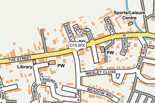
DT6 6PX is located in the Lyme & Charmouth electoral ward, within the unitary authority of Dorset and the English Parliamentary constituency of West Dorset. The Sub Integrated Care Board (ICB) Location is NHS Dorset ICB - 11J and the police force is Dorset. This postcode has been in use since January 1980.


GetTheData
Source: OS OpenMap – Local (Ordnance Survey)
Source: OS VectorMap District (Ordnance Survey)
Licence: Open Government Licence (requires attribution)
| Easting | 336532 |
| Northing | 93633 |
| Latitude | 50.738812 |
| Longitude | -2.900804 |
GetTheData
Source: Open Postcode Geo
Licence: Open Government Licence
| Country | England |
| Postcode District | DT6 |
| ➜ DT6 open data dashboard ➜ See where DT6 is on a map ➜ Where is Charmouth? | |
GetTheData
Source: Land Registry Price Paid Data
Licence: Open Government Licence
Elevation or altitude of DT6 6PX as distance above sea level:
| Metres | Feet | |
|---|---|---|
| Elevation | 20m | 66ft |
Elevation is measured from the approximate centre of the postcode, to the nearest point on an OS contour line from OS Terrain 50, which has contour spacing of ten vertical metres.
➜ How high above sea level am I? Find the elevation of your current position using your device's GPS.
GetTheData
Source: Open Postcode Elevation
Licence: Open Government Licence
| Ward | Lyme & Charmouth |
| Constituency | West Dorset |
GetTheData
Source: ONS Postcode Database
Licence: Open Government Licence
| October 2023 | Criminal damage and arson | On or near Bridge Road | 255m |
| July 2023 | Criminal damage and arson | On or near Bridge Road | 255m |
| May 2023 | Anti-social behaviour | On or near Bridge Road | 255m |
| ➜ Get more crime data in our Crime section | |||
GetTheData
Source: data.police.uk
Licence: Open Government Licence
| St Andrews Church (The Street) | Charmouth | 109m |
| St Andrews Church | Charmouth | 125m |
| Georges Close (The Street) | Charmouth | 225m |
| Georges Close (The Street) | Charmouth | 228m |
| Old Lyme Hill (Axminster Road) | Charmouth | 430m |
GetTheData
Source: NaPTAN
Licence: Open Government Licence
GetTheData
Source: ONS Postcode Database
Licence: Open Government Licence


➜ Get more ratings from the Food Standards Agency
GetTheData
Source: Food Standards Agency
Licence: FSA terms & conditions
| Last Collection | |||
|---|---|---|---|
| Location | Mon-Fri | Sat | Distance |
| Wood Farm Caravan Park | 17:00 | 09:30 | 1,132m |
| Bellair Charmouth | 11:30 | 09:00 | 1,330m |
| Anning Road | 16:15 | 11:45 | 2,507m |
GetTheData
Source: Dracos
Licence: Creative Commons Attribution-ShareAlike
| Facility | Distance |
|---|---|
| Charmouth Tennis Club Lower Sea Lane, Charmouth Outdoor Tennis Courts | 98m |
| Barrs Lane Recreation Ground Barrs Lane, Charmouth, Bridport Grass Pitches | 242m |
| Wootton Fitzpaine Playing Field Wootton Fitzpaine, Bridport Grass Pitches | 1.8km |
GetTheData
Source: Active Places
Licence: Open Government Licence
| School | Phase of Education | Distance |
|---|---|---|
| Charmouth Primary School Lower Sea Lane, Charmouth, Bridport, DT6 6LR | Primary | 376m |
| St Michael's Church of England Voluntary Aided Primary School, Lyme Regis Kings Way, Lyme Regis, DT7 3DY | Primary | 2.5km |
| The Woodroffe School Uplyme Road, Lyme Regis, DT7 3LX | Secondary | 3.5km |
GetTheData
Source: Edubase
Licence: Open Government Licence
The below table lists the International Territorial Level (ITL) codes (formerly Nomenclature of Territorial Units for Statistics (NUTS) codes) and Local Administrative Units (LAU) codes for DT6 6PX:
| ITL 1 Code | Name |
|---|---|
| TLK | South West (England) |
| ITL 2 Code | Name |
| TLK2 | Dorset and Somerset |
| ITL 3 Code | Name |
| TLK25 | Dorset |
| LAU 1 Code | Name |
| E06000059 | Dorset |
GetTheData
Source: ONS Postcode Directory
Licence: Open Government Licence
The below table lists the Census Output Area (OA), Lower Layer Super Output Area (LSOA), and Middle Layer Super Output Area (MSOA) for DT6 6PX:
| Code | Name | |
|---|---|---|
| OA | E00104001 | |
| LSOA | E01020511 | West Dorset 005A |
| MSOA | E02004273 | West Dorset 005 |
GetTheData
Source: ONS Postcode Directory
Licence: Open Government Licence
| DT6 6PU | The Street | 15m |
| DT6 6PZ | The Street | 48m |
| DT6 6LH | Lower Sea Lane | 53m |
| DT6 6AB | Queens Walk | 80m |
| DT6 6PN | The Street | 89m |
| DT6 6QA | Devonedge Lane | 92m |
| DT6 6QE | The Street | 112m |
| DT6 6LJ | Lower Sea Lane | 115m |
| DT6 6PS | Barrs Lane | 117m |
| DT6 6QQ | Grange Villas | 122m |
GetTheData
Source: Open Postcode Geo; Land Registry Price Paid Data
Licence: Open Government Licence