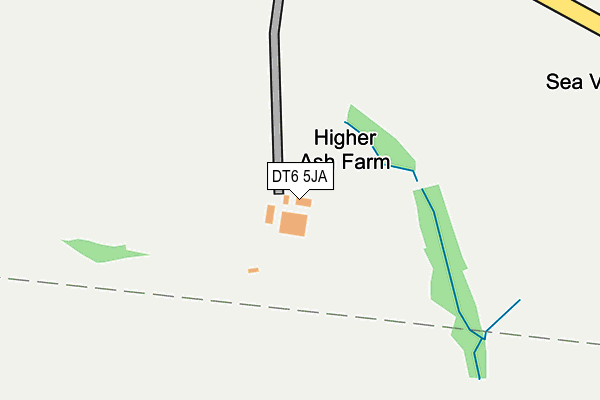
DT6 5JA lies on Ash Lane in Salwayash, Bridport. DT6 5JA is located in the Eggardon electoral ward, within the unitary authority of Dorset and the English Parliamentary constituency of West Dorset. The Sub Integrated Care Board (ICB) Location is NHS Dorset ICB - 11J and the police force is Dorset. This postcode has been in use since January 1980.


GetTheData
Source: OS OpenMap – Local (Ordnance Survey)
Source: OS VectorMap District (Ordnance Survey)
Licence: Open Government Licence (requires attribution)
| Easting | 346368 |
| Northing | 95999 |
| Latitude | 50.761081 |
| Longitude | -2.761770 |
GetTheData
Source: Open Postcode Geo
Licence: Open Government Licence
| Street | Ash Lane |
| Locality | Salwayash |
| Town/City | Bridport |
| Country | England |
| Postcode District | DT6 |
| ➜ DT6 open data dashboard ➜ See where DT6 is on a map | |
GetTheData
Source: Land Registry Price Paid Data
Licence: Open Government Licence
Elevation or altitude of DT6 5JA as distance above sea level:
| Metres | Feet | |
|---|---|---|
| Elevation | 60m | 197ft |
Elevation is measured from the approximate centre of the postcode, to the nearest point on an OS contour line from OS Terrain 50, which has contour spacing of ten vertical metres.
➜ How high above sea level am I? Find the elevation of your current position using your device's GPS.
GetTheData
Source: Open Postcode Elevation
Licence: Open Government Licence
| Ward | Eggardon |
| Constituency | West Dorset |
GetTheData
Source: ONS Postcode Database
Licence: Open Government Licence
| The Anchor Inn (B3162) | Salwayash | 991m |
| The Anchor Inn (B3162) | Salwayash | 1,003m |
| Post Box (B3162) | Dottery | 1,040m |
| Sunnyside Cottages (Dottery Road) | Dottery | 1,049m |
GetTheData
Source: NaPTAN
Licence: Open Government Licence
| Percentage of properties with Next Generation Access | 100.0% |
| Percentage of properties with Superfast Broadband | 66.7% |
| Percentage of properties with Ultrafast Broadband | 0.0% |
| Percentage of properties with Full Fibre Broadband | 0.0% |
Superfast Broadband is between 30Mbps and 300Mbps
Ultrafast Broadband is > 300Mbps
| Percentage of properties unable to receive 2Mbps | 0.0% |
| Percentage of properties unable to receive 5Mbps | 0.0% |
| Percentage of properties unable to receive 10Mbps | 33.3% |
| Percentage of properties unable to receive 30Mbps | 33.3% |
GetTheData
Source: Ofcom
Licence: Ofcom Terms of Use (requires attribution)
GetTheData
Source: ONS Postcode Database
Licence: Open Government Licence
➜ Get more ratings from the Food Standards Agency
GetTheData
Source: Food Standards Agency
Licence: FSA terms & conditions
| Last Collection | |||
|---|---|---|---|
| Location | Mon-Fri | Sat | Distance |
| Dottery | 11:45 | 09:00 | 1,038m |
| Pymore | 09:00 | 09:00 | 1,452m |
| Waytown | 09:00 | 09:00 | 1,734m |
GetTheData
Source: Dracos
Licence: Creative Commons Attribution-ShareAlike
| Facility | Distance |
|---|---|
| Salway Ash Playing Field Pitchers, Salwayash Grass Pitches | 930m |
| Salway Ash C Of E Primary School Salwayash, Bridport Grass Pitches | 1.8km |
| The Sir John Colfox Academy Ridgeway, Bridport Grass Pitches, Sports Hall, Artificial Grass Pitch, Health and Fitness Gym, Outdoor Tennis Courts | 1.9km |
GetTheData
Source: Active Places
Licence: Open Government Licence
| School | Phase of Education | Distance |
|---|---|---|
| The Sir John Colfox Academy Ridgeway, Bridport, DT6 3DT | Secondary | 1.9km |
| Salway Ash Church of England Voluntary Aided Primary School Salwayash, Bridport, DT6 5JE | Primary | 2km |
| St Catherine's Roman Catholic School Pymore Road, Bridport, DT6 3TR | Primary | 2.3km |
GetTheData
Source: Edubase
Licence: Open Government Licence
The below table lists the International Territorial Level (ITL) codes (formerly Nomenclature of Territorial Units for Statistics (NUTS) codes) and Local Administrative Units (LAU) codes for DT6 5JA:
| ITL 1 Code | Name |
|---|---|
| TLK | South West (England) |
| ITL 2 Code | Name |
| TLK2 | Dorset and Somerset |
| ITL 3 Code | Name |
| TLK25 | Dorset |
| LAU 1 Code | Name |
| E06000059 | Dorset |
GetTheData
Source: ONS Postcode Directory
Licence: Open Government Licence
The below table lists the Census Output Area (OA), Lower Layer Super Output Area (LSOA), and Middle Layer Super Output Area (MSOA) for DT6 5JA:
| Code | Name | |
|---|---|---|
| OA | E00104147 | |
| LSOA | E01020536 | West Dorset 007D |
| MSOA | E02004275 | West Dorset 007 |
GetTheData
Source: ONS Postcode Directory
Licence: Open Government Licence
| DT6 5HZ | Pineapple Lane | 729m |
| DT6 5HT | 842m | |
| DT6 5HU | 867m | |
| DT6 5QS | Pitchers | 955m |
| DT6 5HS | 984m | |
| DT6 5PS | Pymore Lane | 1001m |
| DT6 5HY | Pineapple Lane | 1007m |
| DT6 5LE | 1027m | |
| DT6 5LD | Salway Drive | 1047m |
| DT6 5PT | Dottery Cottages | 1058m |
GetTheData
Source: Open Postcode Geo; Land Registry Price Paid Data
Licence: Open Government Licence