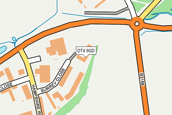
DT4 9GD is located in the Chickerell electoral ward, within the unitary authority of Dorset and the English Parliamentary constituency of West Dorset. The Sub Integrated Care Board (ICB) Location is NHS Dorset ICB - 11J and the police force is Dorset. This postcode has been in use since December 2001.


GetTheData
Source: OS OpenMap – Local (Ordnance Survey)
Source: OS VectorMap District (Ordnance Survey)
Licence: Open Government Licence (requires attribution)
| Easting | 365760 |
| Northing | 79895 |
| Latitude | 50.617740 |
| Longitude | -2.485340 |
GetTheData
Source: Open Postcode Geo
Licence: Open Government Licence
| Country | England |
| Postcode District | DT4 |
| ➜ DT4 open data dashboard ➜ See where DT4 is on a map ➜ Where is Weymouth? | |
GetTheData
Source: Land Registry Price Paid Data
Licence: Open Government Licence
Elevation or altitude of DT4 9GD as distance above sea level:
| Metres | Feet | |
|---|---|---|
| Elevation | 10m | 33ft |
Elevation is measured from the approximate centre of the postcode, to the nearest point on an OS contour line from OS Terrain 50, which has contour spacing of ten vertical metres.
➜ How high above sea level am I? Find the elevation of your current position using your device's GPS.
GetTheData
Source: Open Postcode Elevation
Licence: Open Government Licence
| Ward | Chickerell |
| Constituency | West Dorset |
GetTheData
Source: ONS Postcode Database
Licence: Open Government Licence
| June 2022 | Drugs | On or near Radipole Lane | 208m |
| June 2022 | Violence and sexual offences | On or near Radipole Lane | 208m |
| June 2022 | Violence and sexual offences | On or near Sports/Recreation Area | 241m |
| ➜ Get more crime data in our Crime section | |||
GetTheData
Source: data.police.uk
Licence: Open Government Licence
| Police Station | Southill | 171m |
| Police Station (Radipole Lane) | Southill | 194m |
| Surrey Close | Charlestown | 195m |
| Wessex Stadium | Southill | 203m |
| Surrey Close (Hampshire Road) | Charlestown | 217m |
| Weymouth Station | 2.2km |
| Upwey Station | 3.7km |
GetTheData
Source: NaPTAN
Licence: Open Government Licence
GetTheData
Source: ONS Postcode Database
Licence: Open Government Licence


➜ Get more ratings from the Food Standards Agency
GetTheData
Source: Food Standards Agency
Licence: FSA terms & conditions
| Last Collection | |||
|---|---|---|---|
| Location | Mon-Fri | Sat | Distance |
| Chickerell P.o. | 16:45 | 11:00 | 1,408m |
| Littlesea Estate | 17:30 | 12:00 | 1,460m |
| Westham P.o. | 17:30 | 12:00 | 1,470m |
GetTheData
Source: Dracos
Licence: Creative Commons Attribution-ShareAlike
| Facility | Distance |
|---|---|
| Bob Lucas Stadium Radipole Lane, Weymouth Grass Pitches | 238m |
| New Body Cambridge Road, Granby Industrial Estate, Weymouth Health and Fitness Gym, Studio | 510m |
| Conifers Primary School Radipole Lane, Weymouth Grass Pitches | 677m |
GetTheData
Source: Active Places
Licence: Open Government Licence
| School | Phase of Education | Distance |
|---|---|---|
| Conifers Primary School Radipole Lane, Weymouth, DT4 0QF | Primary | 659m |
| Budmouth Academy Weymouth Chickerell Road, Weymouth, DT4 9SY | Secondary | 864m |
| Chickerell Primary Academy Rashley Road, Chickerell, Weymouth, DT3 4AT | Primary | 1.2km |
GetTheData
Source: Edubase
Licence: Open Government Licence
The below table lists the International Territorial Level (ITL) codes (formerly Nomenclature of Territorial Units for Statistics (NUTS) codes) and Local Administrative Units (LAU) codes for DT4 9GD:
| ITL 1 Code | Name |
|---|---|
| TLK | South West (England) |
| ITL 2 Code | Name |
| TLK2 | Dorset and Somerset |
| ITL 3 Code | Name |
| TLK25 | Dorset |
| LAU 1 Code | Name |
| E06000059 | Dorset |
GetTheData
Source: ONS Postcode Directory
Licence: Open Government Licence
The below table lists the Census Output Area (OA), Lower Layer Super Output Area (LSOA), and Middle Layer Super Output Area (MSOA) for DT4 9GD:
| Code | Name | |
|---|---|---|
| OA | E00104030 | |
| LSOA | E01020516 | West Dorset 012E |
| MSOA | E02004280 | West Dorset 012 |
GetTheData
Source: ONS Postcode Directory
Licence: Open Government Licence
| DT4 9TY | Surrey Close | 114m |
| DT4 9XJ | Radipole Lane | 241m |
| DT4 9TR | Cumberland Drive | 297m |
| DT4 9ST | Cumberland Drive | 302m |
| DT4 0SX | Cobham Drive | 306m |
| DT4 0TQ | Radipole Lane | 394m |
| DT4 0SU | Cobham Drive | 416m |
| DT4 0SN | Radipole Lane | 418m |
| DT4 9TH | Albany Road | 440m |
| DT4 9TF | Kent Close | 463m |
GetTheData
Source: Open Postcode Geo; Land Registry Price Paid Data
Licence: Open Government Licence