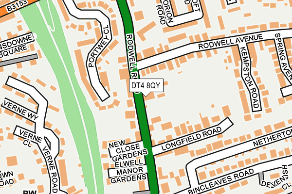
DT4 8QY is located in the Rodwell & Wyke electoral ward, within the unitary authority of Dorset and the English Parliamentary constituency of South Dorset. The Sub Integrated Care Board (ICB) Location is NHS Dorset ICB - 11J and the police force is Dorset. This postcode has been in use since January 1980.


GetTheData
Source: OS OpenMap – Local (Ordnance Survey)
Source: OS VectorMap District (Ordnance Survey)
Licence: Open Government Licence (requires attribution)
| Easting | 367619 |
| Northing | 78229 |
| Latitude | 50.602864 |
| Longitude | -2.458917 |
GetTheData
Source: Open Postcode Geo
Licence: Open Government Licence
| Country | England |
| Postcode District | DT4 |
| ➜ DT4 open data dashboard ➜ See where DT4 is on a map ➜ Where is Weymouth? | |
GetTheData
Source: Land Registry Price Paid Data
Licence: Open Government Licence
Elevation or altitude of DT4 8QY as distance above sea level:
| Metres | Feet | |
|---|---|---|
| Elevation | 30m | 98ft |
Elevation is measured from the approximate centre of the postcode, to the nearest point on an OS contour line from OS Terrain 50, which has contour spacing of ten vertical metres.
➜ How high above sea level am I? Find the elevation of your current position using your device's GPS.
GetTheData
Source: Open Postcode Elevation
Licence: Open Government Licence
| Ward | Rodwell & Wyke |
| Constituency | South Dorset |
GetTheData
Source: ONS Postcode Database
Licence: Open Government Licence
| January 2024 | Public order | On or near Glebe Close | 374m |
| December 2023 | Burglary | On or near Parking Area | 449m |
| August 2023 | Anti-social behaviour | On or near Parking Area | 449m |
| ➜ Get more crime data in our Crime section | |||
GetTheData
Source: data.police.uk
Licence: Open Government Licence
| The Kingswood (Rodwell Road) | Rodwell | 28m |
| Rodwell (Rodwell Road) | Rodwell | 107m |
| Rodwell Avenue | Rodwell | 131m |
| Bincleaves Road (Rodwell Road) | Southlands | 165m |
| Bincleaves Road | Southlands | 183m |
| Weymouth Station | 1.4km |
GetTheData
Source: NaPTAN
Licence: Open Government Licence
GetTheData
Source: ONS Postcode Database
Licence: Open Government Licence

➜ Get more ratings from the Food Standards Agency
GetTheData
Source: Food Standards Agency
Licence: FSA terms & conditions
| Last Collection | |||
|---|---|---|---|
| Location | Mon-Fri | Sat | Distance |
| Rodwell Avenue | 18:30 | 11:30 | 195m |
| Bincleaves Road | 18:00 | 12:00 | 393m |
| Hope Square | 18:30 | 12:00 | 572m |
GetTheData
Source: Dracos
Licence: Creative Commons Attribution-ShareAlike
| Facility | Distance |
|---|---|
| Holy Trinity C Of E Primary School And Community Nursery Cross Road, Weymouth Swimming Pool, Grass Pitches | 580m |
| Active Fitness Club (Weymouth) Newstead Road, Weymouth Health and Fitness Gym, Studio, Squash Courts | 672m |
| Moonfleet 2000 Indoor Bowls Club Knightsdale Road, Weymouth Indoor Bowls | 740m |
GetTheData
Source: Active Places
Licence: Open Government Licence
| School | Phase of Education | Distance |
|---|---|---|
| Holy Trinity Church of England VC Primary School & Community Nursery Cross Road, Weymouth, DT4 9QX | Primary | 536m |
| St Augustine's Catholic Primary School, Weymouth Hardy Avenue, Weymouth, DT4 0RH | Primary | 1.1km |
| The Compass 307a Chickerell Road, Westham, Weymouth, DT4 0QU | Not applicable | 1.2km |
GetTheData
Source: Edubase
Licence: Open Government Licence
The below table lists the International Territorial Level (ITL) codes (formerly Nomenclature of Territorial Units for Statistics (NUTS) codes) and Local Administrative Units (LAU) codes for DT4 8QY:
| ITL 1 Code | Name |
|---|---|
| TLK | South West (England) |
| ITL 2 Code | Name |
| TLK2 | Dorset and Somerset |
| ITL 3 Code | Name |
| TLK25 | Dorset |
| LAU 1 Code | Name |
| E06000059 | Dorset |
GetTheData
Source: ONS Postcode Directory
Licence: Open Government Licence
The below table lists the Census Output Area (OA), Lower Layer Super Output Area (LSOA), and Middle Layer Super Output Area (MSOA) for DT4 8QY:
| Code | Name | |
|---|---|---|
| OA | E00104412 | |
| LSOA | E01020581 | Weymouth and Portland 004E |
| MSOA | E02004284 | Weymouth and Portland 004 |
GetTheData
Source: ONS Postcode Directory
Licence: Open Government Licence
| DT4 8QX | Rodwell Road | 71m |
| DT4 8QU | Rodwell Road | 72m |
| DT4 8SH | Rodwell Avenue | 98m |
| DT4 8SQ | Rodwell Avenue | 103m |
| DT4 8RG | New Close Gardens | 106m |
| DT4 8RQ | Longfield Road | 122m |
| DT4 8RJ | Elwell Manor Gardens | 152m |
| DT4 8RF | Portwey Close | 157m |
| DT4 8LQ | Norwich Road | 157m |
| DT4 8QT | Rodwell Road | 161m |
GetTheData
Source: Open Postcode Geo; Land Registry Price Paid Data
Licence: Open Government Licence