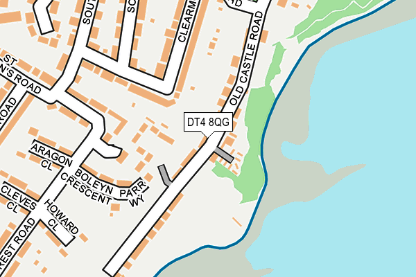
DT4 8QG is located in the Rodwell & Wyke electoral ward, within the unitary authority of Dorset and the English Parliamentary constituency of South Dorset. The Sub Integrated Care Board (ICB) Location is NHS Dorset ICB - 11J and the police force is Dorset. This postcode has been in use since September 1991.


GetTheData
Source: OS OpenMap – Local (Ordnance Survey)
Source: OS VectorMap District (Ordnance Survey)
Licence: Open Government Licence (requires attribution)
| Easting | 367442 |
| Northing | 77504 |
| Latitude | 50.596335 |
| Longitude | -2.461354 |
GetTheData
Source: Open Postcode Geo
Licence: Open Government Licence
| Country | England |
| Postcode District | DT4 |
| ➜ DT4 open data dashboard ➜ See where DT4 is on a map ➜ Where is Weymouth? | |
GetTheData
Source: Land Registry Price Paid Data
Licence: Open Government Licence
Elevation or altitude of DT4 8QG as distance above sea level:
| Metres | Feet | |
|---|---|---|
| Elevation | 20m | 66ft |
Elevation is measured from the approximate centre of the postcode, to the nearest point on an OS contour line from OS Terrain 50, which has contour spacing of ten vertical metres.
➜ How high above sea level am I? Find the elevation of your current position using your device's GPS.
GetTheData
Source: Open Postcode Elevation
Licence: Open Government Licence
| Ward | Rodwell & Wyke |
| Constituency | South Dorset |
GetTheData
Source: ONS Postcode Database
Licence: Open Government Licence
| June 2022 | Public order | On or near Khartoum Road | 360m |
| May 2022 | Other theft | On or near Old Castle Road | 83m |
| May 2022 | Violence and sexual offences | On or near Khartoum Road | 360m |
| ➜ Get more crime data in our Crime section | |||
GetTheData
Source: data.police.uk
Licence: Open Government Licence
| Clearmount Corner (Clearmount Road) | Southlands | 96m |
| Clearmount Corner (Clearmount Road) | Southlands | 105m |
| Southdown Road (Clearmount Road) | Southlands | 188m |
| Southdown Road (Clearmount Road) | Southlands | 209m |
| The Old Castle (Clearmount Road) | Southlands | 231m |
| Weymouth Station | 2.2km |
GetTheData
Source: NaPTAN
Licence: Open Government Licence
| Percentage of properties with Next Generation Access | 100.0% |
| Percentage of properties with Superfast Broadband | 100.0% |
| Percentage of properties with Ultrafast Broadband | 0.0% |
| Percentage of properties with Full Fibre Broadband | 0.0% |
Superfast Broadband is between 30Mbps and 300Mbps
Ultrafast Broadband is > 300Mbps
| Percentage of properties unable to receive 2Mbps | 0.0% |
| Percentage of properties unable to receive 5Mbps | 0.0% |
| Percentage of properties unable to receive 10Mbps | 0.0% |
| Percentage of properties unable to receive 30Mbps | 0.0% |
GetTheData
Source: Ofcom
Licence: Ofcom Terms of Use (requires attribution)
GetTheData
Source: ONS Postcode Database
Licence: Open Government Licence


➜ Get more ratings from the Food Standards Agency
GetTheData
Source: Food Standards Agency
Licence: FSA terms & conditions
| Last Collection | |||
|---|---|---|---|
| Location | Mon-Fri | Sat | Distance |
| Bincleaves Road | 18:00 | 12:00 | 813m |
| Rodwell Avenue | 18:30 | 11:30 | 895m |
| Pyehill P.o. | 17:30 | 12:00 | 1,171m |
GetTheData
Source: Dracos
Licence: Creative Commons Attribution-ShareAlike
| Facility | Distance |
|---|---|
| Holy Trinity C Of E Primary School And Community Nursery Cross Road, Weymouth Swimming Pool, Grass Pitches | 601m |
| All Saints Church Of England School Sunnyside Road, Weymouth Sports Hall, Grass Pitches, Artificial Grass Pitch | 894m |
| Wellworthy Indoor Bowls Club Dumbarton Road, Weymouth Indoor Bowls | 997m |
GetTheData
Source: Active Places
Licence: Open Government Licence
| School | Phase of Education | Distance |
|---|---|---|
| Holy Trinity Church of England VC Primary School & Community Nursery Cross Road, Weymouth, DT4 9QX | Primary | 643m |
| All Saints' Church of England Academy Sunnyside Road, Wyke Regis, Weymouth, DT4 9BJ | Secondary | 894m |
| Wyke Regis Infant School and Nursery Shrubbery Lane, Wyke Regis, Weymouth, DT4 9LU | Primary | 1.1km |
GetTheData
Source: Edubase
Licence: Open Government Licence
The below table lists the International Territorial Level (ITL) codes (formerly Nomenclature of Territorial Units for Statistics (NUTS) codes) and Local Administrative Units (LAU) codes for DT4 8QG:
| ITL 1 Code | Name |
|---|---|
| TLK | South West (England) |
| ITL 2 Code | Name |
| TLK2 | Dorset and Somerset |
| ITL 3 Code | Name |
| TLK25 | Dorset |
| LAU 1 Code | Name |
| E06000059 | Dorset |
GetTheData
Source: ONS Postcode Directory
Licence: Open Government Licence
The below table lists the Census Output Area (OA), Lower Layer Super Output Area (LSOA), and Middle Layer Super Output Area (MSOA) for DT4 8QG:
| Code | Name | |
|---|---|---|
| OA | E00104417 | |
| LSOA | E01020581 | Weymouth and Portland 004E |
| MSOA | E02004284 | Weymouth and Portland 004 |
GetTheData
Source: ONS Postcode Directory
Licence: Open Government Licence
| DT4 8QE | Old Castle Road | 34m |
| DT4 9TX | Henry Close | 126m |
| DT4 9LF | Clearmount Road | 145m |
| DT4 9JX | Boleyn Crescent | 157m |
| DT4 9LE | Clearmount Road | 168m |
| DT4 9JR | Hillcrest Road | 169m |
| DT4 9LH | Southlands Road | 214m |
| DT4 9JY | Aragon Close | 228m |
| DT4 9JT | Howard Close | 235m |
| DT4 9LB | Sudan Road | 241m |
GetTheData
Source: Open Postcode Geo; Land Registry Price Paid Data
Licence: Open Government Licence