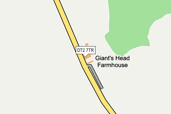
DT2 7TR is located in the Chalk Valleys electoral ward, within the unitary authority of Dorset and the English Parliamentary constituency of West Dorset. The Sub Integrated Care Board (ICB) Location is NHS Dorset ICB - 11J and the police force is Dorset. This postcode has been in use since January 1980.


GetTheData
Source: OS OpenMap – Local (Ordnance Survey)
Source: OS VectorMap District (Ordnance Survey)
Licence: Open Government Licence (requires attribution)
| Easting | 367480 |
| Northing | 102912 |
| Latitude | 50.824818 |
| Longitude | -2.463067 |
GetTheData
Source: Open Postcode Geo
Licence: Open Government Licence
| Country | England |
| Postcode District | DT2 |
| ➜ DT2 open data dashboard ➜ See where DT2 is on a map | |
GetTheData
Source: Land Registry Price Paid Data
Licence: Open Government Licence
Elevation or altitude of DT2 7TR as distance above sea level:
| Metres | Feet | |
|---|---|---|
| Elevation | 240m | 787ft |
Elevation is measured from the approximate centre of the postcode, to the nearest point on an OS contour line from OS Terrain 50, which has contour spacing of ten vertical metres.
➜ How high above sea level am I? Find the elevation of your current position using your device's GPS.
GetTheData
Source: Open Postcode Elevation
Licence: Open Government Licence
| Ward | Chalk Valleys |
| Constituency | West Dorset |
GetTheData
Source: ONS Postcode Database
Licence: Open Government Licence
| Up Cerne Road (A352) | Minterne Parva | 1,225m |
| Up Cerne Road (A352) | Minterne Parva | 1,236m |
| Davidson House Nursing Home (Acreman Street) | Cerne Abbas | 1,755m |
| Davidson House Nursing Home (Acreman Street) | Cerne Abbas | 1,769m |
GetTheData
Source: NaPTAN
Licence: Open Government Licence
GetTheData
Source: ONS Postcode Database
Licence: Open Government Licence


➜ Get more ratings from the Food Standards Agency
GetTheData
Source: Food Standards Agency
Licence: FSA terms & conditions
| Last Collection | |||
|---|---|---|---|
| Location | Mon-Fri | Sat | Distance |
| Cerne Abbas P.o. | 17:00 | 11:00 | 2,007m |
| Duntish Oaks | 13:00 | 10:45 | 3,873m |
| Nether Cerne | 13:15 | 10:30 | 4,571m |
GetTheData
Source: Dracos
Licence: Creative Commons Attribution-ShareAlike
| Facility | Distance |
|---|---|
| Simsay Oval Alton Lane, Cerne Abbas Grass Pitches | 1.6km |
| Cerne Abbas Village Hall Kettle Bridge Lane, Cerne Abbas, Dorchester Sports Hall | 1.9km |
| Buckland Newton Parish Field Buckland Newton, Dorchester Grass Pitches | 3.1km |
GetTheData
Source: Active Places
Licence: Open Government Licence
| School | Phase of Education | Distance |
|---|---|---|
| Cerne Abbas CofE VC First School Duck Street, Cerne Abbas, Dorchester, DT2 7LA | Primary | 2km |
| Buckland Newton Church of England Primary School Buckland Newton, Dorchester, DT2 7BY | Primary | 3km |
| Piddle Valley Church of England First School Piddletrenthide, Dorchester, DT2 7QL | Primary | 4.7km |
GetTheData
Source: Edubase
Licence: Open Government Licence
The below table lists the International Territorial Level (ITL) codes (formerly Nomenclature of Territorial Units for Statistics (NUTS) codes) and Local Administrative Units (LAU) codes for DT2 7TR:
| ITL 1 Code | Name |
|---|---|
| TLK | South West (England) |
| ITL 2 Code | Name |
| TLK2 | Dorset and Somerset |
| ITL 3 Code | Name |
| TLK25 | Dorset |
| LAU 1 Code | Name |
| E06000059 | Dorset |
GetTheData
Source: ONS Postcode Directory
Licence: Open Government Licence
The below table lists the Census Output Area (OA), Lower Layer Super Output Area (LSOA), and Middle Layer Super Output Area (MSOA) for DT2 7TR:
| Code | Name | |
|---|---|---|
| OA | E00103989 | |
| LSOA | E01020509 | West Dorset 004A |
| MSOA | E02004272 | West Dorset 004 |
GetTheData
Source: ONS Postcode Directory
Licence: Open Government Licence
| DT2 7TS | Abbey Street | 1098m |
| DT2 7GD | Simsay Fields | 1802m |
| DT2 7AL | 1855m | |
| DT2 7JH | Abbey Court | 1857m |
| DT2 7JJ | Piddle Lane | 1883m |
| DT2 7JQ | Abbey Street | 1885m |
| DT2 7JG | Long Street | 1905m |
| DT2 7LS | Riverside Close | 1932m |
| DT2 7LB | Mill Lane | 1968m |
| DT2 7LA | Duck Street | 1976m |
GetTheData
Source: Open Postcode Geo; Land Registry Price Paid Data
Licence: Open Government Licence