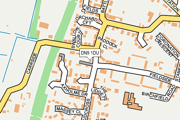
DN9 1DU is located in the Axholme Central electoral ward, within the unitary authority of North Lincolnshire and the English Parliamentary constituency of Brigg and Goole. The Sub Integrated Care Board (ICB) Location is NHS Humber and North Yorkshire ICB - 03K and the police force is Humberside. This postcode has been in use since January 1980.


GetTheData
Source: OS OpenMap – Local (Ordnance Survey)
Source: OS VectorMap District (Ordnance Survey)
Licence: Open Government Licence (requires attribution)
| Easting | 477498 |
| Northing | 404000 |
| Latitude | 53.526957 |
| Longitude | -0.832413 |
GetTheData
Source: Open Postcode Geo
Licence: Open Government Licence
| Country | England |
| Postcode District | DN9 |
| ➜ DN9 open data dashboard ➜ See where DN9 is on a map ➜ Where is Epworth? | |
GetTheData
Source: Land Registry Price Paid Data
Licence: Open Government Licence
Elevation or altitude of DN9 1DU as distance above sea level:
| Metres | Feet | |
|---|---|---|
| Elevation | 10m | 33ft |
Elevation is measured from the approximate centre of the postcode, to the nearest point on an OS contour line from OS Terrain 50, which has contour spacing of ten vertical metres.
➜ How high above sea level am I? Find the elevation of your current position using your device's GPS.
GetTheData
Source: Open Postcode Elevation
Licence: Open Government Licence
| Ward | Axholme Central |
| Constituency | Brigg And Goole |
GetTheData
Source: ONS Postcode Database
Licence: Open Government Licence
| November 2023 | Anti-social behaviour | On or near King Oswald Road | 313m |
| October 2023 | Violence and sexual offences | On or near Orchard Croft | 123m |
| August 2023 | Other theft | On or near King Oswald Road | 313m |
| ➜ Get more crime data in our Crime section | |||
GetTheData
Source: data.police.uk
Licence: Open Government Licence
| Fieldside | Epworth | 53m |
| South Axholme School (Burnham Road) | Epworth | 525m |
| Fieldside (Burnham Road) | Epworth | 557m |
| Tottermire Lane (Belton Road) | Epworth | 591m |
| Tottermire Lane (Belton Road) | Epworth | 601m |
GetTheData
Source: NaPTAN
Licence: Open Government Licence
| Percentage of properties with Next Generation Access | 100.0% |
| Percentage of properties with Superfast Broadband | 100.0% |
| Percentage of properties with Ultrafast Broadband | 0.0% |
| Percentage of properties with Full Fibre Broadband | 0.0% |
Superfast Broadband is between 30Mbps and 300Mbps
Ultrafast Broadband is > 300Mbps
| Percentage of properties unable to receive 2Mbps | 0.0% |
| Percentage of properties unable to receive 5Mbps | 0.0% |
| Percentage of properties unable to receive 10Mbps | 0.0% |
| Percentage of properties unable to receive 30Mbps | 0.0% |
GetTheData
Source: Ofcom
Licence: Ofcom Terms of Use (requires attribution)
GetTheData
Source: ONS Postcode Database
Licence: Open Government Licence


➜ Get more ratings from the Food Standards Agency
GetTheData
Source: Food Standards Agency
Licence: FSA terms & conditions
| Last Collection | |||
|---|---|---|---|
| Location | Mon-Fri | Sat | Distance |
| Battle Green | 16:45 | 12:00 | 358m |
| Epworth Post Office | 16:45 | 11:30 | 669m |
| Blow Road | 17:00 | 12:00 | 899m |
GetTheData
Source: Dracos
Licence: Creative Commons Attribution-ShareAlike
| Facility | Distance |
|---|---|
| Epworth Tennis Club Station Road, Station Road, Epworth Outdoor Tennis Courts | 258m |
| South Axholme Academy Burnham Road, Epworth, Doncaster Grass Pitches, Sports Hall, Artificial Grass Pitch | 465m |
| Carrside Playing Field Carrside, Epworth, Doncaster Grass Pitches | 478m |
GetTheData
Source: Active Places
Licence: Open Government Licence
| School | Phase of Education | Distance |
|---|---|---|
| Epworth Primary Academy Birchfield Road, Epworth, Doncaster, DN9 1DL | Primary | 192m |
| South Axholme Academy Burnham Road, Epworth, Doncaster, DN9 1BY | Secondary | 468m |
| Belton All Saints CofE Primary School High Street, Belton, Doncaster, DN9 1LR | Primary | 3.2km |
GetTheData
Source: Edubase
Licence: Open Government Licence
The below table lists the International Territorial Level (ITL) codes (formerly Nomenclature of Territorial Units for Statistics (NUTS) codes) and Local Administrative Units (LAU) codes for DN9 1DU:
| ITL 1 Code | Name |
|---|---|
| TLE | Yorkshire and The Humber |
| ITL 2 Code | Name |
| TLE1 | East Yorkshire and Northern Lincolnshire |
| ITL 3 Code | Name |
| TLE13 | North and North East Lincolnshire |
| LAU 1 Code | Name |
| E06000013 | North Lincolnshire |
GetTheData
Source: ONS Postcode Directory
Licence: Open Government Licence
The below table lists the Census Output Area (OA), Lower Layer Super Output Area (LSOA), and Middle Layer Super Output Area (MSOA) for DN9 1DU:
| Code | Name | |
|---|---|---|
| OA | E00066826 | |
| LSOA | E01013244 | North Lincolnshire 020D |
| MSOA | E02002768 | North Lincolnshire 020 |
GetTheData
Source: ONS Postcode Directory
Licence: Open Government Licence
| DN9 1DT | Myers Villas | 45m |
| DN9 1EH | Manley Court | 58m |
| DN9 1EB | Swallow Court | 83m |
| DN9 1FR | Paddock Close | 101m |
| DN9 1EL | Axholme Drive | 111m |
| DN9 1LL | Orchard Croft | 113m |
| DN9 1EJ | The Lidgett | 127m |
| DN9 1DP | Fieldside | 127m |
| DN9 1DR | Fieldside | 158m |
| DN9 1JT | Battle Green | 171m |
GetTheData
Source: Open Postcode Geo; Land Registry Price Paid Data
Licence: Open Government Licence