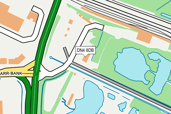
DN4 8DB is located in the Hexthorpe & Balby North electoral ward, within the metropolitan district of Doncaster and the English Parliamentary constituency of Doncaster Central. The Sub Integrated Care Board (ICB) Location is NHS South Yorkshire ICB - 02X and the police force is South Yorkshire. This postcode has been in use since March 2006.


GetTheData
Source: OS OpenMap – Local (Ordnance Survey)
Source: OS VectorMap District (Ordnance Survey)
Licence: Open Government Licence (requires attribution)
| Easting | 458925 |
| Northing | 400702 |
| Latitude | 53.499744 |
| Longitude | -1.113165 |
GetTheData
Source: Open Postcode Geo
Licence: Open Government Licence
| Country | England |
| Postcode District | DN4 |
| ➜ DN4 open data dashboard ➜ See where DN4 is on a map ➜ Where is Doncaster? | |
GetTheData
Source: Land Registry Price Paid Data
Licence: Open Government Licence
Elevation or altitude of DN4 8DB as distance above sea level:
| Metres | Feet | |
|---|---|---|
| Elevation | 10m | 33ft |
Elevation is measured from the approximate centre of the postcode, to the nearest point on an OS contour line from OS Terrain 50, which has contour spacing of ten vertical metres.
➜ How high above sea level am I? Find the elevation of your current position using your device's GPS.
GetTheData
Source: Open Postcode Elevation
Licence: Open Government Licence
| Ward | Hexthorpe & Balby North |
| Constituency | Doncaster Central |
GetTheData
Source: ONS Postcode Database
Licence: Open Government Licence
| June 2022 | Vehicle crime | On or near Park/Open Space | 253m |
| June 2022 | Shoplifting | On or near White Rose Way | 282m |
| June 2022 | Shoplifting | On or near White Rose Way | 282m |
| ➜ Get more crime data in our Crime section | |||
GetTheData
Source: data.police.uk
Licence: Open Government Licence
| White Rose Way (Woodfield Way) | Balby | 301m |
| White Rose Way (Woodfield Way) | Balby | 314m |
| Wisconsin Drive (Carolina Way) | Lakeside | 563m |
| Catesby Park (Woodfield Way) | Balby | 611m |
| Catesby Park (Woodfield Way) | Balby | 617m |
| Doncaster Station | 3.1km |
| Bentley (S Yorks) Station | 5.5km |
GetTheData
Source: NaPTAN
Licence: Open Government Licence
GetTheData
Source: ONS Postcode Database
Licence: Open Government Licence


➜ Get more ratings from the Food Standards Agency
GetTheData
Source: Food Standards Agency
Licence: FSA terms & conditions
| Last Collection | |||
|---|---|---|---|
| Location | Mon-Fri | Sat | Distance |
| The Yorkshire Outlet | 18:45 | 12:15 | 757m |
| Lakeside Boulevard | 18:45 | 12:15 | 1,303m |
| Doncaster Mail Centre | 19:30 | 13:30 | 1,585m |
GetTheData
Source: Dracos
Licence: Creative Commons Attribution-ShareAlike
| Facility | Distance |
|---|---|
| Nuffield Health (Doncaster) Sidings Court, Lakeside, Doncaster Swimming Pool, Health and Fitness Gym, Studio | 1.2km |
| Fitness Village (Stadium) Stadium Way, Doncaster Health and Fitness Gym, Studio | 1.2km |
| Eco-power Stadium Stadium Way, Doncaster Artificial Grass Pitch, Athletics, Grass Pitches, Sports Hall | 1.3km |
GetTheData
Source: Active Places
Licence: Open Government Licence
| School | Phase of Education | Distance |
|---|---|---|
| XP East Middle Bank, Doncaster, DN4 5NG | Secondary | 1.4km |
| XP School Middle Bank, Doncaster, DN4 5NG | Secondary | 1.4km |
| Lakeside Primary Academy Sandy Lane, Doncaster, DN4 5ES | Primary | 1.5km |
GetTheData
Source: Edubase
Licence: Open Government Licence
The below table lists the International Territorial Level (ITL) codes (formerly Nomenclature of Territorial Units for Statistics (NUTS) codes) and Local Administrative Units (LAU) codes for DN4 8DB:
| ITL 1 Code | Name |
|---|---|
| TLE | Yorkshire and The Humber |
| ITL 2 Code | Name |
| TLE3 | South Yorkshire |
| ITL 3 Code | Name |
| TLE31 | Barnsley, Doncaster and Rotherham |
| LAU 1 Code | Name |
| E08000017 | Doncaster |
GetTheData
Source: ONS Postcode Directory
Licence: Open Government Licence
The below table lists the Census Output Area (OA), Lower Layer Super Output Area (LSOA), and Middle Layer Super Output Area (MSOA) for DN4 8DB:
| Code | Name | |
|---|---|---|
| OA | E00038157 | |
| LSOA | E01007534 | Doncaster 028D |
| MSOA | E02001566 | Doncaster 028 |
GetTheData
Source: ONS Postcode Directory
Licence: Open Government Licence
| DN4 5JT | Balby Carr Bank | 409m |
| DN4 7LH | Short Lane | 999m |
| DN4 5FE | Kentmere Drive | 1006m |
| DN4 5FG | Kentmere Drive | 1009m |
| DN4 5FA | Winscar Road | 1028m |
| DN4 5JH | White Rose Way | 1038m |
| DN4 7RQ | Clayworth Drive | 1066m |
| DN4 7RJ | Clayworth Drive | 1095m |
| DN4 5FL | Kentmere Drive | 1100m |
| DN4 7RE | Burnham Close | 1100m |
GetTheData
Source: Open Postcode Geo; Land Registry Price Paid Data
Licence: Open Government Licence