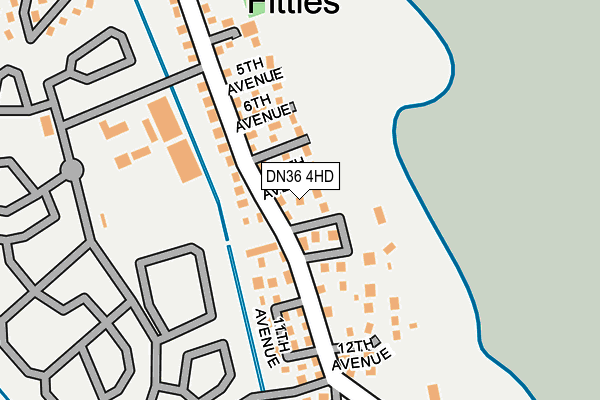
DN36 4HD lies on Humberston Fitties in Humberston, Grimsby. DN36 4HD is located in the Humberston and New Waltham electoral ward, within the unitary authority of North East Lincolnshire and the English Parliamentary constituency of Cleethorpes. The Sub Integrated Care Board (ICB) Location is NHS Humber and North Yorkshire ICB - 03H and the police force is Humberside. This postcode has been in use since January 1980.


GetTheData
Source: OS OpenMap – Local (Ordnance Survey)
Source: OS VectorMap District (Ordnance Survey)
Licence: Open Government Licence (requires attribution)
| Easting | 533666 |
| Northing | 405257 |
| Latitude | 53.527006 |
| Longitude | 0.014957 |
GetTheData
Source: Open Postcode Geo
Licence: Open Government Licence
| Street | Humberston Fitties |
| Locality | Humberston |
| Town/City | Grimsby |
| Country | England |
| Postcode District | DN36 |
➜ See where DN36 is on a map ➜ Where is Humberston? | |
GetTheData
Source: Land Registry Price Paid Data
Licence: Open Government Licence
Elevation or altitude of DN36 4HD as distance above sea level:
| Metres | Feet | |
|---|---|---|
| Elevation | 10m | 33ft |
Elevation is measured from the approximate centre of the postcode, to the nearest point on an OS contour line from OS Terrain 50, which has contour spacing of ten vertical metres.
➜ How high above sea level am I? Find the elevation of your current position using your device's GPS.
GetTheData
Source: Open Postcode Elevation
Licence: Open Government Licence
| Ward | Humberston And New Waltham |
| Constituency | Cleethorpes |
GetTheData
Source: ONS Postcode Database
Licence: Open Government Licence
147A, HUMBERSTON FITTIES, HUMBERSTON, GRIMSBY, DN36 4HD 2022 24 JUN £108,000 |
2022 21 FEB £120,000 |
228, HUMBERSTON FITTIES, HUMBERSTON, GRIMSBY, DN36 4HD 2019 20 DEC £100,000 |
151, HUMBERSTON FITTIES, HUMBERSTON, GRIMSBY, DN36 4HD 2019 29 OCT £100,000 |
2015 25 MAR £60,000 |
202, HUMBERSTON FITTIES, HUMBERSTON, GRIMSBY, DN36 4HD 2010 16 JUL £68,000 |
2010 1 JUN £75,000 |
2008 28 MAY £75,000 |
GetTheData
Source: HM Land Registry Price Paid Data
Licence: Contains HM Land Registry data © Crown copyright and database right 2025. This data is licensed under the Open Government Licence v3.0.
| 5th Avenue (1st Main Road) | Thorpe Park | 142m |
| 12th Avenue (1st Main Road) | Thorpe Park | 155m |
| Recreational Centre (Main Road) | Thorpe Park | 251m |
| Boating Lake (Main Road) | Thorpe Park | 290m |
| 1st Main Road | Thorpe Park | 486m |
| Cleethorpes Station | 4.9km |
GetTheData
Source: NaPTAN
Licence: Open Government Licence
| Percentage of properties with Next Generation Access | 0.0% |
| Percentage of properties with Superfast Broadband | 0.0% |
| Percentage of properties with Ultrafast Broadband | 0.0% |
| Percentage of properties with Full Fibre Broadband | 0.0% |
Superfast Broadband is between 30Mbps and 300Mbps
Ultrafast Broadband is > 300Mbps
| Median download speed | 2.6Mbps |
| Average download speed | 2.9Mbps |
| Maximum download speed | 5.70Mbps |
| Median upload speed | 0.4Mbps |
| Average upload speed | 0.6Mbps |
| Maximum upload speed | 0.87Mbps |
| Percentage of properties unable to receive 2Mbps | 0.0% |
| Percentage of properties unable to receive 5Mbps | 100.0% |
| Percentage of properties unable to receive 10Mbps | 100.0% |
| Percentage of properties unable to receive 30Mbps | 100.0% |
GetTheData
Source: Ofcom
Licence: Ofcom Terms of Use (requires attribution)
GetTheData
Source: ONS Postcode Database
Licence: Open Government Licence


➜ Get more ratings from the Food Standards Agency
GetTheData
Source: Food Standards Agency
Licence: FSA terms & conditions
| Last Collection | |||
|---|---|---|---|
| Location | Mon-Fri | Sat | Distance |
| Humberston | 16:00 | 11:00 | 2,545m |
| Humberstone Post Office | 17:45 | 11:45 | 2,665m |
| Tetney Road | 16:15 | 11:00 | 3,119m |
GetTheData
Source: Dracos
Licence: Creative Commons Attribution-ShareAlike
| Risk of DN36 4HD flooding from rivers and sea | Medium |
| ➜ DN36 4HD flood map | |
GetTheData
Source: Open Flood Risk by Postcode
Licence: Open Government Licence
The below table lists the International Territorial Level (ITL) codes (formerly Nomenclature of Territorial Units for Statistics (NUTS) codes) and Local Administrative Units (LAU) codes for DN36 4HD:
| ITL 1 Code | Name |
|---|---|
| TLE | Yorkshire and The Humber |
| ITL 2 Code | Name |
| TLE1 | East Yorkshire and Northern Lincolnshire |
| ITL 3 Code | Name |
| TLE13 | North and North East Lincolnshire |
| LAU 1 Code | Name |
| E06000012 | North East Lincolnshire |
GetTheData
Source: ONS Postcode Directory
Licence: Open Government Licence
The below table lists the Census Output Area (OA), Lower Layer Super Output Area (LSOA), and Middle Layer Super Output Area (MSOA) for DN36 4HD:
| Code | Name | |
|---|---|---|
| OA | E00066444 | |
| LSOA | E01013167 | North East Lincolnshire 020D |
| MSOA | E02002745 | North East Lincolnshire 020 |
GetTheData
Source: ONS Postcode Directory
Licence: Open Government Licence
| DN36 4HE | Humberston Fitties | 105m |
| DN36 4EZ | Humberston Fitties | 322m |
| DN36 4HA | Humberston Fitties | 387m |
| DN36 4HB | Humberston Fitties | 441m |
| DN36 4EU | Humberston Fitties | 696m |
| DN36 4EY | Humberston Fitties | 747m |
| DN36 4EX | Humberston Fitties | 767m |
| DN36 4BX | Forest Way | 1743m |
| DN35 0PG | Kings Mews | 1822m |
| DN35 0PP | North Sea Lane | 1863m |
GetTheData
Source: Open Postcode Geo; Land Registry Price Paid Data
Licence: Open Government Licence