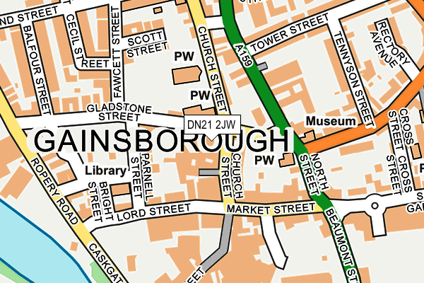
DN21 2JW is located in the Gainsborough South-West electoral ward, within the local authority district of West Lindsey and the English Parliamentary constituency of Gainsborough. The Sub Integrated Care Board (ICB) Location is NHS Lincolnshire ICB - 71E and the police force is Lincolnshire. This postcode has been in use since January 1980.


GetTheData
Source: OS OpenMap – Local (Ordnance Survey)
Source: OS VectorMap District (Ordnance Survey)
Licence: Open Government Licence (requires attribution)
| Easting | 481485 |
| Northing | 390015 |
| Latitude | 53.400680 |
| Longitude | -0.775904 |
GetTheData
Source: Open Postcode Geo
Licence: Open Government Licence
| Country | England |
| Postcode District | DN21 |
➜ See where DN21 is on a map ➜ Where is Gainsborough? | |
GetTheData
Source: Land Registry Price Paid Data
Licence: Open Government Licence
Elevation or altitude of DN21 2JW as distance above sea level:
| Metres | Feet | |
|---|---|---|
| Elevation | 10m | 33ft |
Elevation is measured from the approximate centre of the postcode, to the nearest point on an OS contour line from OS Terrain 50, which has contour spacing of ten vertical metres.
➜ How high above sea level am I? Find the elevation of your current position using your device's GPS.
GetTheData
Source: Open Postcode Elevation
Licence: Open Government Licence
| Ward | Gainsborough South-west |
| Constituency | Gainsborough |
GetTheData
Source: ONS Postcode Database
Licence: Open Government Licence
| Gladstone Street (Church Street) | Gainsborough | 23m |
| Surgery (Spital Terrace) | Gainsborough | 181m |
| Surgery (Spital Terrace) | Gainsborough | 204m |
| Silver Street (Caskgate Street) | Gainsborough | 272m |
| Silver Street (Caskgate Street) | Gainsborough | 287m |
| Gainsborough Central Station | 0.4km |
| Gainsborough Lea Road Station | 1.7km |
GetTheData
Source: NaPTAN
Licence: Open Government Licence
GetTheData
Source: ONS Postcode Database
Licence: Open Government Licence


➜ Get more ratings from the Food Standards Agency
GetTheData
Source: Food Standards Agency
Licence: FSA terms & conditions
| Last Collection | |||
|---|---|---|---|
| Location | Mon-Fri | Sat | Distance |
| Market Place | 17:00 | 11:45 | 141m |
| Church Street | 17:00 | 12:00 | 151m |
| Acland Street | 16:45 | 12:15 | 246m |
GetTheData
Source: Dracos
Licence: Creative Commons Attribution-ShareAlike
| Risk of DN21 2JW flooding from rivers and sea | Very Low |
| ➜ DN21 2JW flood map | |
GetTheData
Source: Open Flood Risk by Postcode
Licence: Open Government Licence
The below table lists the International Territorial Level (ITL) codes (formerly Nomenclature of Territorial Units for Statistics (NUTS) codes) and Local Administrative Units (LAU) codes for DN21 2JW:
| ITL 1 Code | Name |
|---|---|
| TLF | East Midlands (England) |
| ITL 2 Code | Name |
| TLF3 | Lincolnshire |
| ITL 3 Code | Name |
| TLF30 | Lincolnshire CC |
| LAU 1 Code | Name |
| E07000142 | West Lindsey |
GetTheData
Source: ONS Postcode Directory
Licence: Open Government Licence
The below table lists the Census Output Area (OA), Lower Layer Super Output Area (LSOA), and Middle Layer Super Output Area (MSOA) for DN21 2JW:
| Code | Name | |
|---|---|---|
| OA | E00134028 | |
| LSOA | E01026384 | West Lindsey 004F |
| MSOA | E02005495 | West Lindsey 004 |
GetTheData
Source: ONS Postcode Directory
Licence: Open Government Licence
| DN21 2JH | Church Street | 50m |
| DN21 2JJ | Church Street | 53m |
| DN21 2BL | Market Street | 94m |
| DN21 2NB | Parnell Street | 99m |
| DN21 2HB | Charlotte Court | 103m |
| DN21 2DD | Lord Street | 108m |
| DN21 2HS | North Street | 111m |
| DN21 2DB | Lord Street | 112m |
| DN21 2JR | Church Street | 120m |
| DN21 2BZ | Market Place | 129m |
GetTheData
Source: Open Postcode Geo; Land Registry Price Paid Data
Licence: Open Government Licence