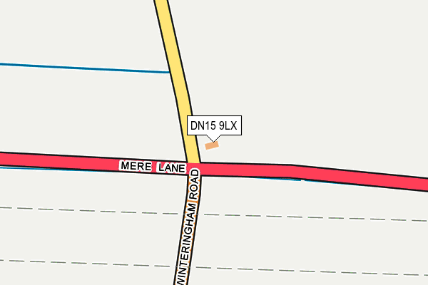
DN15 9LX is located in the Burton upon Stather & Winterton electoral ward, within the unitary authority of North Lincolnshire and the English Parliamentary constituency of Brigg and Goole. The Sub Integrated Care Board (ICB) Location is NHS Humber and North Yorkshire ICB - 03K and the police force is Humberside. This postcode has been in use since January 1980.


GetTheData
Source: OS OpenMap – Local (Ordnance Survey)
Source: OS VectorMap District (Ordnance Survey)
Licence: Open Government Licence (requires attribution)
| Easting | 493398 |
| Northing | 420437 |
| Latitude | 53.672071 |
| Longitude | -0.587717 |
GetTheData
Source: Open Postcode Geo
Licence: Open Government Licence
| Country | England |
| Postcode District | DN15 |
| ➜ DN15 open data dashboard ➜ See where DN15 is on a map | |
GetTheData
Source: Land Registry Price Paid Data
Licence: Open Government Licence
Elevation or altitude of DN15 9LX as distance above sea level:
| Metres | Feet | |
|---|---|---|
| Elevation | 20m | 66ft |
Elevation is measured from the approximate centre of the postcode, to the nearest point on an OS contour line from OS Terrain 50, which has contour spacing of ten vertical metres.
➜ How high above sea level am I? Find the elevation of your current position using your device's GPS.
GetTheData
Source: Open Postcode Elevation
Licence: Open Government Licence
| Ward | Burton Upon Stather & Winterton |
| Constituency | Brigg And Goole |
GetTheData
Source: ONS Postcode Database
Licence: Open Government Licence
| Mere Garage (Winterton Road) | Winteringham | 31m |
| Mere Garage (Winterton Road) | Winteringham | 38m |
| Mere Farm (Winterton Road) | Winteringham | 436m |
| Mere Farm (Winterton Road) | Winteringham | 442m |
| Selling Centre (North Street) | Winterton | 1,014m |
GetTheData
Source: NaPTAN
Licence: Open Government Licence
GetTheData
Source: ONS Postcode Database
Licence: Open Government Licence


➜ Get more ratings from the Food Standards Agency
GetTheData
Source: Food Standards Agency
Licence: FSA terms & conditions
| Last Collection | |||
|---|---|---|---|
| Location | Mon-Fri | Sat | Distance |
| Winteringham Road | 17:00 | 09:00 | 1,680m |
| Northlands Road | 17:15 | 09:15 | 1,726m |
| Winteringham Post Office | 16:45 | 10:00 | 1,736m |
GetTheData
Source: Dracos
Licence: Creative Commons Attribution-ShareAlike
| Facility | Distance |
|---|---|
| Winterton Npdpf Newport Drive, Winterton Grass Pitches | 1.4km |
| Winterton Synthetic Pitch Newport Drive, Winterton Artificial Grass Pitch | 1.6km |
| Winterton Community Academy Newport Drive, Winterton, Scunthorpe Grass Pitches, Sports Hall, Health and Fitness Gym, Outdoor Tennis Courts | 1.6km |
GetTheData
Source: Active Places
Licence: Open Government Licence
| School | Phase of Education | Distance |
|---|---|---|
| Winterton Community Academy Newport Drive, Winterton, Scunthorpe, DN15 9QD | Secondary | 1.6km |
| Winteringham Primary School School Road, Winteringham, Scunthorpe, DN15 9NL | Primary | 1.8km |
| Winterton Church of England Infants' School West Street, Winterton, Scunthorpe, DN15 9QF | Primary | 1.8km |
GetTheData
Source: Edubase
Licence: Open Government Licence
The below table lists the International Territorial Level (ITL) codes (formerly Nomenclature of Territorial Units for Statistics (NUTS) codes) and Local Administrative Units (LAU) codes for DN15 9LX:
| ITL 1 Code | Name |
|---|---|
| TLE | Yorkshire and The Humber |
| ITL 2 Code | Name |
| TLE1 | East Yorkshire and Northern Lincolnshire |
| ITL 3 Code | Name |
| TLE13 | North and North East Lincolnshire |
| LAU 1 Code | Name |
| E06000013 | North Lincolnshire |
GetTheData
Source: ONS Postcode Directory
Licence: Open Government Licence
The below table lists the Census Output Area (OA), Lower Layer Super Output Area (LSOA), and Middle Layer Super Output Area (MSOA) for DN15 9LX:
| Code | Name | |
|---|---|---|
| OA | E00067077 | |
| LSOA | E01013294 | North Lincolnshire 003D |
| MSOA | E02002751 | North Lincolnshire 003 |
GetTheData
Source: ONS Postcode Directory
Licence: Open Government Licence
| DN15 9PQ | Winterton Road | 375m |
| DN15 9NA | Ferriby Road | 1241m |
| DN15 9QW | North Street | 1248m |
| DN15 9NB | Ermine Street | 1414m |
| DN15 9RG | Newport Drive | 1428m |
| DN15 9UW | Northlands Road | 1449m |
| DN15 9NF | Winterton Road | 1466m |
| DN15 9NQ | Cliff Road | 1515m |
| DN15 9QP | Mill House Lane | 1526m |
| DN15 9QN | North Street | 1541m |
GetTheData
Source: Open Postcode Geo; Land Registry Price Paid Data
Licence: Open Government Licence