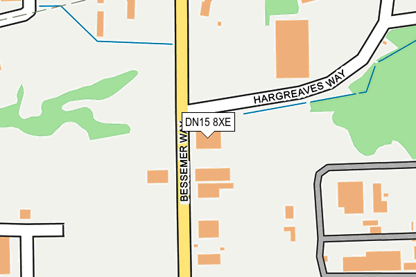
DN15 8XE lies on Bessemer Way in Scunthorpe. DN15 8XE is located in the Crosby & Park electoral ward, within the unitary authority of North Lincolnshire and the English Parliamentary constituency of Scunthorpe. The Sub Integrated Care Board (ICB) Location is NHS Humber and North Yorkshire ICB - 03K and the police force is Humberside. This postcode has been in use since January 1991.


GetTheData
Source: OS OpenMap – Local (Ordnance Survey)
Source: OS VectorMap District (Ordnance Survey)
Licence: Open Government Licence (requires attribution)
| Easting | 489751 |
| Northing | 412515 |
| Latitude | 53.601546 |
| Longitude | -0.645191 |
GetTheData
Source: Open Postcode Geo
Licence: Open Government Licence
| Street | Bessemer Way |
| Town/City | Scunthorpe |
| Country | England |
| Postcode District | DN15 |
| ➜ DN15 open data dashboard ➜ See where DN15 is on a map ➜ Where is Scunthorpe? | |
GetTheData
Source: Land Registry Price Paid Data
Licence: Open Government Licence
Elevation or altitude of DN15 8XE as distance above sea level:
| Metres | Feet | |
|---|---|---|
| Elevation | 40m | 131ft |
Elevation is measured from the approximate centre of the postcode, to the nearest point on an OS contour line from OS Terrain 50, which has contour spacing of ten vertical metres.
➜ How high above sea level am I? Find the elevation of your current position using your device's GPS.
GetTheData
Source: Open Postcode Elevation
Licence: Open Government Licence
| Ward | Crosby & Park |
| Constituency | Scunthorpe |
GetTheData
Source: ONS Postcode Database
Licence: Open Government Licence
| June 2022 | Anti-social behaviour | On or near Mannaberg Way | 282m |
| June 2022 | Anti-social behaviour | On or near Mannaberg Way | 282m |
| May 2022 | Burglary | On or near Normanby Road | 492m |
| ➜ Get more crime data in our Crime section | |||
GetTheData
Source: data.police.uk
Licence: Open Government Licence
| Normanby Grange (Normanby Road) | Scunthorpe | 431m |
| Normanby Grange (Normanby Road) | Scunthorpe | 468m |
| Boc Works (Winterton Road) | Scunthorpe | 478m |
| Boc Works (Winterton Road) | Scunthorpe | 482m |
| Mannaberg Way | Scunthorpe | 489m |
| Scunthorpe Station | 1.8km |
GetTheData
Source: NaPTAN
Licence: Open Government Licence
GetTheData
Source: ONS Postcode Database
Licence: Open Government Licence


➜ Get more ratings from the Food Standards Agency
GetTheData
Source: Food Standards Agency
Licence: FSA terms & conditions
| Last Collection | |||
|---|---|---|---|
| Location | Mon-Fri | Sat | Distance |
| Grosvenor Street | 17:30 | 12:15 | 600m |
| Crosby Flats | 17:30 | 12:00 | 924m |
| Crosby Avenue | 17:00 | 12:15 | 1,051m |
GetTheData
Source: Dracos
Licence: Creative Commons Attribution-ShareAlike
| Facility | Distance |
|---|---|
| Crosby Primary School Normanby Road, Scunthorpe Grass Pitches | 565m |
| Energie Fitness (Scunthorpe) Mannaberg Way, Scunthorpe Health and Fitness Gym, Studio | 612m |
| Rouge Ladies Fitness (Closed) Frodingham Road, Scunthorpe Health and Fitness Gym | 858m |
GetTheData
Source: Active Places
Licence: Open Government Licence
| School | Phase of Education | Distance |
|---|---|---|
| Crosby Primary School Normanby Road, Scunthorpe, DN15 6AS | Primary | 565m |
| Scunthorpe CofE Primary School Gurnell Street, Scunthorpe, DN15 6HP | Primary | 955m |
| Engineering UTC Northern Lincolnshire Carlton Street, Scunthorpe, DN15 6TA | Secondary | 1.1km |
GetTheData
Source: Edubase
Licence: Open Government Licence
The below table lists the International Territorial Level (ITL) codes (formerly Nomenclature of Territorial Units for Statistics (NUTS) codes) and Local Administrative Units (LAU) codes for DN15 8XE:
| ITL 1 Code | Name |
|---|---|
| TLE | Yorkshire and The Humber |
| ITL 2 Code | Name |
| TLE1 | East Yorkshire and Northern Lincolnshire |
| ITL 3 Code | Name |
| TLE13 | North and North East Lincolnshire |
| LAU 1 Code | Name |
| E06000013 | North Lincolnshire |
GetTheData
Source: ONS Postcode Directory
Licence: Open Government Licence
The below table lists the Census Output Area (OA), Lower Layer Super Output Area (LSOA), and Middle Layer Super Output Area (MSOA) for DN15 8XE:
| Code | Name | |
|---|---|---|
| OA | E00067109 | |
| LSOA | E01013300 | North Lincolnshire 007B |
| MSOA | E02002755 | North Lincolnshire 007 |
GetTheData
Source: ONS Postcode Directory
Licence: Open Government Licence
| DN15 8GN | Mitre Gardens | 498m |
| DN15 8GP | Bedford Way | 511m |
| DN15 6AS | Normanby Road | 535m |
| DN15 0DH | Winterton Road | 552m |
| DN15 8PT | Old Crosby | 562m |
| DN15 8GY | Regents Close | 570m |
| DN15 8GQ | Gloucester Court | 590m |
| DN15 8GS | Granville Road | 605m |
| DN15 6AY | Diana Street | 624m |
| DN15 8GZ | Greenwich Close | 631m |
GetTheData
Source: Open Postcode Geo; Land Registry Price Paid Data
Licence: Open Government Licence