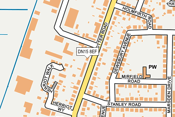
DN15 8EF is located in the Crosby & Park electoral ward, within the unitary authority of North Lincolnshire and the English Parliamentary constituency of Scunthorpe. The Sub Integrated Care Board (ICB) Location is NHS Humber and North Yorkshire ICB - 03K and the police force is Humberside. This postcode has been in use since June 1999.


GetTheData
Source: OS OpenMap – Local (Ordnance Survey)
Source: OS VectorMap District (Ordnance Survey)
Licence: Open Government Licence (requires attribution)
| Easting | 487292 |
| Northing | 411619 |
| Latitude | 53.593888 |
| Longitude | -0.682586 |
GetTheData
Source: Open Postcode Geo
Licence: Open Government Licence
| Country | England |
| Postcode District | DN15 |
| ➜ DN15 open data dashboard ➜ See where DN15 is on a map ➜ Where is Scunthorpe? | |
GetTheData
Source: Land Registry Price Paid Data
Licence: Open Government Licence
Elevation or altitude of DN15 8EF as distance above sea level:
| Metres | Feet | |
|---|---|---|
| Elevation | 10m | 33ft |
Elevation is measured from the approximate centre of the postcode, to the nearest point on an OS contour line from OS Terrain 50, which has contour spacing of ten vertical metres.
➜ How high above sea level am I? Find the elevation of your current position using your device's GPS.
GetTheData
Source: Open Postcode Elevation
Licence: Open Government Licence
| Ward | Crosby & Park |
| Constituency | Scunthorpe |
GetTheData
Source: ONS Postcode Database
Licence: Open Government Licence
| October 2023 | Violence and sexual offences | On or near Herriot Walk | 168m |
| October 2023 | Other theft | On or near Herriot Walk | 168m |
| October 2023 | Criminal damage and arson | On or near Herriot Walk | 168m |
| ➜ Get more crime data in our Crime section | |||
GetTheData
Source: data.police.uk
Licence: Open Government Licence
| Burn Road (Scotter Road) | Scunthorpe | 69m |
| Dewsbury Avenue (Stanley Road) | Scunthorpe | 140m |
| Spar Shop (Scotter Road) | Scunthorpe | 219m |
| Marsden Drive (Stanley Road) | Scunthorpe | 296m |
| Spar Shop (Scotter Road) | Scunthorpe | 298m |
| Scunthorpe Station | 2.3km |
| Althorpe Station | 3.5km |
GetTheData
Source: NaPTAN
Licence: Open Government Licence
GetTheData
Source: ONS Postcode Database
Licence: Open Government Licence


➜ Get more ratings from the Food Standards Agency
GetTheData
Source: Food Standards Agency
Licence: FSA terms & conditions
| Last Collection | |||
|---|---|---|---|
| Location | Mon-Fri | Sat | Distance |
| Scotter Road | 17:30 | 12:00 | 238m |
| Dewsbury Avenue | 17:30 | 12:00 | 289m |
| Hebdon Road | 17:15 | 12:00 | 594m |
GetTheData
Source: Dracos
Licence: Creative Commons Attribution-ShareAlike
| Facility | Distance |
|---|---|
| Scunthorpe Sports Club Herriot Walk, Scunthorpe Sports Hall | 264m |
| Steel Town Gym Hebden Road, Scunthorpe Health and Fitness Gym | 345m |
| Saint Augustine Webster Catholic Academy Baildon Road, Scunthorpe Grass Pitches | 490m |
GetTheData
Source: Active Places
Licence: Open Government Licence
| School | Phase of Education | Distance |
|---|---|---|
| Berkeley Primary School Marsden Drive, Scunthorpe, DN15 8AH | Primary | 363m |
| Skills Centre PLUS Suite 4 Woodfield House, Berkeley Business Centre, Doncaster Road, Scunthorpe, DN15 7DQ | Not applicable | 497m |
| Saint Augustine Webster Catholic Voluntary Academy Baildon Road, Scunthorpe, DN15 8BU | Primary | 520m |
GetTheData
Source: Edubase
Licence: Open Government Licence
The below table lists the International Territorial Level (ITL) codes (formerly Nomenclature of Territorial Units for Statistics (NUTS) codes) and Local Administrative Units (LAU) codes for DN15 8EF:
| ITL 1 Code | Name |
|---|---|
| TLE | Yorkshire and The Humber |
| ITL 2 Code | Name |
| TLE1 | East Yorkshire and Northern Lincolnshire |
| ITL 3 Code | Name |
| TLE13 | North and North East Lincolnshire |
| LAU 1 Code | Name |
| E06000013 | North Lincolnshire |
GetTheData
Source: ONS Postcode Directory
Licence: Open Government Licence
The below table lists the Census Output Area (OA), Lower Layer Super Output Area (LSOA), and Middle Layer Super Output Area (MSOA) for DN15 8EF:
| Code | Name | |
|---|---|---|
| OA | E00067131 | |
| LSOA | E01013302 | North Lincolnshire 007C |
| MSOA | E02002755 | North Lincolnshire 007 |
GetTheData
Source: ONS Postcode Directory
Licence: Open Government Licence
| DN15 8AS | Scotter Road | 82m |
| DN15 8DP | Scotter Road | 95m |
| DN15 8AP | Dewsbury Avenue | 121m |
| DN15 8AT | Scotter Road | 135m |
| DN15 8AW | Dewsbury Avenue | 138m |
| DN15 8AR | Stanley Road | 139m |
| DN15 8EG | Herriot Walk | 151m |
| DN15 8AN | Mirfield Road | 190m |
| DN15 8AG | Hartshead Avenue | 204m |
| DN15 8AU | Scotter Road | 230m |
GetTheData
Source: Open Postcode Geo; Land Registry Price Paid Data
Licence: Open Government Licence