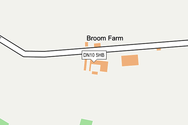
DN10 5HB is located in the Ranskill electoral ward, within the local authority district of Bassetlaw and the English Parliamentary constituency of Bassetlaw. The Sub Integrated Care Board (ICB) Location is NHS Nottingham and Nottinghamshire ICB - 02Q and the police force is Nottinghamshire. This postcode has been in use since January 1980.


GetTheData
Source: OS OpenMap – Local (Ordnance Survey)
Source: OS VectorMap District (Ordnance Survey)
Licence: Open Government Licence (requires attribution)
| Easting | 467140 |
| Northing | 389730 |
| Latitude | 53.400135 |
| Longitude | -0.991678 |
GetTheData
Source: Open Postcode Geo
Licence: Open Government Licence
| Country | England |
| Postcode District | DN10 |
| ➜ DN10 open data dashboard ➜ See where DN10 is on a map | |
GetTheData
Source: Land Registry Price Paid Data
Licence: Open Government Licence
Elevation or altitude of DN10 5HB as distance above sea level:
| Metres | Feet | |
|---|---|---|
| Elevation | 10m | 33ft |
Elevation is measured from the approximate centre of the postcode, to the nearest point on an OS contour line from OS Terrain 50, which has contour spacing of ten vertical metres.
➜ How high above sea level am I? Find the elevation of your current position using your device's GPS.
GetTheData
Source: Open Postcode Elevation
Licence: Open Government Licence
| Ward | Ranskill |
| Constituency | Bassetlaw |
GetTheData
Source: ONS Postcode Database
Licence: Open Government Licence
| Keyes Rise | Mattersey Thorpe | 834m |
| Wavell Crescent (Bader Rise) | Mattersey Thorpe | 1,026m |
| Demand Responsive Area (Phoneabus) | Mattersey Thorpe | 1,028m |
| Breck Lane | Mattersey Thorpe | 1,178m |
| Breck Lane | Mattersey Thorpe | 1,178m |
GetTheData
Source: NaPTAN
Licence: Open Government Licence
| Percentage of properties with Next Generation Access | 100.0% |
| Percentage of properties with Superfast Broadband | 50.0% |
| Percentage of properties with Ultrafast Broadband | 0.0% |
| Percentage of properties with Full Fibre Broadband | 0.0% |
Superfast Broadband is between 30Mbps and 300Mbps
Ultrafast Broadband is > 300Mbps
| Percentage of properties unable to receive 2Mbps | 0.0% |
| Percentage of properties unable to receive 5Mbps | 0.0% |
| Percentage of properties unable to receive 10Mbps | 0.0% |
| Percentage of properties unable to receive 30Mbps | 50.0% |
GetTheData
Source: Ofcom
Licence: Ofcom Terms of Use (requires attribution)
GetTheData
Source: ONS Postcode Database
Licence: Open Government Licence


➜ Get more ratings from the Food Standards Agency
GetTheData
Source: Food Standards Agency
Licence: FSA terms & conditions
| Last Collection | |||
|---|---|---|---|
| Location | Mon-Fri | Sat | Distance |
| Arundle Drive | 17:30 | 11:30 | 1,873m |
| Mattersey P.o. | 17:15 | 11:00 | 1,874m |
| Scrooby Top | 17:00 | 08:15 | 1,922m |
GetTheData
Source: Dracos
Licence: Creative Commons Attribution-ShareAlike
| Facility | Distance |
|---|---|
| Old School Ground Winston Green, Mattersey Thorpe, Doncaster Grass Pitches | 925m |
| Mattersey Primary School Thorpe Road, Mattersey, Doncaster Grass Pitches | 1.7km |
| Ranskill Primary School Cherry Tree Walk, Ranskill, Retford Grass Pitches | 1.9km |
GetTheData
Source: Active Places
Licence: Open Government Licence
| School | Phase of Education | Distance |
|---|---|---|
| Mattersey Primary School Thorpe Road, Mattersey, Doncaster, DN10 5ED | Primary | 1.7km |
| Ranskill Primary School Cherry Tree Walk, Ranskill, Retford, DN22 8LH | Primary | 2km |
| Everton Primary School Chapel Lane, Everton, Doncaster, DN10 5BJ | Primary | 2.4km |
GetTheData
Source: Edubase
Licence: Open Government Licence
The below table lists the International Territorial Level (ITL) codes (formerly Nomenclature of Territorial Units for Statistics (NUTS) codes) and Local Administrative Units (LAU) codes for DN10 5HB:
| ITL 1 Code | Name |
|---|---|
| TLF | East Midlands (England) |
| ITL 2 Code | Name |
| TLF1 | Derbyshire and Nottinghamshire |
| ITL 3 Code | Name |
| TLF15 | North Nottinghamshire |
| LAU 1 Code | Name |
| E07000171 | Bassetlaw |
GetTheData
Source: ONS Postcode Directory
Licence: Open Government Licence
The below table lists the Census Output Area (OA), Lower Layer Super Output Area (LSOA), and Middle Layer Super Output Area (MSOA) for DN10 5HB:
| Code | Name | |
|---|---|---|
| OA | E00142836 | |
| LSOA | E01028034 | Bassetlaw 003B |
| MSOA | E02005837 | Bassetlaw 003 |
GetTheData
Source: ONS Postcode Directory
Licence: Open Government Licence
| DN10 5EJ | Broomfield Lane | 795m |
| DN10 5EL | Keyes Rise | 819m |
| DN10 5EX | Plantation Drive | 867m |
| DN10 5EP | Winston Green | 908m |
| DN10 5EN | Cunningham Close | 915m |
| DN10 5EH | Broomfield Lane | 955m |
| DN10 5JD | Bader Close | 985m |
| DN10 5JA | Bader Rise | 992m |
| DN10 5EZ | Wavell Crescent | 1075m |
| DN10 5JB | Bader View | 1083m |
GetTheData
Source: Open Postcode Geo; Land Registry Price Paid Data
Licence: Open Government Licence