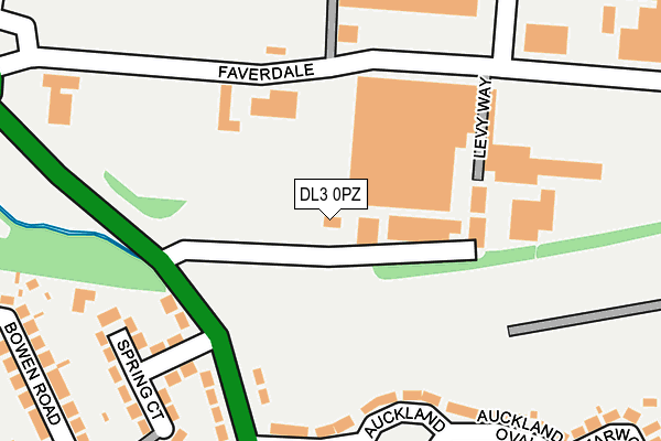
DL3 0PZ is located in the Brinkburn & Faverdale electoral ward, within the unitary authority of Darlington and the English Parliamentary constituency of Darlington. The Sub Integrated Care Board (ICB) Location is NHS North East and North Cumbria ICB - 16C and the police force is Durham. This postcode has been in use since January 1980.


GetTheData
Source: OS OpenMap – Local (Ordnance Survey)
Source: OS VectorMap District (Ordnance Survey)
Licence: Open Government Licence (requires attribution)
| Easting | 427376 |
| Northing | 516486 |
| Latitude | 54.542911 |
| Longitude | -1.578370 |
GetTheData
Source: Open Postcode Geo
Licence: Open Government Licence
| Country | England |
| Postcode District | DL3 |
| ➜ DL3 open data dashboard ➜ See where DL3 is on a map ➜ Where is Darlington? | |
GetTheData
Source: Land Registry Price Paid Data
Licence: Open Government Licence
Elevation or altitude of DL3 0PZ as distance above sea level:
| Metres | Feet | |
|---|---|---|
| Elevation | 60m | 197ft |
Elevation is measured from the approximate centre of the postcode, to the nearest point on an OS contour line from OS Terrain 50, which has contour spacing of ten vertical metres.
➜ How high above sea level am I? Find the elevation of your current position using your device's GPS.
GetTheData
Source: Open Postcode Elevation
Licence: Open Government Licence
| Ward | Brinkburn & Faverdale |
| Constituency | Darlington |
GetTheData
Source: ONS Postcode Database
Licence: Open Government Licence
| December 2023 | Violence and sexual offences | On or near Amiens Close | 326m |
| September 2023 | Vehicle crime | On or near Timothy Hackworth Drive | 312m |
| September 2023 | Vehicle crime | On or near Timothy Hackworth Drive | 312m |
| ➜ Get more crime data in our Crime section | |||
GetTheData
Source: data.police.uk
Licence: Open Government Licence
| Faverdale Road (Faverdale) | Faverdale | 31m |
| Faverdale Road (Faverdale) | Faverdale | 49m |
| Beck House (West Auckland Road) | Faverdale | 95m |
| Westgate Crescent (West Auckland Road) | Faverdale | 146m |
| Beck House (West Auckland Road) | Faverdale | 154m |
| North Road Station | 1.7km |
| Darlington Station | 3.2km |
GetTheData
Source: NaPTAN
Licence: Open Government Licence
GetTheData
Source: ONS Postcode Database
Licence: Open Government Licence


➜ Get more ratings from the Food Standards Agency
GetTheData
Source: Food Standards Agency
Licence: FSA terms & conditions
| Last Collection | |||
|---|---|---|---|
| Location | Mon-Fri | Sat | Distance |
| Westgate Crescent | 17:00 | 10:45 | 83m |
| Faverdale Industrial Estate | 19:00 | 134m | |
| Faverdale P.o. Sandriggs | 17:30 | 11:00 | 375m |
GetTheData
Source: Dracos
Licence: Creative Commons Attribution-ShareAlike
| Facility | Distance |
|---|---|
| Keep Fit Darlington Faverdale North, Darlington Health and Fitness Gym, Studio | 529m |
| West Park Academy Alderman Leach Drive, Darlington Sports Hall, Grass Pitches | 659m |
| Darlington Railway Athletic Sports And Social Club Brinkburn Road, Darlington Grass Pitches, Sports Hall | 807m |
GetTheData
Source: Active Places
Licence: Open Government Licence
| School | Phase of Education | Distance |
|---|---|---|
| West Park Academy Alderman Leach Drive, Darlington, DL2 2GF | Primary | 658m |
| Holy Family Catholic Primary School Prior Street, Darlington, DL3 9EN | Primary | 826m |
| St Mary's Cockerton Church of England Primary School Newton Lane, Cockerton, Darlington, DL3 9EX | Primary | 968m |
GetTheData
Source: Edubase
Licence: Open Government Licence
The below table lists the International Territorial Level (ITL) codes (formerly Nomenclature of Territorial Units for Statistics (NUTS) codes) and Local Administrative Units (LAU) codes for DL3 0PZ:
| ITL 1 Code | Name |
|---|---|
| TLC | North East (England) |
| ITL 2 Code | Name |
| TLC1 | Tees Valley and Durham |
| ITL 3 Code | Name |
| TLC13 | Darlington |
| LAU 1 Code | Name |
| E06000005 | Darlington |
GetTheData
Source: ONS Postcode Directory
Licence: Open Government Licence
The below table lists the Census Output Area (OA), Lower Layer Super Output Area (LSOA), and Middle Layer Super Output Area (MSOA) for DL3 0PZ:
| Code | Name | |
|---|---|---|
| OA | E00174209 | |
| LSOA | E01033482 | Darlington 001F |
| MSOA | E02002559 | Darlington 001 |
GetTheData
Source: ONS Postcode Directory
Licence: Open Government Licence
| DL3 0ST | West Auckland Road | 132m |
| DL2 2GJ | Locomotion Lane | 151m |
| DL2 2GB | Swinbridge | 180m |
| DL3 0TA | Faverdale Road | 182m |
| DL3 0SU | West Auckland Road | 203m |
| DL3 0SX | Westgate Crescent | 203m |
| DL2 2GD | Paradise Way | 205m |
| DL2 2GA | Rainhill Way | 227m |
| DL2 2GH | Sans Pareil Square | 228m |
| DL3 0SY | Westgate Crescent | 228m |
GetTheData
Source: Open Postcode Geo; Land Registry Price Paid Data
Licence: Open Government Licence