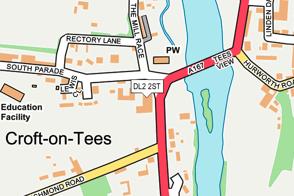
DL2 2ST is in Croft On Tees, Darlington. DL2 2ST is located in the North Richmondshire electoral ward, within the unitary authority of North Yorkshire and the English Parliamentary constituency of Richmond (Yorks). The Sub Integrated Care Board (ICB) Location is NHS Humber and North Yorkshire ICB - 42D and the police force is North Yorkshire. This postcode has been in use since January 1980.


GetTheData
Source: OS OpenMap – Local (Ordnance Survey)
Source: OS VectorMap District (Ordnance Survey)
Licence: Open Government Licence (requires attribution)
| Easting | 428853 |
| Northing | 509768 |
| Latitude | 54.482446 |
| Longitude | -1.556186 |
GetTheData
Source: Open Postcode Geo
Licence: Open Government Licence
| Locality | Croft On Tees |
| Town/City | Darlington |
| Country | England |
| Postcode District | DL2 |
➜ See where DL2 is on a map ➜ Where is Croft-on-Tees? | |
GetTheData
Source: Land Registry Price Paid Data
Licence: Open Government Licence
Elevation or altitude of DL2 2ST as distance above sea level:
| Metres | Feet | |
|---|---|---|
| Elevation | 30m | 98ft |
Elevation is measured from the approximate centre of the postcode, to the nearest point on an OS contour line from OS Terrain 50, which has contour spacing of ten vertical metres.
➜ How high above sea level am I? Find the elevation of your current position using your device's GPS.
GetTheData
Source: Open Postcode Elevation
Licence: Open Government Licence
| Ward | North Richmondshire |
| Constituency | Richmond (Yorks) |
GetTheData
Source: ONS Postcode Database
Licence: Open Government Licence
| Croft Spa (A167) | Croft-on-tees | 40m |
| Croft Spa (A167) | Croft-on-tees | 67m |
| The Comet (Tees View) | Hurworth Place | 212m |
| The Comet (Tees View) | Hurworth Place | 218m |
| Oxford Garage (Hurworth Road) | Hurworth Place | 503m |
| Darlington Station | 4.3km |
GetTheData
Source: NaPTAN
Licence: Open Government Licence
GetTheData
Source: ONS Postcode Database
Licence: Open Government Licence


➜ Get more ratings from the Food Standards Agency
GetTheData
Source: Food Standards Agency
Licence: FSA terms & conditions
| Last Collection | |||
|---|---|---|---|
| Location | Mon-Fri | Sat | Distance |
| Skerne Park P.o | 17:30 | 11:30 | 3,162m |
| Blackwell Hill | 17:30 | 11:30 | 3,296m |
| Geneva Drive | 17:30 | 11:00 | 3,407m |
GetTheData
Source: Dracos
Licence: Creative Commons Attribution-ShareAlike
| Risk of DL2 2ST flooding from rivers and sea | Medium |
| ➜ DL2 2ST flood map | |
GetTheData
Source: Open Flood Risk by Postcode
Licence: Open Government Licence
The below table lists the International Territorial Level (ITL) codes (formerly Nomenclature of Territorial Units for Statistics (NUTS) codes) and Local Administrative Units (LAU) codes for DL2 2ST:
| ITL 1 Code | Name |
|---|---|
| TLE | Yorkshire and The Humber |
| ITL 2 Code | Name |
| TLE2 | North Yorkshire |
| ITL 3 Code | Name |
| TLE22 | North Yorkshire CC |
| LAU 1 Code | Name |
| E07000166 | Richmondshire |
GetTheData
Source: ONS Postcode Directory
Licence: Open Government Licence
The below table lists the Census Output Area (OA), Lower Layer Super Output Area (LSOA), and Middle Layer Super Output Area (MSOA) for DL2 2ST:
| Code | Name | |
|---|---|---|
| OA | E00141325 | |
| LSOA | E01027751 | Richmondshire 001B |
| MSOA | E02005782 | Richmondshire 001 |
GetTheData
Source: ONS Postcode Directory
Licence: Open Government Licence
| DL2 2SU | Spa Courtyard | 49m |
| DL2 2SF | 106m | |
| DL2 2SG | Rectory Cottages | 107m |
| DL2 2SS | Carroll Place | 124m |
| DL2 2SR | South Parade | 137m |
| DL2 2SQ | Monkend Terrace | 140m |
| DL2 2TN | The Mill Race | 189m |
| DL2 2TD | The Terrace | 199m |
| DL2 2SX | Dalton Road | 202m |
| DL2 2SJ | 227m |
GetTheData
Source: Open Postcode Geo; Land Registry Price Paid Data
Licence: Open Government Licence