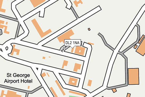
DL2 1NA is located in the Sadberge & Middleton St George electoral ward, within the unitary authority of Darlington and the English Parliamentary constituency of Sedgefield. The Sub Integrated Care Board (ICB) Location is NHS North East and North Cumbria ICB - 16C and the police force is Durham. This postcode has been in use since January 2009.


GetTheData
Source: OS OpenMap – Local (Ordnance Survey)
Source: OS VectorMap District (Ordnance Survey)
Licence: Open Government Licence (requires attribution)
| Easting | 436903 |
| Northing | 513530 |
| Latitude | 54.515745 |
| Longitude | -1.431488 |
GetTheData
Source: Open Postcode Geo
Licence: Open Government Licence
| Country | England |
| Postcode District | DL2 |
| ➜ DL2 open data dashboard ➜ See where DL2 is on a map ➜ Where is Middleton St George? | |
GetTheData
Source: Land Registry Price Paid Data
Licence: Open Government Licence
Elevation or altitude of DL2 1NA as distance above sea level:
| Metres | Feet | |
|---|---|---|
| Elevation | 40m | 131ft |
Elevation is measured from the approximate centre of the postcode, to the nearest point on an OS contour line from OS Terrain 50, which has contour spacing of ten vertical metres.
➜ How high above sea level am I? Find the elevation of your current position using your device's GPS.
GetTheData
Source: Open Postcode Elevation
Licence: Open Government Licence
| Ward | Sadberge & Middleton St George |
| Constituency | Sedgefield |
GetTheData
Source: ONS Postcode Database
Licence: Open Government Licence
| June 2022 | Vehicle crime | On or near Aviation Way | 60m |
| June 2022 | Drugs | On or near Aviation Way | 60m |
| June 2022 | Criminal damage and arson | On or near Aviation Way | 60m |
| ➜ Get more crime data in our Crime section | |||
GetTheData
Source: data.police.uk
Licence: Open Government Licence
| Middleton St George Hospital (Airport) | Durham Tees Valley Airport | 271m |
| Middleton St George Hospital (Airport) | Durham Tees Valley Airport | 279m |
| Oak Tree Inn (Yarm Road) | Oak Tree | 768m |
| Virginia Estate East End (Yarm Road) | Oak Tree | 1,048m |
| Virginia Estate (Yarm Road) | Oak Tree | 1,159m |
| Tees-side Airport Station | 0.5km |
| Dinsdale Station | 2.3km |
| Allens West Station | 4.7km |
GetTheData
Source: NaPTAN
Licence: Open Government Licence
GetTheData
Source: ONS Postcode Database
Licence: Open Government Licence


➜ Get more ratings from the Food Standards Agency
GetTheData
Source: Food Standards Agency
Licence: FSA terms & conditions
| Last Collection | |||
|---|---|---|---|
| Location | Mon-Fri | Sat | Distance |
| Oak Tree, Msg | 16:30 | 09:30 | 1,226m |
| Brass Castle, Msg | 16:30 | 07:30 | 3,235m |
| Grassholme Way | 16:45 | 09:45 | 4,444m |
GetTheData
Source: Dracos
Licence: Creative Commons Attribution-ShareAlike
| Facility | Distance |
|---|---|
| Airport Playing Fields Teesside Airport Road, Teesside Airport Road, Middleton St George Grass Pitches | 382m |
| Saint George Playing Field Woodlands Green, Middleton St. George, Darlington Grass Pitches | 2.3km |
| Middleton St George Cricket Club Middleton St. George, Darlington Grass Pitches | 2.5km |
GetTheData
Source: Active Places
Licence: Open Government Licence
| School | Phase of Education | Distance |
|---|---|---|
| St. George's Church of England Academy Neasham Road, Middleton St George, Darlington, DL2 1LD | Primary | 2.5km |
| St Mary's Church of England Primary School The Green, Long Newton, Stockton-on-Tees, TS21 1DL | Primary | 3.2km |
| Durham Lane Primary School Amberley Way, Eaglescliffe, Stockton-on-Tees, TS16 0NG | Primary | 4.6km |
GetTheData
Source: Edubase
Licence: Open Government Licence
The below table lists the International Territorial Level (ITL) codes (formerly Nomenclature of Territorial Units for Statistics (NUTS) codes) and Local Administrative Units (LAU) codes for DL2 1NA:
| ITL 1 Code | Name |
|---|---|
| TLC | North East (England) |
| ITL 2 Code | Name |
| TLC1 | Tees Valley and Durham |
| ITL 3 Code | Name |
| TLC13 | Darlington |
| LAU 1 Code | Name |
| E06000005 | Darlington |
GetTheData
Source: ONS Postcode Directory
Licence: Open Government Licence
The below table lists the Census Output Area (OA), Lower Layer Super Output Area (LSOA), and Middle Layer Super Output Area (MSOA) for DL2 1NA:
| Code | Name | |
|---|---|---|
| OA | E00062264 | |
| LSOA | E01012345 | Darlington 015D |
| MSOA | E02002573 | Darlington 015 |
GetTheData
Source: ONS Postcode Directory
Licence: Open Government Licence
| DL2 1PD | 109m | |
| DL2 1TS | 188m | |
| DL2 1HW | Yarm Road | 326m |
| DL2 1UZ | Ashdale Close | 642m |
| DL2 1HL | The Crescent | 709m |
| DL2 1HJ | Oaktree Close | 714m |
| DL2 1RF | The Oaks | 788m |
| DL2 1HH | Yarm Road | 800m |
| DL2 1HG | Alexandria Drive | 1083m |
| DL2 1HE | Washington Avenue | 1101m |
GetTheData
Source: Open Postcode Geo; Land Registry Price Paid Data
Licence: Open Government Licence