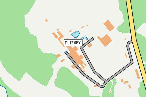
DL17 9EY is located in the Bishop Middleham and Cornforth electoral ward, within the unitary authority of County Durham and the English Parliamentary constituency of Sedgefield. The Sub Integrated Care Board (ICB) Location is NHS North East and North Cumbria ICB - 84H and the police force is Durham. This postcode has been in use since November 2007.


GetTheData
Source: OS OpenMap – Local (Ordnance Survey)
Source: OS VectorMap District (Ordnance Survey)
Licence: Open Government Licence (requires attribution)
| Easting | 430601 |
| Northing | 532734 |
| Latitude | 54.688727 |
| Longitude | -1.526824 |
GetTheData
Source: Open Postcode Geo
Licence: Open Government Licence
| Country | England |
| Postcode District | DL17 |
| ➜ DL17 open data dashboard ➜ See where DL17 is on a map | |
GetTheData
Source: Land Registry Price Paid Data
Licence: Open Government Licence
Elevation or altitude of DL17 9EY as distance above sea level:
| Metres | Feet | |
|---|---|---|
| Elevation | 120m | 394ft |
Elevation is measured from the approximate centre of the postcode, to the nearest point on an OS contour line from OS Terrain 50, which has contour spacing of ten vertical metres.
➜ How high above sea level am I? Find the elevation of your current position using your device's GPS.
GetTheData
Source: Open Postcode Elevation
Licence: Open Government Licence
| Ward | Bishop Middleham And Cornforth |
| Constituency | Sedgefield |
GetTheData
Source: ONS Postcode Database
Licence: Open Government Licence
| June 2022 | Vehicle crime | On or near Pedestrian Subway | 282m |
| May 2022 | Burglary | On or near Pedestrian Subway | 282m |
| April 2022 | Violence and sexual offences | On or near Pedestrian Subway | 282m |
| ➜ Get more crime data in our Crime section | |||
GetTheData
Source: data.police.uk
Licence: Open Government Licence
| Thrislington Quarry (Unclassified Road Adjacent To Thrislington Works) | Mainsforth | 246m |
| Thrislington Quarry (Unclassified Road) | Mainsforth | 257m |
| Duncombe Estate (Cleves Avenue) | Ferryhill | 658m |
| Duncombe Estate (Cleves Avenue) | Ferryhill | 672m |
| Cleves Cross School (Unclassified Road) | Ferryhill | 744m |
GetTheData
Source: NaPTAN
Licence: Open Government Licence
GetTheData
Source: ONS Postcode Database
Licence: Open Government Licence


➜ Get more ratings from the Food Standards Agency
GetTheData
Source: Food Standards Agency
Licence: FSA terms & conditions
| Last Collection | |||
|---|---|---|---|
| Location | Mon-Fri | Sat | Distance |
| Morrison Terrace | 16:45 | 10:30 | 917m |
| Linden Road | 16:45 | 10:45 | 1,117m |
| Broomside | 16:45 | 10:45 | 1,339m |
GetTheData
Source: Dracos
Licence: Creative Commons Attribution-ShareAlike
| Facility | Distance |
|---|---|
| Mainsforth Sports Complex Morrison Terrace, Mainsforth, Ferryhill Grass Pitches | 1km |
| Ferryhill Sports & Education Centre Lambton Road, Ferryhill Sports Hall, Indoor Bowls, Health and Fitness Gym, Studio | 1.1km |
| Broom Cottages Primary And Nursery School Broom Road, Ferryhill Grass Pitches, Swimming Pool | 1.2km |
GetTheData
Source: Active Places
Licence: Open Government Licence
| School | Phase of Education | Distance |
|---|---|---|
| Cleves Cross Primary and Nursery School Academy Cleves Cross, Ferryhill, DL17 8QY | Primary | 828m |
| The Woodlands Broom Road, Ferryhill, DL17 8AN | Not applicable | 1.3km |
| Broom Cottages Primary & Nursery School Broom Road, Ferryhill, DL17 8AN | Primary | 1.3km |
GetTheData
Source: Edubase
Licence: Open Government Licence
The below table lists the International Territorial Level (ITL) codes (formerly Nomenclature of Territorial Units for Statistics (NUTS) codes) and Local Administrative Units (LAU) codes for DL17 9EY:
| ITL 1 Code | Name |
|---|---|
| TLC | North East (England) |
| ITL 2 Code | Name |
| TLC1 | Tees Valley and Durham |
| ITL 3 Code | Name |
| TLC14 | Durham |
| LAU 1 Code | Name |
| E06000047 | County Durham |
GetTheData
Source: ONS Postcode Directory
Licence: Open Government Licence
The below table lists the Census Output Area (OA), Lower Layer Super Output Area (LSOA), and Middle Layer Super Output Area (MSOA) for DL17 9EY:
| Code | Name | |
|---|---|---|
| OA | E00105537 | |
| LSOA | E01020797 | County Durham 050A |
| MSOA | E02004336 | County Durham 050 |
GetTheData
Source: ONS Postcode Directory
Licence: Open Government Licence
| DL17 8BN | Cleves Avenue | 661m |
| DL17 8BL | Cleves Cottages | 668m |
| DL17 8DD | Widecombe Walk | 704m |
| DL17 8BW | Duncombe Terrace | 705m |
| DL17 8DF | Richmond Close | 727m |
| DL17 8BJ | Grey Terrace | 730m |
| DL17 8SX | Belsay Close | 739m |
| DL17 8DB | Corscombe Close | 757m |
| DL17 8SS | Helmsley Close | 774m |
| DL17 8SZ | Morpeth Close | 782m |
GetTheData
Source: Open Postcode Geo; Land Registry Price Paid Data
Licence: Open Government Licence