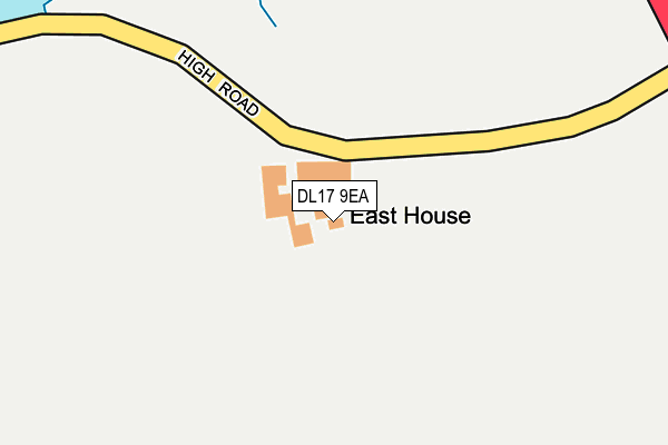
DL17 9EA is located in the Bishop Middleham and Cornforth electoral ward, within the unitary authority of County Durham and the English Parliamentary constituency of Sedgefield. The Sub Integrated Care Board (ICB) Location is NHS North East and North Cumbria ICB - 84H and the police force is Durham. This postcode has been in use since January 1980.


GetTheData
Source: OS OpenMap – Local (Ordnance Survey)
Source: OS VectorMap District (Ordnance Survey)
Licence: Open Government Licence (requires attribution)
| Easting | 434244 |
| Northing | 531501 |
| Latitude | 54.677414 |
| Longitude | -1.470458 |
GetTheData
Source: Open Postcode Geo
Licence: Open Government Licence
| Country | England |
| Postcode District | DL17 |
| ➜ DL17 open data dashboard ➜ See where DL17 is on a map | |
GetTheData
Source: Land Registry Price Paid Data
Licence: Open Government Licence
Elevation or altitude of DL17 9EA as distance above sea level:
| Metres | Feet | |
|---|---|---|
| Elevation | 90m | 295ft |
Elevation is measured from the approximate centre of the postcode, to the nearest point on an OS contour line from OS Terrain 50, which has contour spacing of ten vertical metres.
➜ How high above sea level am I? Find the elevation of your current position using your device's GPS.
GetTheData
Source: Open Postcode Elevation
Licence: Open Government Licence
| Ward | Bishop Middleham And Cornforth |
| Constituency | Sedgefield |
GetTheData
Source: ONS Postcode Database
Licence: Open Government Licence
| Road End (Unclassified Road) | Fishburn | 405m |
| Road End (Unclassified Road) | Fishburn | 406m |
| Stonybeck Lane | Bishop Middleham | 784m |
| The Green (Perm Ter) | Bishop Middleham | 991m |
| Stoneybeck (High Road) | Bishop Middleham | 994m |
GetTheData
Source: NaPTAN
Licence: Open Government Licence
GetTheData
Source: ONS Postcode Database
Licence: Open Government Licence


➜ Get more ratings from the Food Standards Agency
GetTheData
Source: Food Standards Agency
Licence: FSA terms & conditions
| Last Collection | |||
|---|---|---|---|
| Location | Mon-Fri | Sat | Distance |
| Bishop Middleham | 16:15 | 10:30 | 1,214m |
| South East Lodge, Sedgefield | 17:00 | 10:00 | 1,858m |
| Post Office, Front Street | 17:00 | 12:00 | 2,154m |
GetTheData
Source: Dracos
Licence: Creative Commons Attribution-ShareAlike
| Facility | Distance |
|---|---|
| Bishop Middleham Leisure Park The Park, Bishop Middleham Grass Pitches | 1.3km |
| Knotty Hill Golf Centre Sedgefield, Stockton-on-tees Golf, Health and Fitness Gym | 1.4km |
| Triple X Gym & Fitness Butterwick Road, Fishburn, Stockton-on-tees Health and Fitness Gym | 2.3km |
GetTheData
Source: Active Places
Licence: Open Government Licence
| School | Phase of Education | Distance |
|---|---|---|
| St Michael's Church of England Primary School Front Street, Bishop Middleham, Ferryhill, DL17 9AL | Primary | 1.2km |
| Fishburn Primary School East View, Fishburn, Stockton-on-Tees, TS21 4AU | Primary | 2.4km |
| Sedgefield Hardwick Primary Academy Hawthorn Road, Sedgefield, Stockton-on-Tees, TS21 3DA | Primary | 2.5km |
GetTheData
Source: Edubase
Licence: Open Government Licence
The below table lists the International Territorial Level (ITL) codes (formerly Nomenclature of Territorial Units for Statistics (NUTS) codes) and Local Administrative Units (LAU) codes for DL17 9EA:
| ITL 1 Code | Name |
|---|---|
| TLC | North East (England) |
| ITL 2 Code | Name |
| TLC1 | Tees Valley and Durham |
| ITL 3 Code | Name |
| TLC14 | Durham |
| LAU 1 Code | Name |
| E06000047 | County Durham |
GetTheData
Source: ONS Postcode Directory
Licence: Open Government Licence
The below table lists the Census Output Area (OA), Lower Layer Super Output Area (LSOA), and Middle Layer Super Output Area (MSOA) for DL17 9EA:
| Code | Name | |
|---|---|---|
| OA | E00105526 | |
| LSOA | E01020796 | County Durham 054A |
| MSOA | E02004339 | County Durham 054 |
GetTheData
Source: ONS Postcode Directory
Licence: Open Government Licence
| DL17 9DZ | 537m | |
| DL17 9BD | North View | 906m |
| DL17 9BA | South View | 929m |
| DL17 9BE | The Green | 949m |
| DL17 9AZ | West View | 979m |
| DL17 9AY | Insula Cottages | 998m |
| DL17 9AS | Perm Terrace | 1019m |
| DL17 9BG | High Road Avenue | 1034m |
| DL17 9DA | Bishops Court | 1046m |
| DL17 9BB | High Road | 1047m |
GetTheData
Source: Open Postcode Geo; Land Registry Price Paid Data
Licence: Open Government Licence