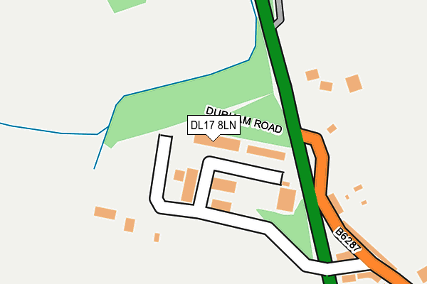
DL17 8LN is located in the Ferryhill electoral ward, within the unitary authority of County Durham and the English Parliamentary constituency of Sedgefield. The Sub Integrated Care Board (ICB) Location is NHS North East and North Cumbria ICB - 84H and the police force is Durham. This postcode has been in use since April 1987.


GetTheData
Source: OS OpenMap – Local (Ordnance Survey)
Source: OS VectorMap District (Ordnance Survey)
Licence: Open Government Licence (requires attribution)
| Easting | 428334 |
| Northing | 533030 |
| Latitude | 54.691520 |
| Longitude | -1.561960 |
GetTheData
Source: Open Postcode Geo
Licence: Open Government Licence
| Country | England |
| Postcode District | DL17 |
| ➜ DL17 open data dashboard ➜ See where DL17 is on a map ➜ Where is Ferryhill? | |
GetTheData
Source: Land Registry Price Paid Data
Licence: Open Government Licence
Elevation or altitude of DL17 8LN as distance above sea level:
| Metres | Feet | |
|---|---|---|
| Elevation | 130m | 427ft |
Elevation is measured from the approximate centre of the postcode, to the nearest point on an OS contour line from OS Terrain 50, which has contour spacing of ten vertical metres.
➜ How high above sea level am I? Find the elevation of your current position using your device's GPS.
GetTheData
Source: Open Postcode Elevation
Licence: Open Government Licence
| Ward | Ferryhill |
| Constituency | Sedgefield |
GetTheData
Source: ONS Postcode Database
Licence: Open Government Licence
| June 2022 | Drugs | On or near A167 | 116m |
| June 2022 | Drugs | On or near A167 | 116m |
| June 2022 | Other crime | On or near Saddler Street | 260m |
| ➜ Get more crime data in our Crime section | |||
GetTheData
Source: data.police.uk
Licence: Open Government Licence
| Durham Road | Ferryhill | 180m |
| Durham Road | Ferryhill | 256m |
| Dean Bank Youth Club (Merrington Road) | Ferryhill | 413m |
| Dean Bank Youth Club (Merrington Road) | Ferryhill | 431m |
| Dean Bank Newcomen Street (Merrington Road) | Ferryhill | 441m |
GetTheData
Source: NaPTAN
Licence: Open Government Licence
Estimated total energy consumption in DL17 8LN by fuel type, 2015.
| Consumption (kWh) | 23,068 |
|---|---|
| Meter count | 7 |
| Mean (kWh/meter) | 3,295 |
| Median (kWh/meter) | 1,012 |
GetTheData
Source: Postcode level gas estimates: 2015 (experimental)
Source: Postcode level electricity estimates: 2015 (experimental)
Licence: Open Government Licence
GetTheData
Source: ONS Postcode Database
Licence: Open Government Licence

➜ Get more ratings from the Food Standards Agency
GetTheData
Source: Food Standards Agency
Licence: FSA terms & conditions
| Last Collection | |||
|---|---|---|---|
| Location | Mon-Fri | Sat | Distance |
| Dental Practice, Durham Road | 17:30 | 11:00 | 342m |
| West End | 18:30 | 11:00 | 440m |
| Kelvin Street | 17:30 | 11:00 | 524m |
GetTheData
Source: Dracos
Licence: Creative Commons Attribution-ShareAlike
| Facility | Distance |
|---|---|
| Allsports Fitness Centre (Closed) Main Street, Ferryhill Health and Fitness Gym | 419m |
| Dean Bank Recreation Ground Hackworth Close, Ferryhill Grass Pitches | 732m |
| King George V Playing Field (Ferryhill) Greenfields, Ferryhill Grass Pitches | 1km |
GetTheData
Source: Active Places
Licence: Open Government Licence
| School | Phase of Education | Distance |
|---|---|---|
| Dean Bank Primary and Nursery School Dean Bank, Ferryhill, DL17 8PP | Primary | 441m |
| The Woodlands Broom Road, Ferryhill, DL17 8AN | Not applicable | 1.1km |
| Broom Cottages Primary & Nursery School Broom Road, Ferryhill, DL17 8AN | Primary | 1.1km |
GetTheData
Source: Edubase
Licence: Open Government Licence
The below table lists the International Territorial Level (ITL) codes (formerly Nomenclature of Territorial Units for Statistics (NUTS) codes) and Local Administrative Units (LAU) codes for DL17 8LN:
| ITL 1 Code | Name |
|---|---|
| TLC | North East (England) |
| ITL 2 Code | Name |
| TLC1 | Tees Valley and Durham |
| ITL 3 Code | Name |
| TLC14 | Durham |
| LAU 1 Code | Name |
| E06000047 | County Durham |
GetTheData
Source: ONS Postcode Directory
Licence: Open Government Licence
The below table lists the Census Output Area (OA), Lower Layer Super Output Area (LSOA), and Middle Layer Super Output Area (MSOA) for DL17 8LN:
| Code | Name | |
|---|---|---|
| OA | E00105596 | |
| LSOA | E01020806 | County Durham 049A |
| MSOA | E02004335 | County Durham 049 |
GetTheData
Source: ONS Postcode Directory
Licence: Open Government Licence
| DL17 8LH | Dean & Chapter Industrial Estate | 87m |
| DL17 8RS | 180m | |
| DL17 8LD | Durham Road | 260m |
| DL17 8LE | Saddler Street | 279m |
| DL17 8PN | Davy Street | 314m |
| DL17 8LG | Durham Road | 352m |
| DL17 8PW | Newton Street | 358m |
| DL17 8PJ | Watt Street | 380m |
| DL17 8PL | Newcomen Street | 396m |
| DL17 8LA | Main Street | 401m |
GetTheData
Source: Open Postcode Geo; Land Registry Price Paid Data
Licence: Open Government Licence