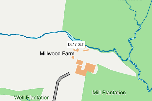
DL17 0LT is located in the Chilton electoral ward, within the unitary authority of County Durham and the English Parliamentary constituency of Sedgefield. The Sub Integrated Care Board (ICB) Location is NHS North East and North Cumbria ICB - 84H and the police force is Durham. This postcode has been in use since January 1980.


GetTheData
Source: OS OpenMap – Local (Ordnance Survey)
Source: OS VectorMap District (Ordnance Survey)
Licence: Open Government Licence (requires attribution)
| Easting | 427562 |
| Northing | 529240 |
| Latitude | 54.657504 |
| Longitude | -1.574293 |
GetTheData
Source: Open Postcode Geo
Licence: Open Government Licence
| Country | England |
| Postcode District | DL17 |
| ➜ DL17 open data dashboard ➜ See where DL17 is on a map | |
GetTheData
Source: Land Registry Price Paid Data
Licence: Open Government Licence
Elevation or altitude of DL17 0LT as distance above sea level:
| Metres | Feet | |
|---|---|---|
| Elevation | 100m | 328ft |
Elevation is measured from the approximate centre of the postcode, to the nearest point on an OS contour line from OS Terrain 50, which has contour spacing of ten vertical metres.
➜ How high above sea level am I? Find the elevation of your current position using your device's GPS.
GetTheData
Source: Open Postcode Elevation
Licence: Open Government Licence
| Ward | Chilton |
| Constituency | Sedgefield |
GetTheData
Source: ONS Postcode Database
Licence: Open Government Licence
| Mill Cottage (A689) | Rushyford | 420m |
| Mill Cottage (A689) | Rushyford | 434m |
| Farm (A689) | Rushyford | 561m |
| Farm (A689) | Rushyford | 596m |
| Eden Arms - West (A689) | Rushyford | 750m |
| Newton Aycliffe Station | 5km |
| Shildon Station | 5.3km |
GetTheData
Source: NaPTAN
Licence: Open Government Licence
GetTheData
Source: ONS Postcode Database
Licence: Open Government Licence


➜ Get more ratings from the Food Standards Agency
GetTheData
Source: Food Standards Agency
Licence: FSA terms & conditions
| Last Collection | |||
|---|---|---|---|
| Location | Mon-Fri | Sat | Distance |
| Kirk Merrington | 17:15 | 09:00 | 2,618m |
| Dean Bank West | 17:30 | 11:00 | 2,976m |
| Kelvin Street | 17:30 | 11:00 | 3,346m |
GetTheData
Source: Dracos
Licence: Creative Commons Attribution-ShareAlike
| Facility | Distance |
|---|---|
| Windlestone School Road Leading To Windlestone School, Chilton Sports Hall, Health and Fitness Gym, Artificial Grass Pitch, Grass Pitches | 758m |
| Advantage Health Club (Rushyford) Rushyford, Ferryhill Swimming Pool, Health and Fitness Gym | 866m |
| Chilton Academy Chilton, Ferryhill Sports Hall, Grass Pitches, Squash Courts | 1.1km |
GetTheData
Source: Active Places
Licence: Open Government Licence
| School | Phase of Education | Distance |
|---|---|---|
| Chilton Academy Chilton, Off New South View, Ferryhill, DL17 0PT | Primary | 1.2km |
| Aycliffe Secure Centre Care of: Durham County Council, 26 Chilton Way, Chilton, Ferryhill, DL17 0SD | Not applicable | 1.4km |
| Kirk Merrington Primary School South View, Kirk Merrington, Spennymoor, DL16 7JB | Primary | 2.3km |
GetTheData
Source: Edubase
Licence: Open Government Licence
The below table lists the International Territorial Level (ITL) codes (formerly Nomenclature of Territorial Units for Statistics (NUTS) codes) and Local Administrative Units (LAU) codes for DL17 0LT:
| ITL 1 Code | Name |
|---|---|
| TLC | North East (England) |
| ITL 2 Code | Name |
| TLC1 | Tees Valley and Durham |
| ITL 3 Code | Name |
| TLC14 | Durham |
| LAU 1 Code | Name |
| E06000047 | County Durham |
GetTheData
Source: ONS Postcode Directory
Licence: Open Government Licence
The below table lists the Census Output Area (OA), Lower Layer Super Output Area (LSOA), and Middle Layer Super Output Area (MSOA) for DL17 0LT:
| Code | Name | |
|---|---|---|
| OA | E00105588 | |
| LSOA | E01020803 | County Durham 053B |
| MSOA | E02004338 | County Durham 053 |
GetTheData
Source: ONS Postcode Directory
Licence: Open Government Licence
| DL17 0LS | Mill Cottages | 362m |
| DL17 0ND | 576m | |
| DL17 0EQ | Rushyford Drive | 712m |
| DL17 0LW | School Cottages | 723m |
| DL17 0EB | Rushyford Drive | 744m |
| DL17 0EE | Paddock Close | 763m |
| DL17 0EL | Oak Crescent | 775m |
| DL17 0LP | 779m | |
| DL17 0LN | The Cottages | 795m |
| DL17 0RR | Millwood | 803m |
GetTheData
Source: Open Postcode Geo; Land Registry Price Paid Data
Licence: Open Government Licence