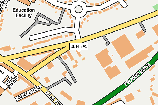
DL14 9AS is located in the Woodhouse Close electoral ward, within the unitary authority of County Durham and the English Parliamentary constituency of Bishop Auckland. The Sub Integrated Care Board (ICB) Location is NHS North East and North Cumbria ICB - 84H and the police force is Durham. This postcode has been in use since January 1980.


GetTheData
Source: OS OpenMap – Local (Ordnance Survey)
Source: OS VectorMap District (Ordnance Survey)
Licence: Open Government Licence (requires attribution)
| Easting | 420313 |
| Northing | 527439 |
| Latitude | 54.641661 |
| Longitude | -1.686778 |
GetTheData
Source: Open Postcode Geo
Licence: Open Government Licence
| Country | England |
| Postcode District | DL14 |
| ➜ DL14 open data dashboard ➜ See where DL14 is on a map ➜ Where is Bishop Auckland? | |
GetTheData
Source: Land Registry Price Paid Data
Licence: Open Government Licence
Elevation or altitude of DL14 9AS as distance above sea level:
| Metres | Feet | |
|---|---|---|
| Elevation | 100m | 328ft |
Elevation is measured from the approximate centre of the postcode, to the nearest point on an OS contour line from OS Terrain 50, which has contour spacing of ten vertical metres.
➜ How high above sea level am I? Find the elevation of your current position using your device's GPS.
GetTheData
Source: Open Postcode Elevation
Licence: Open Government Licence
| Ward | Woodhouse Close |
| Constituency | Bishop Auckland |
GetTheData
Source: ONS Postcode Database
Licence: Open Government Licence
| June 2022 | Other theft | On or near Fylands Drive | 230m |
| June 2022 | Other theft | On or near Dent Street | 247m |
| June 2022 | Other theft | On or near Dent Street | 247m |
| ➜ Get more crime data in our Crime section | |||
GetTheData
Source: data.police.uk
Licence: Open Government Licence
| Watling Road - Bakery (A688 Watling Road) | Bishop Auckland | 66m |
| Watling Road - Bakery (A688 Watling Road) | Bishop Auckland | 106m |
| Price Avenue (Walker Drive) | Woodhouse Close Estate | 190m |
| Club - Watling Road (A688 Watling Road) | Tindale Crescent | 220m |
| Club - Brantwood Avenue (Unclassified Road) | Tindale Crescent | 221m |
| Bishop Auckland Station | 1.8km |
| Shildon Station | 3.7km |
GetTheData
Source: NaPTAN
Licence: Open Government Licence
GetTheData
Source: ONS Postcode Database
Licence: Open Government Licence

➜ Get more ratings from the Food Standards Agency
GetTheData
Source: Food Standards Agency
Licence: FSA terms & conditions
| Last Collection | |||
|---|---|---|---|
| Location | Mon-Fri | Sat | Distance |
| Tindale Crescent | 17:30 | 11:15 | 382m |
| Proudfoot Drive | 17:30 | 11:15 | 483m |
| Watling Road | 17:30 | 11:15 | 679m |
GetTheData
Source: Dracos
Licence: Creative Commons Attribution-ShareAlike
| Facility | Distance |
|---|---|
| One Gym Fitness (Bishop Auckland) Watling Road, Bishop Auckland Health and Fitness Gym, Studio | 167m |
| Woodhouse Community Primary School Walker Drive, Bishop Auckland Grass Pitches | 288m |
| Bishop Auckland Fc St. Helen Auckland, Bishop Auckland Grass Pitches | 610m |
GetTheData
Source: Active Places
Licence: Open Government Licence
| School | Phase of Education | Distance |
|---|---|---|
| Woodhouse Community Primary School Walker Drive, Bishop Auckland, DL14 6QW | Primary | 286m |
| Aclet Close Nursery School Aclet Close, Bishop Auckland, DL14 6PX | Nursery | 511m |
| St Wilfrid's Catholic Primary School, Bishop Auckland Murphy Crescent, Bishop Auckland, DL14 6QH | Primary | 839m |
GetTheData
Source: Edubase
Licence: Open Government Licence
The below table lists the International Territorial Level (ITL) codes (formerly Nomenclature of Territorial Units for Statistics (NUTS) codes) and Local Administrative Units (LAU) codes for DL14 9AS:
| ITL 1 Code | Name |
|---|---|
| TLC | North East (England) |
| ITL 2 Code | Name |
| TLC1 | Tees Valley and Durham |
| ITL 3 Code | Name |
| TLC14 | Durham |
| LAU 1 Code | Name |
| E06000047 | County Durham |
GetTheData
Source: ONS Postcode Directory
Licence: Open Government Licence
The below table lists the Census Output Area (OA), Lower Layer Super Output Area (LSOA), and Middle Layer Super Output Area (MSOA) for DL14 9AS:
| Code | Name | |
|---|---|---|
| OA | E00106127 | |
| LSOA | E01020907 | County Durham 058C |
| MSOA | E02004355 | County Durham 058 |
GetTheData
Source: ONS Postcode Directory
Licence: Open Government Licence
| DL14 9SY | Dere Avenue | 134m |
| DL14 9SR | Cambridge Court | 148m |
| DL14 9TA | Brantwood Terrace | 233m |
| DL14 6PP | Brooklands | 244m |
| DL14 6PB | Proudfoot Drive | 248m |
| DL14 6PE | Proudfoot Drive | 255m |
| DL14 9SZ | Dent Street | 257m |
| DL14 9TB | Boddy Street | 283m |
| DL14 6PS | Crawford Close | 301m |
| DL14 6QW | Walker Drive | 313m |
GetTheData
Source: Open Postcode Geo; Land Registry Price Paid Data
Licence: Open Government Licence