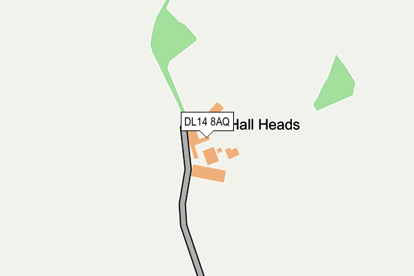
DL14 8AQ is located in the Ferryhill electoral ward, within the unitary authority of County Durham and the English Parliamentary constituency of Bishop Auckland. The Sub Integrated Care Board (ICB) Location is NHS North East and North Cumbria ICB - 84H and the police force is Durham. This postcode has been in use since January 1980.


GetTheData
Source: OS OpenMap – Local (Ordnance Survey)
Source: OS VectorMap District (Ordnance Survey)
Licence: Open Government Licence (requires attribution)
| Easting | 425169 |
| Northing | 531590 |
| Latitude | 54.678746 |
| Longitude | -1.611183 |
GetTheData
Source: Open Postcode Geo
Licence: Open Government Licence
| Country | England |
| Postcode District | DL14 |
| ➜ DL14 open data dashboard ➜ See where DL14 is on a map | |
GetTheData
Source: Land Registry Price Paid Data
Licence: Open Government Licence
Elevation or altitude of DL14 8AQ as distance above sea level:
| Metres | Feet | |
|---|---|---|
| Elevation | 190m | 623ft |
Elevation is measured from the approximate centre of the postcode, to the nearest point on an OS contour line from OS Terrain 50, which has contour spacing of ten vertical metres.
➜ How high above sea level am I? Find the elevation of your current position using your device's GPS.
GetTheData
Source: Open Postcode Elevation
Licence: Open Government Licence
| Ward | Ferryhill |
| Constituency | Bishop Auckland |
GetTheData
Source: ONS Postcode Database
Licence: Open Government Licence
| June 2022 | Vehicle crime | On or near High Road | 423m |
| June 2022 | Anti-social behaviour | On or near High Road | 423m |
| April 2022 | Other theft | On or near Low Road | 454m |
| ➜ Get more crime data in our Crime section | |||
GetTheData
Source: data.police.uk
Licence: Open Government Licence
| Ship Inn (B6287 Low Road) | Middlestone | 448m |
| Ship Inn (B6287 Low Road) | Middlestone | 464m |
| Green (Unclassified Road Opposite Half Moon Inn) | Kirk Merrington | 899m |
| Green (Merrington Road) | Kirk Merrington | 902m |
| Vyners Close | North Close | 926m |
| Bishop Auckland Station | 4.9km |
GetTheData
Source: NaPTAN
Licence: Open Government Licence
GetTheData
Source: ONS Postcode Database
Licence: Open Government Licence


➜ Get more ratings from the Food Standards Agency
GetTheData
Source: Food Standards Agency
Licence: FSA terms & conditions
| Last Collection | |||
|---|---|---|---|
| Location | Mon-Fri | Sat | Distance |
| Kirk Merrington | 17:15 | 09:00 | 896m |
| North Close | 17:15 | 09:15 | 997m |
| Central Drive | 17:00 | 11:15 | 1,222m |
GetTheData
Source: Dracos
Licence: Creative Commons Attribution-ShareAlike
| Facility | Distance |
|---|---|
| Middlestone Moor Football Pitch (Closed) Durham Street, Spennymoor Grass Pitches | 1.1km |
| Middlestone Moor Community Centre Albion Street, Middlestone Moor, Spennymoor Grass Pitches | 1.2km |
| Kirk Merrington Football Pitch Blue House Estate, Kirk Merrington Grass Pitches | 1.2km |
GetTheData
Source: Active Places
Licence: Open Government Licence
| School | Phase of Education | Distance |
|---|---|---|
| Kirk Merrington Primary School South View, Kirk Merrington, Spennymoor, DL16 7JB | Primary | 1.2km |
| The Oaks Secondary School Rock Road, Spennymoor, DL16 7DB | Not applicable | 1.4km |
| Middlestone Moor Academy Rock Road, Durham, DL16 7DA | Primary | 1.4km |
GetTheData
Source: Edubase
Licence: Open Government Licence
The below table lists the International Territorial Level (ITL) codes (formerly Nomenclature of Territorial Units for Statistics (NUTS) codes) and Local Administrative Units (LAU) codes for DL14 8AQ:
| ITL 1 Code | Name |
|---|---|
| TLC | North East (England) |
| ITL 2 Code | Name |
| TLC1 | Tees Valley and Durham |
| ITL 3 Code | Name |
| TLC14 | Durham |
| LAU 1 Code | Name |
| E06000047 | County Durham |
GetTheData
Source: ONS Postcode Directory
Licence: Open Government Licence
The below table lists the Census Output Area (OA), Lower Layer Super Output Area (LSOA), and Middle Layer Super Output Area (MSOA) for DL14 8AQ:
| Code | Name | |
|---|---|---|
| OA | E00105669 | |
| LSOA | E01020822 | County Durham 052B |
| MSOA | E02004337 | County Durham 052 |
GetTheData
Source: ONS Postcode Directory
Licence: Open Government Licence
| DL14 8AE | High Road | 404m |
| DL14 8AD | Eden View | 430m |
| DL14 8AB | Low Road | 463m |
| DL14 8AA | Wells Cottages | 547m |
| DL16 7JT | 645m | |
| DL16 7QD | 689m | |
| DL16 7LA | Merrington Heights | 779m |
| DL16 7JX | The Croft | 807m |
| DL16 7JW | Leasingthorne Road | 836m |
| DL16 7JL | Crowther Place | 867m |
GetTheData
Source: Open Postcode Geo; Land Registry Price Paid Data
Licence: Open Government Licence