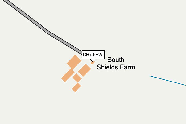
DH7 9EW is located in the Esh and Witton Gilbert electoral ward, within the unitary authority of County Durham and the English Parliamentary constituency of North West Durham. The Sub Integrated Care Board (ICB) Location is NHS North East and North Cumbria ICB - 84H and the police force is Durham. This postcode has been in use since January 1980.


GetTheData
Source: OS OpenMap – Local (Ordnance Survey)
Source: OS VectorMap District (Ordnance Survey)
Licence: Open Government Licence (requires attribution)
| Easting | 413031 |
| Northing | 541316 |
| Latitude | 54.766607 |
| Longitude | -1.798993 |
GetTheData
Source: Open Postcode Geo
Licence: Open Government Licence
| Country | England |
| Postcode District | DH7 |
| ➜ DH7 open data dashboard ➜ See where DH7 is on a map | |
GetTheData
Source: Land Registry Price Paid Data
Licence: Open Government Licence
Elevation or altitude of DH7 9EW as distance above sea level:
| Metres | Feet | |
|---|---|---|
| Elevation | 270m | 886ft |
Elevation is measured from the approximate centre of the postcode, to the nearest point on an OS contour line from OS Terrain 50, which has contour spacing of ten vertical metres.
➜ How high above sea level am I? Find the elevation of your current position using your device's GPS.
GetTheData
Source: Open Postcode Elevation
Licence: Open Government Licence
| Ward | Esh And Witton Gilbert |
| Constituency | North West Durham |
GetTheData
Source: ONS Postcode Database
Licence: Open Government Licence
GetTheData
Source: ONS Postcode Database
Licence: Open Government Licence
| Last Collection | |||
|---|---|---|---|
| Location | Mon-Fri | Sat | Distance |
| Old Cornsay | 16:00 | 08:30 | 1,557m |
| North Road, Tow Law | 16:00 | 10:15 | 2,285m |
| Castle Bank, Tow Law | 16:15 | 09:15 | 2,332m |
GetTheData
Source: Dracos
Licence: Creative Commons Attribution-ShareAlike
| Facility | Distance |
|---|---|
| Ironworks Road Ground Ironworks Road, Tow Law, Bishop Auckland Grass Pitches | 2.5km |
| Tow Law Recreation Ground Ironworks Road, Tow Law Grass Pitches | 2.8km |
| Tow Law Bmx Track Wolsingham Road, Tow Law, Bishop Auckland Cycling | 2.9km |
GetTheData
Source: Active Places
Licence: Open Government Licence
| School | Phase of Education | Distance |
|---|---|---|
| Blessed John Duckett Catholic Primary School, Tow Law Smith Street, Tow Law, Bishop Auckland, DL13 4AU | Primary | 2.1km |
| Tow Law Millennium Primary School Wear Street, Attlee Estate, Tow Law, Bishop Auckland, DL13 4LF | Primary | 3km |
| Peases West Academy Billy Row, Crook, DL15 9SZ | Primary | 4.9km |
GetTheData
Source: Edubase
Licence: Open Government Licence
The below table lists the International Territorial Level (ITL) codes (formerly Nomenclature of Territorial Units for Statistics (NUTS) codes) and Local Administrative Units (LAU) codes for DH7 9EW:
| ITL 1 Code | Name |
|---|---|
| TLC | North East (England) |
| ITL 2 Code | Name |
| TLC1 | Tees Valley and Durham |
| ITL 3 Code | Name |
| TLC14 | Durham |
| LAU 1 Code | Name |
| E06000047 | County Durham |
GetTheData
Source: ONS Postcode Directory
Licence: Open Government Licence
The below table lists the Census Output Area (OA), Lower Layer Super Output Area (LSOA), and Middle Layer Super Output Area (MSOA) for DH7 9EW:
| Code | Name | |
|---|---|---|
| OA | E00104754 | |
| LSOA | E01020646 | County Durham 024A |
| MSOA | E02004307 | County Durham 024 |
GetTheData
Source: ONS Postcode Directory
Licence: Open Government Licence
| DL13 4HW | 1778m | |
| DL13 4AX | Brick Flats | 1992m |
| DL13 4BN | 2038m | |
| DL13 4PR | 2064m | |
| DL13 4AP | Northside Court | 2078m |
| DH7 9EU | 2102m | |
| DL13 4AU | Smith Street | 2166m |
| DL13 4QD | Inkerman | 2184m |
| DL13 4QE | Browns Houses | 2202m |
| DL13 4DD | Fellside Close | 2205m |
GetTheData
Source: Open Postcode Geo; Land Registry Price Paid Data
Licence: Open Government Licence