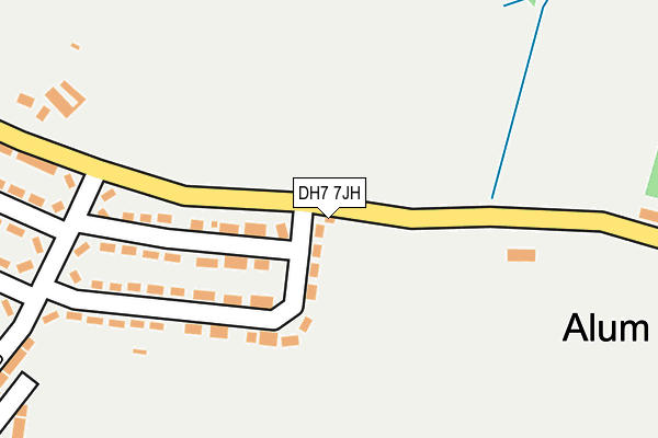
DH7 7JH is located in the Deerness electoral ward, within the unitary authority of County Durham and the English Parliamentary constituency of City of Durham. The Sub Integrated Care Board (ICB) Location is NHS North East and North Cumbria ICB - 84H and the police force is Durham. This postcode has been in use since January 1980.


GetTheData
Source: OS OpenMap – Local (Ordnance Survey)
Source: OS VectorMap District (Ordnance Survey)
Licence: Open Government Licence (requires attribution)
| Easting | 423064 |
| Northing | 541523 |
| Latitude | 54.768109 |
| Longitude | -1.643045 |
GetTheData
Source: Open Postcode Geo
Licence: Open Government Licence
| Country | England |
| Postcode District | DH7 |
| ➜ DH7 open data dashboard ➜ See where DH7 is on a map ➜ Where is New Brancepeth? | |
GetTheData
Source: Land Registry Price Paid Data
Licence: Open Government Licence
Elevation or altitude of DH7 7JH as distance above sea level:
| Metres | Feet | |
|---|---|---|
| Elevation | 110m | 361ft |
Elevation is measured from the approximate centre of the postcode, to the nearest point on an OS contour line from OS Terrain 50, which has contour spacing of ten vertical metres.
➜ How high above sea level am I? Find the elevation of your current position using your device's GPS.
GetTheData
Source: Open Postcode Elevation
Licence: Open Government Licence
| Ward | Deerness |
| Constituency | City Of Durham |
GetTheData
Source: ONS Postcode Database
Licence: Open Government Licence
| June 2022 | Violence and sexual offences | On or near Mill Lane | 239m |
| May 2022 | Violence and sexual offences | On or near Sports/Recreation Area | 268m |
| April 2022 | Violence and sexual offences | On or near Doric Road | 363m |
| ➜ Get more crime data in our Crime section | |||
GetTheData
Source: data.police.uk
Licence: Open Government Licence
| Braunespeth Estate (Braunspath Estate) | New Brancepeth | 55m |
| Braunespath Cottage (Waltons Terrace) | New Brancepeth | 183m |
| Doric Road - Walton's Terrace (Doric Road) | New Brancepeth | 231m |
| Doric Road | New Brancepeth | 263m |
| Bus Stop (Waltons Ter) | New Brancepeth | 332m |
| Durham Station | 4.1km |
GetTheData
Source: NaPTAN
Licence: Open Government Licence
| Percentage of properties with Next Generation Access | 100.0% |
| Percentage of properties with Superfast Broadband | 100.0% |
| Percentage of properties with Ultrafast Broadband | 0.0% |
| Percentage of properties with Full Fibre Broadband | 0.0% |
Superfast Broadband is between 30Mbps and 300Mbps
Ultrafast Broadband is > 300Mbps
| Percentage of properties unable to receive 2Mbps | 0.0% |
| Percentage of properties unable to receive 5Mbps | 0.0% |
| Percentage of properties unable to receive 10Mbps | 0.0% |
| Percentage of properties unable to receive 30Mbps | 0.0% |
GetTheData
Source: Ofcom
Licence: Ofcom Terms of Use (requires attribution)
GetTheData
Source: ONS Postcode Database
Licence: Open Government Licence


➜ Get more ratings from the Food Standards Agency
GetTheData
Source: Food Standards Agency
Licence: FSA terms & conditions
| Last Collection | |||
|---|---|---|---|
| Location | Mon-Fri | Sat | Distance |
| Oakridge Road, Ushaw Moor | 16:00 | 09:15 | 942m |
| Broomhall Drive | 16:00 | 08:30 | 1,055m |
| Station Road, Ushaw Moor | 16:50 | 09:00 | 1,067m |
GetTheData
Source: Dracos
Licence: Creative Commons Attribution-ShareAlike
| Facility | Distance |
|---|---|
| New Brancepeth Recreation Ground Braunespath Estate, New Brancepeth Grass Pitches | 269m |
| New Brancepeth Primary Academy New Brancepeth, Durham Grass Pitches | 449m |
| Ushaw Moor Park Highfield Terrace, Ushaw Moor Grass Pitches | 906m |
GetTheData
Source: Active Places
Licence: Open Government Licence
| School | Phase of Education | Distance |
|---|---|---|
| New Brancepeth Primary Academy Rock Terrace, New Brancepeth, Durham, DH7 7EU | Primary | 441m |
| Silver Tree Primary School and Nursery Durham Road, Ushaw Moor, Durham Road, Ushaw Moor, Durham, Durham, DH7 7LF | Primary | 1km |
| St Joseph's Catholic Primary School, Ushaw Moor Durham Road, Ushaw Moor, Durham, DH7 7LF | Primary | 1.1km |
GetTheData
Source: Edubase
Licence: Open Government Licence
The below table lists the International Territorial Level (ITL) codes (formerly Nomenclature of Territorial Units for Statistics (NUTS) codes) and Local Administrative Units (LAU) codes for DH7 7JH:
| ITL 1 Code | Name |
|---|---|
| TLC | North East (England) |
| ITL 2 Code | Name |
| TLC1 | Tees Valley and Durham |
| ITL 3 Code | Name |
| TLC14 | Durham |
| LAU 1 Code | Name |
| E06000047 | County Durham |
GetTheData
Source: ONS Postcode Directory
Licence: Open Government Licence
The below table lists the Census Output Area (OA), Lower Layer Super Output Area (LSOA), and Middle Layer Super Output Area (MSOA) for DH7 7JH:
| Code | Name | |
|---|---|---|
| OA | E00105112 | |
| LSOA | E01020714 | County Durham 026D |
| MSOA | E02004310 | County Durham 026 |
GetTheData
Source: ONS Postcode Directory
Licence: Open Government Licence
| DH7 7JG | Braunespath Estate | 157m |
| DH7 7JQ | Braunespath Estate | 172m |
| DH7 7JF | Braunespath Estate | 328m |
| DH7 7ER | Waltons Terrace | 328m |
| DH7 7JE | Doric Road | 380m |
| DH7 7JL | Alum Waters | 406m |
| DH7 7EL | Model Cottages | 421m |
| DH7 7EU | 449m | |
| DH7 7EP | Rock Terrace | 486m |
| DH7 7EN | Edward Terrace | 503m |
GetTheData
Source: Open Postcode Geo; Land Registry Price Paid Data
Licence: Open Government Licence