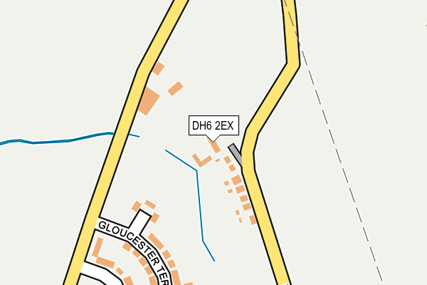
DH6 2EX is located in the Shotton and South Hetton electoral ward, within the unitary authority of County Durham and the English Parliamentary constituency of Easington. The Sub Integrated Care Board (ICB) Location is NHS North East and North Cumbria ICB - 84H and the police force is Durham. This postcode has been in use since January 1995.


GetTheData
Source: OS OpenMap – Local (Ordnance Survey)
Source: OS VectorMap District (Ordnance Survey)
Licence: Open Government Licence (requires attribution)
| Easting | 437218 |
| Northing | 542570 |
| Latitude | 54.776671 |
| Longitude | -1.422929 |
GetTheData
Source: Open Postcode Geo
Licence: Open Government Licence
| Country | England |
| Postcode District | DH6 |
| ➜ DH6 open data dashboard ➜ See where DH6 is on a map ➜ Where is Haswell Plough? | |
GetTheData
Source: Land Registry Price Paid Data
Licence: Open Government Licence
Elevation or altitude of DH6 2EX as distance above sea level:
| Metres | Feet | |
|---|---|---|
| Elevation | 130m | 427ft |
Elevation is measured from the approximate centre of the postcode, to the nearest point on an OS contour line from OS Terrain 50, which has contour spacing of ten vertical metres.
➜ How high above sea level am I? Find the elevation of your current position using your device's GPS.
GetTheData
Source: Open Postcode Elevation
Licence: Open Government Licence
| Ward | Shotton And South Hetton |
| Constituency | Easington |
GetTheData
Source: ONS Postcode Database
Licence: Open Government Licence
| June 2022 | Violence and sexual offences | On or near Gloucester Terrace | 279m |
| May 2022 | Criminal damage and arson | On or near Gloucester Terrace | 279m |
| May 2022 | Criminal damage and arson | On or near Gloucester Terrace | 279m |
| ➜ Get more crime data in our Crime section | |||
GetTheData
Source: data.police.uk
Licence: Open Government Licence
| Gloucester Terrace (Un-named Lane) | Haswell Plough | 170m |
| High Row (Un-named Lane) | Haswell | 176m |
| Gloucester Terrace (Un-named Lane) | Haswell Plough | 217m |
| High Row (Un-named Lane) | Haswell | 221m |
| Hessewelle Crescent (Un-named Lane) | Haswell Plough | 327m |
GetTheData
Source: NaPTAN
Licence: Open Government Licence
GetTheData
Source: ONS Postcode Database
Licence: Open Government Licence


➜ Get more ratings from the Food Standards Agency
GetTheData
Source: Food Standards Agency
Licence: FSA terms & conditions
| Last Collection | |||
|---|---|---|---|
| Location | Mon-Fri | Sat | Distance |
| Plough, Haswell | 16:00 | 09:00 | 448m |
| Haswell | 17:00 | 11:30 | 799m |
| East Villas, Haswell | 16:00 | 08:00 | 1,096m |
GetTheData
Source: Dracos
Licence: Creative Commons Attribution-ShareAlike
| Facility | Distance |
|---|---|
| Haswell Playing Fields Windsor Terrace, Haswell, Durham Grass Pitches | 378m |
| Hazelwell Centre Windsor Terrace, Haswell, Durham Artificial Grass Pitch | 469m |
| Ludworth Recreation Ground Usher Street, Ludworth Grass Pitches | 1.6km |
GetTheData
Source: Active Places
Licence: Open Government Licence
| School | Phase of Education | Distance |
|---|---|---|
| Ludworth Primary School Moor Crescent, Ludworth, Durham, DH6 1LZ | Primary | 1.8km |
| Our Lady of Lourdes Catholic Primary School, Shotton Fleming Field, Shotton, Durham, DH6 2JQ | Primary | 1.9km |
| Shotton Primary School Grange Terrace, Shotton Colliery, DH6 2JP | Primary | 2.6km |
GetTheData
Source: Edubase
Licence: Open Government Licence
The below table lists the International Territorial Level (ITL) codes (formerly Nomenclature of Territorial Units for Statistics (NUTS) codes) and Local Administrative Units (LAU) codes for DH6 2EX:
| ITL 1 Code | Name |
|---|---|
| TLC | North East (England) |
| ITL 2 Code | Name |
| TLC1 | Tees Valley and Durham |
| ITL 3 Code | Name |
| TLC14 | Durham |
| LAU 1 Code | Name |
| E06000047 | County Durham |
GetTheData
Source: ONS Postcode Directory
Licence: Open Government Licence
The below table lists the Census Output Area (OA), Lower Layer Super Output Area (LSOA), and Middle Layer Super Output Area (MSOA) for DH6 2EX:
| Code | Name | |
|---|---|---|
| OA | E00105345 | |
| LSOA | E01020763 | County Durham 034D |
| MSOA | E02004326 | County Durham 034 |
GetTheData
Source: ONS Postcode Directory
Licence: Open Government Licence
| DH6 2EF | Mazine Terrace | 78m |
| DH6 2EG | Gloucester Terrace | 259m |
| DH6 2EH | Hessewelle Crescent | 264m |
| DH6 2EQ | Hessewelle Crescent | 292m |
| DH6 2EL | Kent Terrace | 387m |
| DH6 2ER | Rutland Terrace | 425m |
| DH6 2DY | Windsor Terrace | 462m |
| DH6 2EN | Attlee Crescent | 467m |
| DH6 2EE | 468m | |
| DH6 2EW | Front Street | 486m |
GetTheData
Source: Open Postcode Geo; Land Registry Price Paid Data
Licence: Open Government Licence