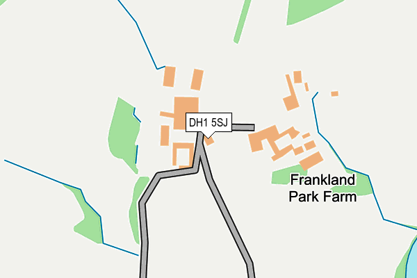
DH1 5SJ is in Durham. DH1 5SJ is located in the Framwellgate and Newton Hall electoral ward, within the unitary authority of County Durham and the English Parliamentary constituency of City of Durham. The Sub Integrated Care Board (ICB) Location is NHS North East and North Cumbria ICB - 84H and the police force is Durham. This postcode has been in use since January 1980.


GetTheData
Source: OS OpenMap – Local (Ordnance Survey)
Source: OS VectorMap District (Ordnance Survey)
Licence: Open Government Licence (requires attribution)
| Easting | 428232 |
| Northing | 544252 |
| Latitude | 54.792369 |
| Longitude | -1.562458 |
GetTheData
Source: Open Postcode Geo
Licence: Open Government Licence
| Town/City | Durham |
| Country | England |
| Postcode District | DH1 |
| ➜ DH1 open data dashboard ➜ See where DH1 is on a map | |
GetTheData
Source: Land Registry Price Paid Data
Licence: Open Government Licence
Elevation or altitude of DH1 5SJ as distance above sea level:
| Metres | Feet | |
|---|---|---|
| Elevation | 40m | 131ft |
Elevation is measured from the approximate centre of the postcode, to the nearest point on an OS contour line from OS Terrain 50, which has contour spacing of ten vertical metres.
➜ How high above sea level am I? Find the elevation of your current position using your device's GPS.
GetTheData
Source: Open Postcode Elevation
Licence: Open Government Licence
| Ward | Framwellgate And Newton Hall |
| Constituency | City Of Durham |
GetTheData
Source: ONS Postcode Database
Licence: Open Government Licence
| January 2022 | Anti-social behaviour | On or near Lindisfarne Road | 441m |
| December 2021 | Burglary | On or near Lindisfarne Road | 441m |
| December 2021 | Anti-social behaviour | On or near Lindisfarne Road | 453m |
| ➜ Get more crime data in our Crime section | |||
GetTheData
Source: data.police.uk
Licence: Open Government Licence
| Lindisfarne Road | Newton Hall | 393m |
| Lindisfarne Road | Newton Hall | 402m |
| Dilston Road (Canterbury Road) | Newton Hall | 531m |
| Dilston Road (Canterbury Road) | Newton Hall | 613m |
| Hamsterley Crescent | Newton Hall | 677m |
| Durham Station | 1.9km |
GetTheData
Source: NaPTAN
Licence: Open Government Licence
| Percentage of properties with Next Generation Access | 100.0% |
| Percentage of properties with Superfast Broadband | 0.0% |
| Percentage of properties with Ultrafast Broadband | 0.0% |
| Percentage of properties with Full Fibre Broadband | 0.0% |
Superfast Broadband is between 30Mbps and 300Mbps
Ultrafast Broadband is > 300Mbps
| Percentage of properties unable to receive 2Mbps | 0.0% |
| Percentage of properties unable to receive 5Mbps | 0.0% |
| Percentage of properties unable to receive 10Mbps | 75.0% |
| Percentage of properties unable to receive 30Mbps | 100.0% |
GetTheData
Source: Ofcom
Licence: Ofcom Terms of Use (requires attribution)
GetTheData
Source: ONS Postcode Database
Licence: Open Government Licence


➜ Get more ratings from the Food Standards Agency
GetTheData
Source: Food Standards Agency
Licence: FSA terms & conditions
| Last Collection | |||
|---|---|---|---|
| Location | Mon-Fri | Sat | Distance |
| Lindisfarne Road | 17:15 | 11:45 | 558m |
| Mill Road, Littleburn | 18:30 | 08:15 | 839m |
| Auckland Road | 17:00 | 11:45 | 908m |
GetTheData
Source: Dracos
Licence: Creative Commons Attribution-ShareAlike
| Facility | Distance |
|---|---|
| Blue Coat Junior C Of E (Aided) School Langley Road, Durham Grass Pitches | 961m |
| Low Carr Richmond Road, Newton Hall Grass Pitches | 982m |
| Finchale Primary School Canterbury Road, Durham Grass Pitches | 1.1km |
GetTheData
Source: Active Places
Licence: Open Government Licence
| School | Phase of Education | Distance |
|---|---|---|
| Durham Newton Hall Infants' School Langley Road, Newton Hall, Durham, DH1 5LP | Primary | 913m |
| Blue Coat CofE (Aided) Junior School Langley Road, Newton Hall Estate, Durham, DH1 5LP | Primary | 962m |
| Finchale Primary School Canterbury Road, Newton Hall, Durham, DH1 5XT | Primary | 1.1km |
GetTheData
Source: Edubase
Licence: Open Government Licence
The below table lists the International Territorial Level (ITL) codes (formerly Nomenclature of Territorial Units for Statistics (NUTS) codes) and Local Administrative Units (LAU) codes for DH1 5SJ:
| ITL 1 Code | Name |
|---|---|
| TLC | North East (England) |
| ITL 2 Code | Name |
| TLC1 | Tees Valley and Durham |
| ITL 3 Code | Name |
| TLC14 | Durham |
| LAU 1 Code | Name |
| E06000047 | County Durham |
GetTheData
Source: ONS Postcode Directory
Licence: Open Government Licence
The below table lists the Census Output Area (OA), Lower Layer Super Output Area (LSOA), and Middle Layer Super Output Area (MSOA) for DH1 5SJ:
| Code | Name | |
|---|---|---|
| OA | E00105094 | |
| LSOA | E01020709 | County Durham 022A |
| MSOA | E02004308 | County Durham 022 |
GetTheData
Source: ONS Postcode Directory
Licence: Open Government Licence
| DH1 5YH | Lindisfarne Road | 401m |
| DH1 5YQ | Lindisfarne Road | 452m |
| DH1 5YJ | Halton Road | 462m |
| DH1 5XP | Blanchland Avenue | 525m |
| DH1 5NF | Canterbury Road | 533m |
| DH1 5YL | Elsdon Road | 539m |
| DH1 5YN | Cotherstone Road | 554m |
| DH1 5ND | Dilston Road | 592m |
| DH1 5YX | Lindisfarne Road | 608m |
| DH1 5XT | Canterbury Road | 615m |
GetTheData
Source: Open Postcode Geo; Land Registry Price Paid Data
Licence: Open Government Licence